
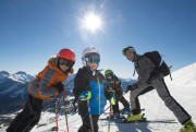
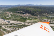
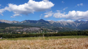
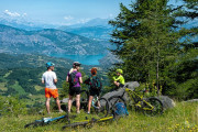
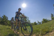
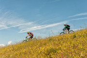
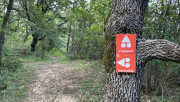
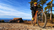
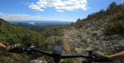
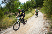
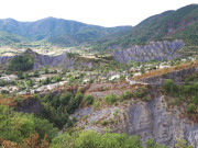
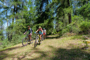
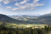
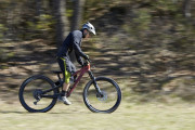
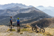
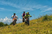
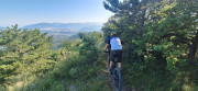
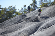
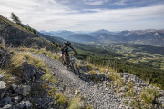
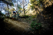
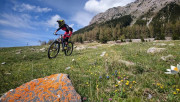
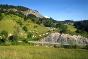
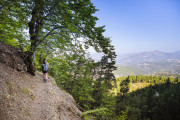
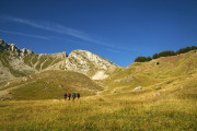
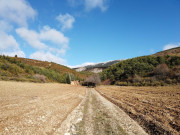
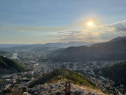
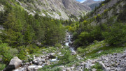
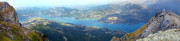
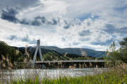
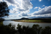
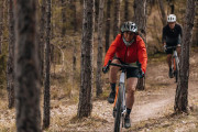
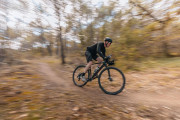
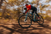
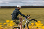
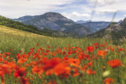
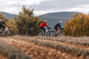
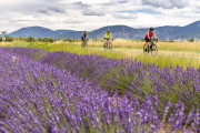
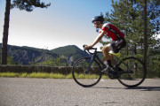
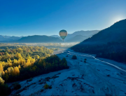
Discover outdoor activities


routes filtered
site(s) filtered
Only my favorites
Delete filters
Around me :
< 5km
< 10km
< 25km
< 50km
Inactive
Difficulties :
Easy
Medium
Difficult
Expert
Durée :
<1h
1-2h
2-3h
3-4h
>4h
Distance (km) :
<10
10-25
25-50
50-75
>75
Distance (km) :
<25
25-50
50-100
100-150
>150
Elevation gain (m) :
<500
500-1000
1000-1500
1500-2500
>2500
Elevation lost (m) :
<500
500-1000
1000-1500
1500-2500
>2500
Tags :
Areas :

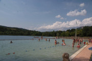
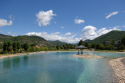
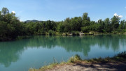
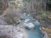
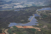
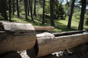
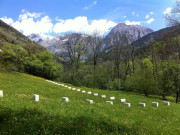
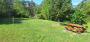
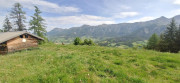
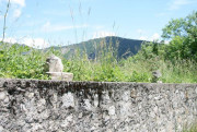
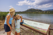
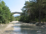
Ferréols bathing lake
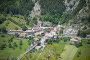
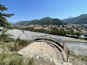
Digne-les-Bains
Digne-les-Bains
Plan d'eau naturel du Petit Lac
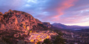
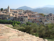
Moustiers-Sainte-Marie
Moustiers-Sainte-Marie

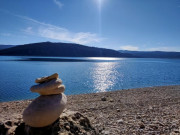
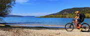
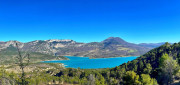
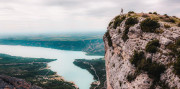
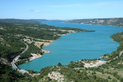
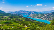
Sainte-Croix Lake and Beach
Sainte-Croix-du-Verdon
Sainte-Croix-du-Verdon
Base Durance Nautique à Volonne
Volonne
Volonne
Base Nautique de Sainte-Croix
Sainte-Croix-du-Verdon
Sainte-Croix-du-Verdon

Espace Nordique du Fanget
Auzet
Auzet
Station de Montclar
Montclar
Montclar
Chabanon-Selonnet station
Selonnet
Selonnet

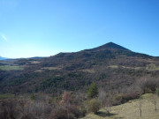
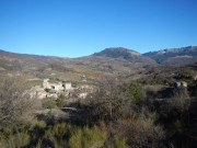
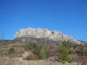
Le Grand-Puy
Seyne
Seyne

Découverte du Fanget - Très facile 1km
1.19km 40m 40m
Auzet
1.19km 40m 40m
Auzet
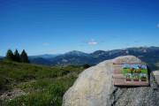
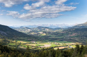
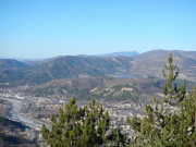
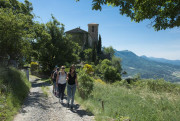
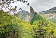
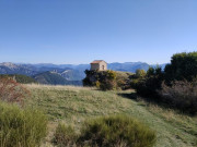
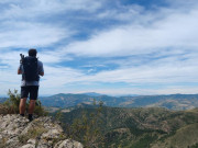
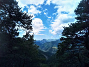
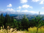
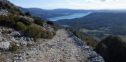
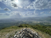
Panoramic viewIn mountains
Pique-nique face à la Blanche - Facile 2km A/R
1.97km 120m 120m
Seyne
1.97km 120m 120m
Seyne
La cheminée - Très facile 1km
1.13km 70m 60m
Auzet
1.13km 70m 60m
Auzet
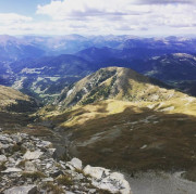
Panoramic viewIn mountains
Les Crêtes par le télésiège des Monges - Facile 3km
2.74km 100m 100m
Selonnet
2.74km 100m 100m
Selonnet
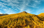
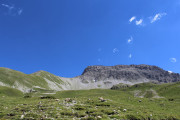
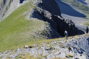
In mountains
Tour des Clots - Facile 3km
3.07km 120m 120m
Selonnet
3.07km 120m 120m
Selonnet
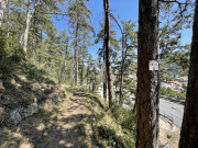
In the forestIn mountains
Négron - Modéré 7km
6.74km 200m 200m
Selonnet
6.74km 200m 200m
Selonnet
Panoramic viewIn mountains
Balcons du Grand Puy -Moyen 4km
3.89km 250m 250m
Seyne
3.89km 250m 250m
Seyne
Balade Forestière - Facile 5km A/R
5.19km 200m 200m
Seyne
5.19km 200m 200m
Seyne
Le plateau d'Iroire - Modéré 5,5km
5.94km 240m 240m
Auzet
5.94km 240m 240m
Auzet
Panoramic viewIn mountains
Négron - Modéré 7km
6.99km 260m 260m
Auzet
6.99km 260m 260m
Auzet
Panoramic viewIn mountains

Le Fanget par les Clots - Difficile 16km
16.31km 540m 540m
Selonnet
16.31km 540m 540m
Selonnet
Panoramic viewIn mountains
Sommet et crêtes du Grand Puy - Difficile 8km
8.06km 460m 460m
Seyne
8.06km 460m 460m
Seyne

Plateau de Chauvet - Difficile 9km
8.67km 300m 300m
Selonnet
8.67km 300m 300m
Selonnet
In the forestIn mountains
Crête et bois de Méarzes - Difficile 3km
3.23km 140m 140m
Auzet
3.23km 140m 140m
Auzet
Panoramic view
Chabanon - Très difficile 16km
6.45km 280m 140m
Auzet
6.45km 280m 140m
Auzet
Panoramic viewIn mountains
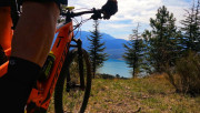
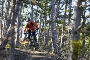
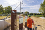
VTT n°27 - Le tour du Lac
5.2km 50m 50m
Les Mées
5.2km 50m 50m
Les Mées
On the water's edgeLake view
VTT n°1 - Saint-Vincent-les-Forts
8.72km 160m 160m
Montclar
8.72km 160m 160m
Montclar
In the forest
VTT n°8 - Le Mermoz
5km 50m 50m
Château-Arnoux-Saint-Auban
5km 50m 50m
Château-Arnoux-Saint-Auban
In the forest
VTT n°1 - Le plan d'eau
5.19km 30m 30m
Digne-les-Bains
5.19km 30m 30m
Digne-les-Bains
VTT n°1 - Le lac de Sainte-Croix depuis Moustiers
10.27km 130m 130m
Moustiers-Sainte-Marie
10.27km 130m 130m
Moustiers-Sainte-Marie
Lake view

VTT n°4 - Le lac de Saint-Léger
5.26km 130m 130m
Montclar
5.26km 130m 130m
Montclar
In mountains
VTT n°8 - La Maison du Mulet
10km 150m 150m
Seyne
10km 150m 150m
Seyne
In the forest
VTT n°11 - Le lac de Gaubert
12.9km 60m 60m
Digne-les-Bains
12.9km 60m 60m
Digne-les-Bains
On the water's edgeLake view

VTT n°13 - Les Thermes
5.71km 60m 60m
Digne-les-Bains
5.71km 60m 60m
Digne-les-Bains

VTT n°17 - Fissac
6.19km 190m 190m
Auzet
6.19km 190m 190m
Auzet
In the forestIn mountainsPanoramic view
VTT n°9 - Les Iscles
8.6km 60m 60m
Peyruis
8.6km 60m 60m
Peyruis
VTT n°11 - Les balcons de Chabanon
5.9km 210m 210m
Selonnet
5.9km 210m 210m
Selonnet
Panoramic viewIn the forestIn mountains
VTT n°14 - Le lac des Eaux Chaudes
9.1km 220m 220m
Prads-Haute-Bléone
9.1km 220m 220m
Prads-Haute-Bléone
On the water's edgePanoramic viewIn the forestIn mountains

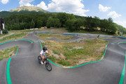
Parcours vert - Stade VTT XCO de Haute-Provence
1.5km 40m 40m
Château-Arnoux-Saint-Auban
1.5km 40m 40m
Château-Arnoux-Saint-Auban
VTT n°6 - L'Estoublaïsse
6.31km 70m 70m
Estoublon
6.31km 70m 70m
Estoublon
In the forest
VTT n°6 - Les contreforts du Lac
14.49km 380m 380m
Moustiers-Sainte-Marie
14.49km 380m 380m
Moustiers-Sainte-Marie
Panoramic viewLake viewE-BIKE
VTT n°6 - La Pierre Plantée
7.3km 220m 220m
Peyruis
7.3km 220m 220m
Peyruis
In the forest
VTT n°7 - Balade des Bruyères
9.1km 220m 220m
Château-Arnoux-Saint-Auban
9.1km 220m 220m
Château-Arnoux-Saint-Auban
In the forestE-BIKE
VTT n°2 - Le Clot du Dou
13.09km 290m 290m
Montclar
13.09km 290m 290m
Montclar
In the forestLake viewIn mountainsE-BIKE
VTT n°2 - Le Hameau de Gaubert
16.2km 230m 230m
Digne-les-Bains
16.2km 230m 230m
Digne-les-Bains
In the forest

VTT n°3 - La maison forestière
5.62km 110m 110m
Le Brusquet
5.62km 110m 110m
Le Brusquet
In the forestPanoramic view

VTT n°3 - Les balcons du lac de Sainte-Croix
14.88km 90m 90m
Moustiers-Sainte-Marie
14.88km 90m 90m
Moustiers-Sainte-Marie
Lake viewPanoramic view

Liaison VTT - Château-Arnoux - Les Mées
16.5km 130m 150m
Château-Arnoux-Saint-Auban
16.5km 130m 150m
Château-Arnoux-Saint-Auban

Liaison VTT - Seyne - Montclar
8.7km 340m 200m
Seyne
8.7km 340m 200m
Seyne
In the forest
Liaison VTT - Seyne - Selonnet
7.01km 30m 170m
Seyne
7.01km 30m 170m
Seyne
In the forest
VTT n°10 - La Grosse Pierre
14.2km 280m 280m
Selonnet
14.2km 280m 280m
Selonnet
In the forest

Liaison VTT - Selonnet - Seyne
6.99km 170m 40m
Selonnet
6.99km 170m 40m
Selonnet
In the forest

Liaison VTT - Seyne-Le Grand Puy
6.77km 230m 60m
Seyne
6.77km 230m 60m
Seyne
In the forest
Liaison VTT - Le Grand Puy - Seyne
6.84km 70m 230m
Seyne
6.84km 70m 230m
Seyne
In the forest
VTT n°24 - Le chemin des Oliviers
7.6km 150m 150m
Les Mées
7.6km 150m 150m
Les Mées

VTT n°30 - La Napoléonienne
20.9km 120m 120m
Château-Arnoux-Saint-Auban
20.9km 120m 120m
Château-Arnoux-Saint-Auban
Liaison VTT - Montclar - Seyne
9.07km 200m 340m
Montclar
9.07km 200m 340m
Montclar
In the forest
VTT n°20 - Le hameau de Mariaud
15.01km 490m 490m
Prads-Haute-Bléone
15.01km 490m 490m
Prads-Haute-Bléone
Panoramic viewIn the forest
VTT n°2 - Le Circuit des Lavandes
10.5km 120m 120m
Moustiers-Sainte-Marie
10.5km 120m 120m
Moustiers-Sainte-Marie
Panoramic viewLake view
Parcours bleu - Stade VTT XCO de Haute-Provence
1.9km 60m 60m
Château-Arnoux-Saint-Auban
1.9km 60m 60m
Château-Arnoux-Saint-Auban
VTT n°5 - La rando des chapelles
46.3km 1130m 1130m
Château-Arnoux-Saint-Auban
46.3km 1130m 1130m
Château-Arnoux-Saint-Auban
In the forest
VTT n°3 - Le Grognard
15.1km 460m 460m
L'Escale
15.1km 460m 460m
L'Escale
Panoramic viewIn the forest
VTT n°18 - Enduro du sommet de L’Andran
14.16km 610m 610m
Digne-les-Bains
14.16km 610m 610m
Digne-les-Bains
Panoramic viewIn the forestEnduro
VTT n°9 - Les Hameaux de Beynes
15.8km 510m 510m
Mézel
15.8km 510m 510m
Mézel
Panoramic viewIn the forest
Liaison VTT - Château-Arnoux - Peyruis
19.4km 370m 360m
Château-Arnoux-Saint-Auban
19.4km 370m 360m
Château-Arnoux-Saint-Auban
In the forest
Liaison VTT - Peyruis - Château-Arnoux
17.6km 360m 370m
Peyruis
17.6km 360m 370m
Peyruis
In the forest
VTT n°7 - Le moulin de Mouresse
20.18km 710m 710m
Moustiers-Sainte-Marie
20.18km 710m 710m
Moustiers-Sainte-Marie
Panoramic viewLake viewE-BIKE

VTT n°3 - Le bois Noir
31.04km 980m 980m
Montclar
31.04km 980m 980m
Montclar
Lake viewIn mountainsE-BIKE
VTT n°4 - La Saint-Jursienne
26.47km 1060m 1060m
Saint-Jurs
26.47km 1060m 1060m
Saint-Jurs
Panoramic viewLake view
VTT n°12 - La Fubie
18.13km 730m 730m
Volonne
18.13km 730m 730m
Volonne
In the forest
VTT n°4 - Les pistes du bois du Siron
24.1km 810m 810m
La Robine-sur-Galabre
24.1km 810m 810m
La Robine-sur-Galabre
Panoramic viewIn the forestE-BIKE

VTT n°19 - Le Tour des Augiers
20.47km 540m 540m
Digne-les-Bains
20.47km 540m 540m
Digne-les-Bains
In the forestE-BIKEPanoramic view
VTT n°5 - Les Hameaux de la Haute-Bléone
16.31km 540m 540m
Prads-Haute-Bléone
16.31km 540m 540m
Prads-Haute-Bléone
Panoramic viewIn the forestIn mountains
Liaison VTT - Les Mées-Château-Arnoux
15km 160m 140m
Les Mées
15km 160m 140m
Les Mées

VTT n°18A - Enduro Baisse de Blanchard
15.98km 670m 670m
Digne-les-Bains
15.98km 670m 670m
Digne-les-Bains
Panoramic viewIn the forestEnduro
VTT n°15 - La Rando du Cairn
39.3km 930m 930m
Château-Arnoux-Saint-Auban
39.3km 930m 930m
Château-Arnoux-Saint-Auban
In the forestE-BIKE
VTT n°19 - Les Jas
23.9km 690m 690m
Peyruis
23.9km 690m 690m
Peyruis
In the forest
Liaison VTT - Chabanon - Le Grand Puy
17.83km 460m 690m
Selonnet
17.83km 460m 690m
Selonnet
In the forest
VTT n°9 - Le Tour de la Blanche
29.1km 990m 990m
Seyne
29.1km 990m 990m
Seyne
Panoramic viewIn mountainsE-BIKE

VTT n°20 - Escapade sur Mallefougasse
22.5km 550m 550m
Peyruis
22.5km 550m 550m
Peyruis
In the forest
VTT n°12 - La crête de la Jaillière
15.17km 470m 470m
Estoublon
15.17km 470m 470m
Estoublon
Panoramic viewIn the forest
VTT n°16 - Tour de Seyne à Montclar
18.69km 480m 480m
Seyne
18.69km 480m 480m
Seyne
Panoramic viewIn mountainsE-BIKE

Liaison VTT - Le Grand Puy - Chabanon
17.8km 690m 450m
Seyne
17.8km 690m 450m
Seyne
In the forest
VTT n°18 - Les crêtes de Caramelin
20.5km 620m 620m
Peyruis
20.5km 620m 620m
Peyruis
In the forest
VTT n°22 - Enduro de la Bastide Blanche
22.9km 930m 930m
L'Escale
22.9km 930m 930m
L'Escale
In the forestEnduro
VTT n°23 - Le Tour de Tigne
9.9km 280m 280m
Volonne
9.9km 280m 280m
Volonne
In the forestE-BIKE
VTT n°13 - Les quatre cols
24.9km 750m 750m
Verdaches
24.9km 750m 750m
Verdaches
In the forestIn mountains
VTT n°2 - Le tour des clochers
47.4km 660m 660m
Château-Arnoux-Saint-Auban
47.4km 660m 660m
Château-Arnoux-Saint-Auban
Panoramic viewIn the forest
VTT n°14 - Les clues de Verdaches
19.8km 500m 500m
Verdaches
19.8km 500m 500m
Verdaches
In the forestE-BIKE
VTT n°25 - Le Grand Tour des Pénitents
24.5km 790m 790m
Les Mées
24.5km 790m 790m
Les Mées

VTT n°1 - La Bastide Blanche
21.4km 810m 810m
L'Escale
21.4km 810m 810m
L'Escale
In the forest
VTT n°26 - Le plateau de la Colle
17.9km 530m 520m
Les Mées
17.9km 530m 520m
Les Mées
In the forest

Parcours rouge/noir - Stade VTT XCO de Haute-Provence
6.4km 240m 240m
Château-Arnoux-Saint-Auban
6.4km 240m 240m
Château-Arnoux-Saint-Auban
VTT n°5 - Le Montdenier
35.81km 1390m 1390m
Moustiers-Sainte-Marie
35.81km 1390m 1390m
Moustiers-Sainte-Marie
Lake viewPanoramic view

VTT n°17 - Les terres noires
24.7km 1000m 1000m
Marcoux
24.7km 1000m 1000m
Marcoux
Panoramic viewIn the forest
VTT n°8 - Les Balcons de Digne les Bains
40.6km 1190m 1190m
Digne-les-Bains
40.6km 1190m 1190m
Digne-les-Bains
Panoramic viewIn the forest
VTT n°10 - Le Cousson
31.7km 1070m 1070m
Digne-les-Bains
31.7km 1070m 1070m
Digne-les-Bains
Panoramic viewIn the forest
VTT n°21 - Randuro des Terres Noires
35.66km 1130m 1130m
Digne-les-Bains
35.66km 1130m 1130m
Digne-les-Bains
Panoramic viewIn the forestEnduro
VTT n°13 - Les Grandes Côtes
25.4km 870m 870m
Château-Arnoux-Saint-Auban
25.4km 870m 870m
Château-Arnoux-Saint-Auban
In the forest
VTT n°16 - La Ferme Belon
27.54km 900m 900m
Marcoux
27.54km 900m 900m
Marcoux
Panoramic viewIn the forestE-BIKE
VTT n°6 - Les Balcons de la Blanche
26.9km 840m 840m
Seyne
26.9km 840m 840m
Seyne
In mountainsE-BIKE
VTT n°14 - Enduro des Amarines
26.5km 910m 910m
Château-Arnoux-Saint-Auban
26.5km 910m 910m
Château-Arnoux-Saint-Auban
In the forestEnduro

VTT n°5 - Les Chapelles
11.66km 370m 370m
Montclar
11.66km 370m 370m
Montclar
In mountains
VTT n°16 - Le tour de Tourdeaux
22.6km 650m 650m
Peyruis
22.6km 650m 650m
Peyruis
VTT n°7 - Les crêtes de Dormillouse
19.2km 1050m 1050m
Seyne
19.2km 1050m 1050m
Seyne
In mountains
VTT n°17 - La chapelle d'Augès
15.3km 620m 620m
Peyruis
15.3km 620m 620m
Peyruis
In the forest

VTT n°7 - Les sources du Rouveiret
31.14km 1010m 1010m
Digne-les-Bains
31.14km 1010m 1010m
Digne-les-Bains
Panoramic viewIn the forestE-BIKE
VTT n°21 - La rando de St Joseph
25.2km 970m 970m
Volonne
25.2km 970m 970m
Volonne
Panoramic viewIn the forestE-BIKE

VTT n°11 - Le Haut Val
19.03km 780m 780m
Malijai
19.03km 780m 780m
Malijai
In the forestE-BIKE
VTT n°15 - Les crêtes de Draix
35.85km 1080m 1080m
Marcoux
35.85km 1080m 1080m
Marcoux
Panoramic viewIn the forest

VTT n°10 - La Combe Obscure
12.82km 460m 460m
Malijai
12.82km 460m 460m
Malijai
In the forest
VTT n°29 - Le domaine du Prieuré
21.54km 740m 740m
Ganagobie
21.54km 740m 740m
Ganagobie
In the forest
VTT n°4 - Le Pas des Bœufs
28.7km 910m 910m
Château-Arnoux-Saint-Auban
28.7km 910m 910m
Château-Arnoux-Saint-Auban
Panoramic viewIn the forest

Grande Traversée VTT - Les Chemins du Soleil
96.46km 3085m 2621m
Château-Arnoux-Saint-Auban
96.46km 3085m 2621m
Château-Arnoux-Saint-Auban
In the forestPanoramic view
Grande Traversée VTT - L'Alpes Provence
139.82km 3821m 4432m
Seyne
139.82km 3821m 4432m
Seyne
In mountains

Grande Traversée VTT - La TransVerdon
38.5km 681m 876m
Moustiers-Sainte-Marie
38.5km 681m 876m
Moustiers-Sainte-Marie
In the forestLake viewIn mountainsPanoramic view
Parcours vert - Stade VTT XCO de Haute-Provence
1.5km 40m 40m
Château-Arnoux-Saint-Auban
1.5km 40m 40m
Château-Arnoux-Saint-Auban

Parcours bleu - Stade VTT XCO de Haute-Provence
1.9km 60m 60m
Château-Arnoux-Saint-Auban
1.9km 60m 60m
Château-Arnoux-Saint-Auban
Parcours rouge/noir - Stade VTT XCO de Haute-Provence
6.4km 250m 250m
Château-Arnoux-Saint-Auban
6.4km 250m 250m
Château-Arnoux-Saint-Auban

Pumptrack
Digne-les-Bains
Digne-les-Bains
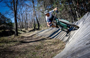
Piste de BMX et zone de trial VTT
Digne-les-Bains
Digne-les-Bains
Aire ludique de maniabilité
Château-Arnoux-Saint-Auban
Château-Arnoux-Saint-Auban
Bike-Park de Montclar
Montclar
Montclar

Champs de bosses
Château-Arnoux-Saint-Auban
Château-Arnoux-Saint-Auban

Evo Bike Park
Digne-les-Bains
Digne-les-Bains
Pumptrack Montclar
Montclar
Montclar
Pumptrack
Château-Arnoux-Saint-Auban
Château-Arnoux-Saint-Auban

Sentier Armand Payan
3.6km 190m 190m
Barles
3.6km 190m 190m
Barles
In mountains

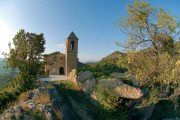
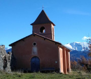
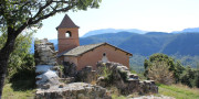
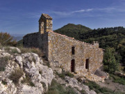
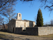
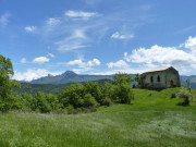
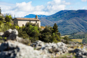
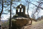
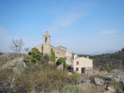
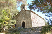
Chapelle Notre-Dame
3.3km 170m 170m
Mézel
3.3km 170m 170m
Mézel
Panoramic view

Écobalade : Balade du patrimoine
2.22km 70m 70m
Volonne
2.22km 70m 70m
Volonne
Panoramic view
Le Col
6.2km 260m 260m
Auzet
6.2km 260m 260m
Auzet
Panoramic viewIn the forestIn mountains

Sentier de découverte de Marcoux
1.4km 80m 80m
Marcoux
1.4km 80m 80m
Marcoux
Panoramic viewIn the forestIn mountainsArt hikes
Sentier de découverte du Col de Fontbelle
2.45km 80m 80m
Le Castellard-Melan
2.45km 80m 80m
Le Castellard-Melan
In the forestGeology hiking
Tour du village par les Claux
2.46km 100m 100m
Moustiers-Sainte-Marie
2.46km 100m 100m
Moustiers-Sainte-Marie
Panoramic viewIn the forest
Montée du Vieux-Bras d'Asse
2.3km 140m 140m
Bras-d'Asse
2.3km 140m 140m
Bras-d'Asse
Panoramic view

Forêt de Valentin
6km 190m 200m
Selonnet
6km 190m 200m
Selonnet
Panoramic viewIn the forestIn mountains

La Routo et la Chapelle Saint-Jean
3.5km 220m 220m
Saint-Jeannet
3.5km 220m 220m
Saint-Jeannet
In the forest
Chapelle Saint Pancrace
5.62km 240m 240m
Digne-les-Bains
5.62km 240m 240m
Digne-les-Bains
Panoramic viewIn mountainsGeology hiking

Ichtyosaure de la Robine
4.26km 190m 190m
La Robine-sur-Galabre
4.26km 190m 190m
La Robine-sur-Galabre
In the forestGeology hiking
Chapelle Notre Dame (variante courte)
2.1km 140m 140m
La Javie
2.1km 140m 140m
La Javie
Sentier de découverte de Caguerenard
5.73km 200m 200m
Digne-les-Bains
5.73km 200m 200m
Digne-les-Bains
Geology hiking

Boucle de la Dalle aux ammonites
3.51km 140m 140m
Digne-les-Bains
3.51km 140m 140m
Digne-les-Bains
In the forestGeology hiking

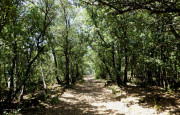
Parcours forestier
4km 90m 90m
Le Brusquet
4km 90m 90m
Le Brusquet
In the forest

Sentier des trois chapelles
3.64km 270m 270m
Digne-les-Bains
3.64km 270m 270m
Digne-les-Bains
Panoramic viewIn the forest
Notre Dame de Lauzière
5.2km 200m 200m
Le Brusquet
5.2km 200m 200m
Le Brusquet
Circuit de la Chapelle d'Auges
1.9km 60m 60m
Peyruis
1.9km 60m 60m
Peyruis
In the forest
Sentier Marcel
4km 200m 200m
Prads-Haute-Bléone
4km 200m 200m
Prads-Haute-Bléone
In the forestArt hikes
Sentier thématique du plateau de la Chau
3.1km 170m 170m
Montclar
3.1km 170m 170m
Montclar
Lake viewIn mountainsPanoramic view
Découverte du Golf des Lavandes
2.25km 40m 40m
Digne-les-Bains
2.25km 40m 40m
Digne-les-Bains
Panoramic viewIn mountains
Sentier du parc du château
1.3km 20m 20m
Château-Arnoux-Saint-Auban
1.3km 20m 20m
Château-Arnoux-Saint-Auban
In the forest
Saint-Vincent-les-Forts
9.6km 180m 180m
Montclar
9.6km 180m 180m
Montclar
Panoramic viewIn the forestIn mountains

Sommet des philosophes
3.15km 160m 160m
Digne-les-Bains
3.15km 160m 160m
Digne-les-Bains
Panoramic viewIn the forestIn mountainsArt hikes
Sentier de la Tatée
3.61km 110m 110m
Château-Arnoux-Saint-Auban
3.61km 110m 110m
Château-Arnoux-Saint-Auban
In the forest
Sentier du gypse et de Sainte-Madeleine
3.72km 240m 240m
Thoard
3.72km 240m 240m
Thoard
Panoramic viewArt hikes

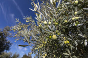
Chemin des Oliviers
3.7km 50m 60m
Les Mées
3.7km 50m 60m
Les Mées
Panoramic view

La Forestière
5.5km 160m 160m
Seyne
5.5km 160m 160m
Seyne
In the forest

Lagremuse
2.9km 160m 160m
Le Chaffaut-Saint-Jurson
2.9km 160m 160m
Le Chaffaut-Saint-Jurson
Panoramic viewGeology hiking
Écobalade : Les 2 tours
2.09km 100m 100m
Volonne
2.09km 100m 100m
Volonne
Panoramic view

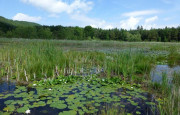
Lac de Saint-Léger
4.7km 130m 130m
Montclar
4.7km 130m 130m
Montclar
On the water's edgeIn the forestLake view
Promenade du philosophe
0.7km 40m 40m
Champtercier
0.7km 40m 40m
Champtercier
Panoramic viewIn mountains

Écobalade : Au Fil de l’eau
4.16km 110m 110m
Volonne
4.16km 110m 110m
Volonne
Panoramic viewIn the forest

Écobalade : Belvédères Saint-Antoine
2.85km 150m 150m
Volonne
2.85km 150m 150m
Volonne
Panoramic view
Sentier botanique de Treguier
4.97km 170m 170m
Moustiers-Sainte-Marie
4.97km 170m 170m
Moustiers-Sainte-Marie
Panoramic viewLake view
La Salette
3.3km 190m 190m
Montclar
3.3km 190m 190m
Montclar
Panoramic viewIn the forest
Cabane des mulets
3.4km 260m 260m
Seyne
3.4km 260m 260m
Seyne
Panoramic viewIn the forestIn mountains

Belvedere de Saint-Jean
4.5km 200m 190m
Château-Arnoux-Saint-Auban
4.5km 200m 190m
Château-Arnoux-Saint-Auban
Panoramic viewIn the forest

La chapelle Notre Dame (variante longue)
3.8km 210m 210m
La Javie
3.8km 210m 210m
La Javie
Balade du Thoron
3.3km 160m 160m
Thoard
3.3km 160m 160m
Thoard
Les Portes d'Entrages
3.79km 130m 130m
Entrages
3.79km 130m 130m
Entrages
Panoramic viewIn mountainsArt hikes

Sentier des Muletiers
4.2km 180m 180m
Sainte-Croix-du-Verdon
4.2km 180m 180m
Sainte-Croix-du-Verdon
Panoramic viewLake view
Petit tour du lac
3.8km 10m 10m
Château-Arnoux-Saint-Auban
3.8km 10m 10m
Château-Arnoux-Saint-Auban
In the forestLake view
Lac de Saint-Léger
4.94km 140m 140m
Montclar
4.94km 140m 140m
Montclar
Lagremuse
2.94km 160m 160m
Le Chaffaut-Saint-Jurson
2.94km 160m 160m
Le Chaffaut-Saint-Jurson
Panoramic viewGeology hiking
Écobalade : Belvédères Saint-Antoine
2.85km 150m 150m
Volonne
2.85km 150m 150m
Volonne
Panoramic view

Promenade du philosophe
0.73km 40m 40m
Champtercier
0.73km 40m 40m
Champtercier
Panoramic viewIn mountains
Écobalade : Balade du patrimoine
2.24km 70m 70m
Volonne
2.24km 70m 70m
Volonne
Panoramic view
Sentier Armand Payan
3.61km 200m 200m
Barles
3.61km 200m 200m
Barles
In mountains
Sentier de découverte de Marcoux
1.4km 80m 80m
Marcoux
1.4km 80m 80m
Marcoux
Panoramic viewIn the forestIn mountainsArt hikes

Le Col
6.2km 270m 270m
Auzet
6.2km 270m 270m
Auzet
Panoramic viewIn the forestIn mountains
Chapelle Notre-Dame
3.36km 180m 180m
Mézel
3.36km 180m 180m
Mézel
Panoramic view

Sentier de découverte du Col de Fontbelle
2.46km 90m 90m
Le Castellard-Melan
2.46km 90m 90m
Le Castellard-Melan
In the forestGeology hiking

Tour du village par les Claux
2.45km 110m 110m
Moustiers-Sainte-Marie
2.45km 110m 110m
Moustiers-Sainte-Marie
Panoramic viewIn the forest

Chapelle Saint Pancrace
5.62km 260m 260m
Digne-les-Bains
5.62km 260m 260m
Digne-les-Bains
Panoramic viewIn mountainsGeology hiking
Forêt de Valentin
6.08km 200m 200m
Selonnet
6.08km 200m 200m
Selonnet
Panoramic viewIn the forestIn mountains

Montée du Vieux-Bras d'Asse
2.42km 140m 140m
Bras-d'Asse
2.42km 140m 140m
Bras-d'Asse
Panoramic view

Sentier de découverte de Caguerenard
5.74km 230m 230m
Digne-les-Bains
5.74km 230m 230m
Digne-les-Bains
Geology hiking
Ichtyosaure de la Robine
4.27km 200m 200m
La Robine-sur-Galabre
4.27km 200m 200m
La Robine-sur-Galabre
In the forestGeology hiking
La Routo et la Chapelle Saint-Jean
3.6km 230m 230m
Saint-Jeannet
3.6km 230m 230m
Saint-Jeannet
In the forest
Sentier des trois chapelles
3.65km 270m 270m
Digne-les-Bains
3.65km 270m 270m
Digne-les-Bains
Panoramic viewIn the forest
Boucle de la Dalle aux ammonites
3.2km 110m 110m
Digne-les-Bains
3.2km 110m 110m
Digne-les-Bains
In the forestGeology hiking

Chapelle Notre Dame (variante courte)
2.28km 140m 140m
La Javie
2.28km 140m 140m
La Javie

Circuit de la Chapelle d'Auges
1.92km 60m 60m
Peyruis
1.92km 60m 60m
Peyruis
In the forest
Parcours forestier
4.13km 110m 110m
Le Brusquet
4.13km 110m 110m
Le Brusquet
In the forest

Notre Dame de Lauzière
5.29km 210m 210m
Le Brusquet
5.29km 210m 210m
Le Brusquet

Sentier du parc du château
1.39km 20m 20m
Château-Arnoux-Saint-Auban
1.39km 20m 20m
Château-Arnoux-Saint-Auban
In the forest

Sentier thématique du plateau de la Chau
3.22km 180m 180m
Montclar
3.22km 180m 180m
Montclar
Lake viewIn mountainsPanoramic view

Sentier Marcel
4.1km 200m 200m
Prads-Haute-Bléone
4.1km 200m 200m
Prads-Haute-Bléone
In the forestArt hikes

Sentier de la Tatée
3.61km 110m 110m
Château-Arnoux-Saint-Auban
3.61km 110m 110m
Château-Arnoux-Saint-Auban
In the forest

Saint-Vincent-les-Forts
9.66km 200m 200m
Montclar
9.66km 200m 200m
Montclar
Panoramic viewIn the forestIn mountains

Découverte du Golf des Lavandes
2.25km 40m 40m
Digne-les-Bains
2.25km 40m 40m
Digne-les-Bains
Panoramic viewIn mountains
Chemin des Oliviers
3.63km 60m 60m
Les Mées
3.63km 60m 60m
Les Mées
Panoramic view
Écobalade : Au Fil de l’eau
4.16km 110m 110m
Volonne
4.16km 110m 110m
Volonne
Panoramic viewIn the forest
Sommet des philosophes
3.15km 160m 160m
Digne-les-Bains
3.15km 160m 160m
Digne-les-Bains
Panoramic viewIn the forestIn mountainsArt hikes

Écobalade : Les 2 tours
2.09km 100m 100m
Volonne
2.09km 100m 100m
Volonne
Panoramic view

Sentier du gypse et de Sainte-Madeleine
3.73km 240m 240m
Thoard
3.73km 240m 240m
Thoard
Panoramic viewArt hikes
La Forestière
5.63km 180m 180m
Seyne
5.63km 180m 180m
Seyne
In the forest

Circuit des Bruyères
5.51km 210m 210m
Château-Arnoux-Saint-Auban
5.51km 210m 210m
Château-Arnoux-Saint-Auban
In the forest

Circuit littéraire "Jean Proal"
4.5km 320m 320m
Seyne
4.5km 320m 320m
Seyne
Panoramic viewIn the forestIn mountains

Boucle de Palus
7.9km 260m 260m
Beynes
7.9km 260m 260m
Beynes
In the forest
Fissac
7km 260m 260m
Auzet
7km 260m 260m
Auzet
Panoramic viewIn mountains

Pont romain - Chapelle Saint-André
5.1km 320m 320m
Beynes
5.1km 320m 320m
Beynes
In the forest
Sentier des Muletiers
4.33km 200m 200m
Sainte-Croix-du-Verdon
4.33km 200m 200m
Sainte-Croix-du-Verdon
Panoramic viewLake view

Rive de l'Asse depuis Mézel
10.8km 80m 80m
Mézel
10.8km 80m 80m
Mézel
In the forest
Tour du château
6.59km 220m 220m
Selonnet
6.59km 220m 220m
Selonnet
Panoramic viewIn the forestIn mountains

Petit tour du lac
3.91km 20m 20m
Château-Arnoux-Saint-Auban
3.91km 20m 20m
Château-Arnoux-Saint-Auban
In the forestLake view
Chemins de Caramantran et des Oreilles d'ânes
4.64km 370m 370m
Digne-les-Bains
4.64km 370m 370m
Digne-les-Bains
Panoramic viewIn the forest
Sentiers des Oliviers
6.23km 150m 150m
Estoublon
6.23km 150m 150m
Estoublon
In the forest
Rive de l'Asse depuis Bras d'Asse
12.2km 140m 140m
Bras-d'Asse
12.2km 140m 140m
Bras-d'Asse
Le sommet de Saint-Michel
1.11km 140m 140m
Marcoux
1.11km 140m 140m
Marcoux
Panoramic viewIn the forestIn mountainsArt hikes
Chemin de Puimichel
5.97km 310m 310m
Malijai
5.97km 310m 310m
Malijai
Panoramic view
Chapelle Saint-Jean
6.37km 380m 380m
Digne-les-Bains
6.37km 380m 380m
Digne-les-Bains
In the forest
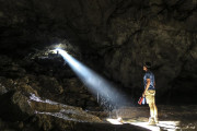
Grotte Saint-Vincent
6.58km 240m 240m
Le Castellard-Melan
6.58km 240m 240m
Le Castellard-Melan
Geology hiking
Les Balcons du Grand-Puy
4.09km 250m 250m
Seyne
4.09km 250m 250m
Seyne
Panoramic viewIn mountains

Sentier botanique de Treguier
4.98km 190m 190m
Moustiers-Sainte-Marie
4.98km 190m 190m
Moustiers-Sainte-Marie
Panoramic viewLake view
Tour du plateau de Ganagobie
5.12km 210m 210m
Ganagobie
5.12km 210m 210m
Ganagobie
In the forestPanoramic view
Jean Médou (Arboretum du Cubertin)
6.6km 370m 370m
Auzet
6.6km 370m 370m
Auzet
Panoramic viewIn the forest
Hameau de Heyre
3.16km 270m 270m
Prads-Haute-Bléone
3.16km 270m 270m
Prads-Haute-Bléone

La Salette
3.45km 200m 200m
Montclar
3.45km 200m 200m
Montclar
Panoramic viewIn the forest
Vieux Mélan
8.7km 330m 330m
Le Castellard-Melan
8.7km 330m 330m
Le Castellard-Melan
In the forest
Hameau de la Cériège
5.6km 310m 310m
Beaujeu
5.6km 310m 310m
Beaujeu
In the forest
Hameau de Tanaron et le rocher Gassendi
4.55km 340m 340m
La Robine-sur-Galabre
4.55km 340m 340m
La Robine-sur-Galabre
Panoramic view
Sentier des Pénitents
4.44km 210m 210m
Les Mées
4.44km 210m 210m
Les Mées
Geology hiking
Tour du Lac
9.65km 60m 60m
Château-Arnoux-Saint-Auban
9.65km 60m 60m
Château-Arnoux-Saint-Auban
In the forestLake view
Circuit des cols
7.1km 280m 280m
Hautes-Duyes
7.1km 280m 280m
Hautes-Duyes
Négron
7.3km 260m 260m
Auzet
7.3km 260m 260m
Auzet
Panoramic viewIn mountains
Lacs du Col Bas
7.8km 350m 340m
Seyne
7.8km 350m 340m
Seyne
On the water's edgeLake viewIn mountainsPanoramic view
Lac de Sainte-Croix par le chemin de Quinson
6.9km 70m 170m
Moustiers-Sainte-Marie
6.9km 70m 170m
Moustiers-Sainte-Marie
Panoramic viewLake view

Cabane des mulets
3.47km 260m 260m
Seyne
3.47km 260m 260m
Seyne
Panoramic viewIn the forestIn mountains

Tour de Tigne
6.18km 260m 260m
Volonne
6.18km 260m 260m
Volonne
In the forestPanoramic view
Terres Noires et Ferme de Belon
8.6km 330m 330m
Draix
8.6km 330m 330m
Draix
In the forestGeology hikingArt hikes
Belvedere de Saint-Jean
4.62km 200m 200m
Château-Arnoux-Saint-Auban
4.62km 200m 200m
Château-Arnoux-Saint-Auban
Hameaux de Verdaches
6.1km 260m 260m
Verdaches
6.1km 260m 260m
Verdaches
In mountains
Forêt du Labouret
7.04km 340m 340m
Le Vernet
7.04km 340m 340m
Le Vernet
In the forest
Chapelle Saint-Philippe
6.46km 230m 230m
Mirabeau
6.46km 230m 230m
Mirabeau
Circuit de Saint Pierre
6.79km 350m 350m
L'Escale
6.79km 350m 350m
L'Escale
In the forest
Crêtes du Grand Puy
8.17km 450m 450m
Seyne
8.17km 450m 450m
Seyne
Panoramic viewIn mountains
Découverte de Mallemoisson
7.6km 150m 150m
Mallemoisson
7.6km 150m 150m
Mallemoisson
In the forest
Tour de la Magdeleine
10.21km 440m 440m
Volonne
10.21km 440m 440m
Volonne
Panoramic viewIn the forest
Rocher de Neuf Heures (892 m)
2.58km 270m 270m
Digne-les-Bains
2.58km 270m 270m
Digne-les-Bains
In the forestIn mountains
L'Auragnerie
7.01km 310m 310m
Seyne
7.01km 310m 310m
Seyne
Panoramic viewIn the forest
Espinouse
7.8km 370m 370m
Le Chaffaut-Saint-Jurson
7.8km 370m 370m
Le Chaffaut-Saint-Jurson
In the forest
Panorama du Vélodrome
4.54km 340m 340m
La Robine-sur-Galabre
4.54km 340m 340m
La Robine-sur-Galabre
Panoramic viewGeology hiking
Courbons et le Saumon
4.61km 280m 280m
Digne-les-Bains
4.61km 280m 280m
Digne-les-Bains
Vieil Aiglun et le Puy
5.9km 390m 390m
Aiglun
5.9km 390m 390m
Aiglun
Roche-Rousse
7.21km 530m 530m
La Robine-sur-Galabre
7.21km 530m 530m
La Robine-sur-Galabre
Panoramic viewArt hikes

La chapelle Notre Dame (variante longue)
3.99km 220m 220m
La Javie
3.99km 220m 220m
La Javie
Pierre Saint-Martin
6.72km 320m 320m
Digne-les-Bains
6.72km 320m 320m
Digne-les-Bains
Panoramic view

Balade du Thoron
3.37km 160m 160m
Thoard
3.37km 160m 160m
Thoard

Les Portes d'Entrages
3.79km 140m 140m
Entrages
3.79km 140m 140m
Entrages
Panoramic viewIn mountainsArt hikes
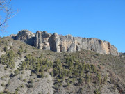
Barre des Dourbes (1728 m)
11.4km 670m 670m
Digne-les-Bains
11.4km 670m 670m
Digne-les-Bains
Panoramic viewIn the forestIn mountainsGeology hiking
Tour de Mouresse
9.8km 450m 450m
Moustiers-Sainte-Marie
9.8km 450m 450m
Moustiers-Sainte-Marie
Panoramic viewIn the forest
Tour de Chènerilles
12km 460m 460m
Malijai
12km 460m 460m
Malijai
In the forest
Sommet de Dormillouse et Lacs du Col Bas depuis le télésiège du Belvédère
12.9km 670m 670m
Montclar
12.9km 670m 670m
Montclar
On the water's edgePanoramic viewLake viewIn mountains
Sommet de l'Agra (1523 m)
10.4km 640m 640m
Saint-Jurs
10.4km 640m 640m
Saint-Jurs
Panoramic viewIn mountains
Sommet de Dormillouse et Lacs du Col Bas depuis le parking du Col-Bas
12.5km 690m 690m
Seyne
12.5km 690m 690m
Seyne
On the water's edgePanoramic viewLake viewIn mountains
Circuit de Pourachère
11.9km 510m 510m
Malijai
11.9km 510m 510m
Malijai
Panoramic viewIn the forest
Fissac et Col de Grangeasse
11.5km 420m 420m
Auzet
11.5km 420m 420m
Auzet
Panoramic viewIn the forest

Chapelle Saint-Joseph (par Volonne)
14.1km 760m 760m
Volonne
14.1km 760m 760m
Volonne
Panoramic viewIn the forest
Col de Clapouse
8.02km 570m 570m
Barles
8.02km 570m 570m
Barles
Panoramic viewIn mountains

Crête de Géruen (1880 m)
13.6km 640m 640m
Le Castellard-Melan
13.6km 640m 640m
Le Castellard-Melan
Panoramic viewIn the forestIn mountainsGeology hiking
Sommet de Dormillouse depuis le télésiège du Belvédère
8.56km 550m 550m
Montclar
8.56km 550m 550m
Montclar
Panoramic viewLake viewIn mountains
Crête des mélèzes
10.9km 560m 560m
Saint-Martin-lès-Seyne
10.9km 560m 560m
Saint-Martin-lès-Seyne
Panoramic viewIn the forest

Gorges de Trévans - Sentier du belvédère
9.2km 470m 470m
Estoublon
9.2km 470m 470m
Estoublon
Panoramic viewIn the forestGeology hiking
Tour des Plaines
8.8km 320m 320m
Saint-Julien-d'Asse
8.8km 320m 320m
Saint-Julien-d'Asse
Panoramic view
Rochette et les Clots
11.95km 560m 560m
Selonnet
11.95km 560m 560m
Selonnet
Panoramic viewIn the forest

Grande Aiguille (1728 m)
10.8km 550m 550m
Le Castellard-Melan
10.8km 550m 550m
Le Castellard-Melan
Panoramic viewIn mountains
Gorges de Trévans - Sentier de Valbonnette
9.3km 470m 470m
Estoublon
9.3km 470m 470m
Estoublon
Panoramic view
Tour de Praconteau
14.01km 500m 500m
Peyruis
14.01km 500m 500m
Peyruis
In the forest
La Peyronnière
10.16km 620m 620m
Auzet
10.16km 620m 620m
Auzet
Panoramic view
Hameau du Poil
11.8km 480m 480m
Majastres
11.8km 480m 480m
Majastres
In the forest
Circuit des cols et le hameau d'Auribeau
11.1km 480m 480m
La Robine-sur-Galabre
11.1km 480m 480m
La Robine-sur-Galabre
In the forest

Forêt du Prieuré
10.8km 440m 450m
Ganagobie
10.8km 440m 450m
Ganagobie
Panoramic view
Tour des clues de Verdaches
8.2km 370m 380m
Verdaches
8.2km 370m 380m
Verdaches
In mountainsGeology hiking
Col des Cloches
9.6km 580m 580m
Barles
9.6km 580m 580m
Barles
Panoramic viewIn mountains

Tour de la roche des Brigands
10km 400m 400m
Hautes-Duyes
10km 400m 400m
Hautes-Duyes
Panoramic viewIn the forest

Sentier de la chaine
6.6km 420m 420m
Moustiers-Sainte-Marie
6.6km 420m 420m
Moustiers-Sainte-Marie
Lake viewPanoramic view
Hameau de Creisset
9.6km 500m 500m
Beynes
9.6km 500m 500m
Beynes
In the forest
Balade du Pré du Bois
12.7km 430m 430m
Verdaches
12.7km 430m 430m
Verdaches

Circuit de Vincel
10km 450m 440m
Moustiers-Sainte-Marie
10km 450m 440m
Moustiers-Sainte-Marie
Lake viewPanoramic view
Garéous
7.8km 480m 480m
Verdaches
7.8km 480m 480m
Verdaches
In the forest
Chapelle Saint-Joseph (par Thoard)
12.75km 650m 650m
Thoard
12.75km 650m 650m
Thoard
Ichtyosaure de la Mélaie
5.1km 430m 430m
Prads-Haute-Bléone
5.1km 430m 430m
Prads-Haute-Bléone
In the forestGeology hiking
Sommet de Cuguyon (1393 m)
10.11km 510m 510m
Selonnet
10.11km 510m 510m
Selonnet
Panoramic viewIn the forestIn mountains

Lac de Sainte-Croix par les plaines
12.54km 360m 360m
Moustiers-Sainte-Marie
12.54km 360m 360m
Moustiers-Sainte-Marie
In the forestLake viewPanoramic view

Chemin de la Colle
14.25km 420m 420m
Les Mées
14.25km 420m 420m
Les Mées

Sommet de Dormillouse depuis le télésiège de la Brèche
3km 200m 200m
Montclar
3km 200m 200m
Montclar
On the water's edgePanoramic viewLake viewIn mountains

Castillon par les Baumes
12.63km 570m 570m
Moustiers-Sainte-Marie
12.63km 570m 570m
Moustiers-Sainte-Marie
Hameaux abandonnés
11.7km 480m 480m
Prads-Haute-Bléone
11.7km 480m 480m
Prads-Haute-Bléone
In the forestArt hikes
Circuit du Château
11.9km 570m 570m
Seyne
11.9km 570m 570m
Seyne
Panoramic viewIn the forest
Marignol
10.7km 400m 410m
Moustiers-Sainte-Marie
10.7km 400m 410m
Moustiers-Sainte-Marie
In the forest

Chastelas
11.16km 600m 600m
Beaujeu
11.16km 600m 600m
Beaujeu
Art hikes
Sommet de Dormillouse
8.6km 550m 550m
Montclar
8.6km 550m 550m
Montclar
Panoramic viewLake viewIn mountains

Crêtes de l'Ourbes
17.3km 910m 910m
Moustiers-Sainte-Marie
17.3km 910m 910m
Moustiers-Sainte-Marie
Lake viewPanoramic view
Sommet de Dormillouse depuis le parking du Col Bas
12.74km 610m 610m
Seyne
12.74km 610m 610m
Seyne
On the water's edgePanoramic viewLake viewIn mountains
La Rouerie
13.33km 710m 710m
L'Escale
13.33km 710m 710m
L'Escale
In the forest
La Lame de facibelle
10.94km 630m 630m
La Robine-sur-Galabre
10.94km 630m 630m
La Robine-sur-Galabre
Geology hiking
Plein voir
8km 640m 640m
Moustiers-Sainte-Marie
8km 640m 640m
Moustiers-Sainte-Marie
Panoramic viewLake viewIn mountains

Balcons de la Durance
13.55km 440m 440m
L'Escale
13.55km 440m 440m
L'Escale
Panoramic viewIn the forest
Tour de Tourtourel
6.3km 420m 420m
Seyne
6.3km 420m 420m
Seyne
Panoramic viewIn the forestIn mountains
Champtercier et la balade du Rouveiret
12.3km 460m 470m
Champtercier
12.3km 460m 470m
Champtercier
Bas col et chapelle d'Augès
10.7km 280m 280m
Mallefougasse-Augès
10.7km 280m 280m
Mallefougasse-Augès
In the forest
Tour des Blaches
13.7km 530m 530m
La Javie
13.7km 530m 530m
La Javie
Panoramic view

Col de l'Escuichière
6.18km 510m 510m
La Javie
6.18km 510m 510m
La Javie
Panoramic viewIn the forest
Sources du Rouveiret
15.39km 580m 580m
Digne-les-Bains
15.39km 580m 580m
Digne-les-Bains
Panoramic viewIn mountains

Sommet du Montdenier (1750 m)
32.4km 1450m 1450m
Moustiers-Sainte-Marie
32.4km 1450m 1450m
Moustiers-Sainte-Marie
Lake viewPanoramic view
Traversée La Javie - Saint-Pierre - Prads Haute Bléone
17.6km 1200m 950m
La Javie
17.6km 1200m 950m
La Javie
In the forest

Sommet de Martignon (1430 m)
13.88km 900m 900m
Digne-les-Bains
13.88km 900m 900m
Digne-les-Bains
Panoramic view
Bois de la Julie
13.5km 970m 970m
Prads-Haute-Bléone
13.5km 970m 970m
Prads-Haute-Bléone
In the forest
Pic de Bernardez (2430 m)
12.7km 970m 970m
Seyne
12.7km 970m 970m
Seyne
Panoramic viewIn the forestIn mountains
Crête de Limans
12.27km 670m 670m
Marcoux
12.27km 670m 670m
Marcoux
Panoramic viewIn mountains
Plateau de Saint-Jurs
8.9km 460m 60m
Bras-d'Asse
8.9km 460m 60m
Bras-d'Asse
Panoramic viewIn the forest
Tour du Carton
19.8km 1160m 1160m
Prads-Haute-Bléone
19.8km 1160m 1160m
Prads-Haute-Bléone
Panoramic viewIn the forest
Crête du Pré de l'Evêque
18.5km 1280m 1280m
Draix
18.5km 1280m 1280m
Draix
Panoramic viewIn the forest
Trois Pâturages
19km 1260m 1260m
Prads-Haute-Bléone
19km 1260m 1260m
Prads-Haute-Bléone
Panoramic view
Sommet du Blayeul (2189 m)
12.74km 1130m 1130m
Verdaches
12.74km 1130m 1130m
Verdaches
Panoramic viewIn mountains
Sommet de tête Grosse
12.9km 680m 680m
Selonnet
12.9km 680m 680m
Selonnet
Panoramic viewIn mountains
Tour des montagnes d'Auzet
15.74km 860m 860m
Auzet
15.74km 860m 860m
Auzet
Panoramic viewIn the forestIn mountains
Montagne de Beynes (1601 m)
13.8km 870m 870m
Beynes
13.8km 870m 870m
Beynes
Panoramic viewIn the forestIn mountains

Cousson par Entrages (1512 m)
12.07km 730m 730m
Entrages
12.07km 730m 730m
Entrages
Panoramic viewIn mountainsArt hikes
Cousson par Digne-les-Bains (1512 m)
15.61km 970m 970m
Digne-les-Bains
15.61km 970m 970m
Digne-les-Bains
Panoramic viewIn mountains
Cousson par Châteauredon (1512 m)
13.91km 970m 970m
Digne-les-Bains
13.91km 970m 970m
Digne-les-Bains
Panoramic viewIn mountains
Circuit des Chapelles
14.2km 600m 600m
Montclar
14.2km 600m 600m
Montclar
In the forestIn mountains
Sommet de Grisonnière (2010 m)
9.88km 780m 780m
Le Vernet
9.88km 780m 780m
Le Vernet
Panoramic viewIn the forestIn mountains
Sommet de la Bigue (1653 m)
24.05km 1140m 1140m
Thoard
24.05km 1140m 1140m
Thoard
Panoramic viewIn the forest
Sommet de l’Estrop (2961 m)
24.93km 1780m 1780m
Prads-Haute-Bléone
24.93km 1780m 1780m
Prads-Haute-Bléone
Panoramic viewIn mountains
Refuge de l'Estrop
16.6km 860m 860m
Prads-Haute-Bléone
16.6km 860m 860m
Prads-Haute-Bléone
Panoramic viewIn mountains
Pic de Couar (1989 m)
14.52km 1050m 1050m
Archail
14.52km 1050m 1050m
Archail
Panoramic viewIn the forestIn mountains
Tour de Tête Grosse
15.19km 580m 580m
Selonnet
15.19km 580m 580m
Selonnet
Panoramic viewIn mountains

Hameaux du Blayeul
16.73km 630m 630m
La Javie
16.73km 630m 630m
La Javie
In the forest
Balcons de l'Asse
14.22km 500m 570m
Mézel
14.22km 500m 570m
Mézel
In the forest

Sommet du Pavillon (1625 m)
23.7km 1140m 1140m
Moustiers-Sainte-Marie
23.7km 1140m 1140m
Moustiers-Sainte-Marie
Lake viewIn mountainsPanoramic view

GR®69 - La Routo® On the paths of transhumance
250.1km 9332m 7250m
Saint-Jurs
250.1km 9332m 7250m
Saint-Jurs
Panoramic view

GR®4 – Haute-Provence via the Verdon Gorges
33.49km 1480m 1064m
Moustiers-Sainte-Marie
33.49km 1480m 1064m
Moustiers-Sainte-Marie
Panoramic viewLake view
GR®6 – From Blanche to Provence
57.12km 3695m 2596m
Seyne
57.12km 3695m 2596m
Seyne
Panoramic viewIn the forest

GR®406 - La Route Napoléon
71.55km 2076m 1539m
Digne-les-Bains
71.55km 2076m 1539m
Digne-les-Bains
In mountains

GR®653D - Saint Jacques de Compostelle et de Rome
34.63km 1128m 1205m
Château-Arnoux-Saint-Auban
34.63km 1128m 1205m
Château-Arnoux-Saint-Auban
In the forestIn mountains
Trail n°1 - Tour de Saint-Léger
4.88km 140m 140m
Montclar
4.88km 140m 140m
Montclar
On the water's edgeIn the forestLake viewIn mountains
Trail n°1 - Chabanas
5km 240m 240m
L'Escale
5km 240m 240m
L'Escale
In the forest
Trail n°1 - Sentier de Caguerenard
5.5km 100m 100m
Digne-les-Bains
5.5km 100m 100m
Digne-les-Bains
Panoramic view
Trail n°3 - Tour de la colline du château
6.63km 220m 220m
Selonnet
6.63km 220m 220m
Selonnet
Panoramic viewIn the forest
Trail n°2 - Tour de Valentin
5.84km 200m 200m
Selonnet
5.84km 200m 200m
Selonnet
Panoramic viewIn the forestIn mountains
Trail n°4 - Tour de l'Auragnerie
6.91km 310m 310m
Seyne
6.91km 310m 310m
Seyne
Panoramic viewIn mountains
Trail n°5 - Crêtes de Fissac
6.9km 290m 290m
Auzet
6.9km 290m 290m
Auzet
In mountainsPanoramic view
Trail n°1 – Le lac de Sainte Croix
13km 400m 400m
Moustiers-Sainte-Marie
13km 400m 400m
Moustiers-Sainte-Marie
Panoramic viewLake view

Trail n°13 - Grand tour des Chapelles
14.48km 610m 610m
Montclar
14.48km 610m 610m
Montclar
Panoramic viewIn the forest
Trail n°2 - Les trois Chapelles
6.91km 280m 280m
Digne-les-Bains
6.91km 280m 280m
Digne-les-Bains
Panoramic view
Trail n°7 - Crêtes du Grand Puy
8.02km 470m 470m
Seyne
8.02km 470m 470m
Seyne
In mountainsPanoramic view
Trail n°2 - Le Pic Bernard
11.12km 550m 550m
L'Escale
11.12km 550m 550m
L'Escale
Panoramic viewIn the forest
Trail n°4 - Le Trail des 2 Tours
9.97km 290m 290m
Volonne
9.97km 290m 290m
Volonne
Trail n°5 - Les Balcons de la Durance
14.35km 489m 489m
L'Escale
14.35km 489m 489m
L'Escale
Panoramic viewIn the forest
Trail n°6 - Petit Tour des Chapelles
9.54km 330m 330m
Montclar
9.54km 330m 330m
Montclar
On the water's edgeIn the forestLake viewIn mountains
Trail N°3 - Voie romaine et Venascle
11.9km 540m 540m
Moustiers-Sainte-Marie
11.9km 540m 540m
Moustiers-Sainte-Marie
Panoramic viewLake view
Trail n°2 – En Naups
12.93km 590m 590m
Moustiers-Sainte-Marie
12.93km 590m 590m
Moustiers-Sainte-Marie
Panoramic viewLake view
Trail n°10 - Col de la Grangeasse
11.45km 470m 470m
Auzet
11.45km 470m 470m
Auzet
Panoramic view

Trail n°11 - Sommet du Château
9.64km 410m 410m
Selonnet
9.64km 410m 410m
Selonnet
Panoramic viewIn the forestIn mountains

Trail n°12 - Tour de Tête Grosse
15.64km 640m 640m
Selonnet
15.64km 640m 640m
Selonnet
Panoramic view
Trail n°14 - Tour de Tête Grosse depuis le col du Fanget
23.08km 900m 900m
Auzet
23.08km 900m 900m
Auzet
In mountainsPanoramic view
Trail n°3 - Sommet du Cousson
16.68km 1010m 1010m
Digne-les-Bains
16.68km 1010m 1010m
Digne-les-Bains
Panoramic viewIn the forest
Trail n°16 - Tour du Château de Montclar
24.11km 1020m 1020m
Montclar
24.11km 1020m 1020m
Montclar
On the water's edgePanoramic viewIn the forestLake viewIn mountains
Trail n°4 - Sommet du Martignon
17.02km 1060m 1060m
Digne-les-Bains
17.02km 1060m 1060m
Digne-les-Bains
Panoramic viewIn the forest
Trail n°4 - Sommet du Pavillon
24.33km 1220m 1220m
Moustiers-Sainte-Marie
24.33km 1220m 1220m
Moustiers-Sainte-Marie
Panoramic viewLake view
Trail n°17 - Tour de la Blanche
33.36km 1350m 1350m
Seyne
33.36km 1350m 1350m
Seyne
Trail n°3 - Le Grand Ruth
25.3km 1530m 1530m
L'Escale
25.3km 1530m 1530m
L'Escale
Panoramic viewIn the forest
Trail n°5 - Les deux sommets (Trail n°3 Le Cousson + Trail n°4 Le Martignon)
33.69km 2030m 2030m
Digne-les-Bains
33.69km 2030m 2030m
Digne-les-Bains
Panoramic viewIn the forest
Trail n°5 - Plein Voir
22.56km 1620m 1620m
Moustiers-Sainte-Marie
22.56km 1620m 1620m
Moustiers-Sainte-Marie
Panoramic viewLake view
Trail n°6 - KMV Rocher de Neuf Heures
1.23km 270m 0m
Digne-les-Bains
1.23km 270m 0m
Digne-les-Bains
Panoramic view

Trail n°7 - KMV Le Cousson
5.99km 900m 10m
Digne-les-Bains
5.99km 900m 10m
Digne-les-Bains
Panoramic view

Trail n°8 - KMV Le Blayeul
4.79km 1070m 20m
Verdaches
4.79km 1070m 20m
Verdaches
In mountainsPanoramic view
Trail N°9 - Montée Tête de l'Estrop
12.79km 1800m 70m
Prads-Haute-Bléone
12.79km 1800m 70m
Prads-Haute-Bléone
Panoramic viewIn the forestIn mountains
Trail n°15 - Montée de Dormillouse
9.58km 1190m 20m
Montclar
9.58km 1190m 20m
Montclar
Panoramic viewLake viewIn mountains
Gravel n°G1 - Petit tour de la Durance
20.84km 110m 110m
Château-Arnoux-Saint-Auban
20.84km 110m 110m
Château-Arnoux-Saint-Auban
In the forest
Gravel n°G1 - Tour de Gaubert
14.59km 150m 150m
Digne-les-Bains
14.59km 150m 150m
Digne-les-Bains
Panoramic viewIn the forest
Gravel n°G1 - Tour Seyne - Selonnet
19.25km 350m 350m
Seyne
19.25km 350m 350m
Seyne
Panoramic viewIn mountains
Gravel n°G1 - Le lac de Sainte Croix vu du plateau
19.76km 160m 160m
Moustiers-Sainte-Marie
19.76km 160m 160m
Moustiers-Sainte-Marie
Panoramic viewIn the forest
Gravel n°G2 - Tour des 2 lacs du Verdon
38.22km 510m 510m
Moustiers-Sainte-Marie
38.22km 510m 510m
Moustiers-Sainte-Marie
Panoramic viewIn the forest
Gravel n°G2 - Grand tour de la Durance
39.52km 480m 480m
Château-Arnoux-Saint-Auban
39.52km 480m 480m
Château-Arnoux-Saint-Auban
In the forest
Gravel n°G2 - Tour en forêt de Mallemoisson
28.16km 240m 240m
Digne-les-Bains
28.16km 240m 240m
Digne-les-Bains
Panoramic viewIn the forest

Gravel n°G6 - Tour du col de Fontbelle
31.27km 920m 920m
Thoard
31.27km 920m 920m
Thoard
Panoramic viewIn the forest
Gravel n°G3 - Grand tour des Pénitents
56.01km 1350m 1350m
Château-Arnoux-Saint-Auban
56.01km 1350m 1350m
Château-Arnoux-Saint-Auban
In the forest
Gravel n°G4 - Grand tour des Terres Noires
49.31km 1080m 1080m
Digne-les-Bains
49.31km 1080m 1080m
Digne-les-Bains
Panoramic viewIn the forest
Gravel n°G3 - Tour des villages du plateau de Valensole
46.34km 1000m 1000m
Moustiers-Sainte-Marie
46.34km 1000m 1000m
Moustiers-Sainte-Marie
Panoramic viewIn the forest
Gravel n°G4 - Tour des Gorges du Verdon
97.31km 2340m 2340m
Moustiers-Sainte-Marie
97.31km 2340m 2340m
Moustiers-Sainte-Marie
In the forestPanoramic view
Gravel n°G2 - Tour Col du Fanget - Grand Puy
23.84km 690m 690m
Seyne
23.84km 690m 690m
Seyne
Panoramic viewIn mountains
Gravel n°G3 - Tour Seyne - Montclar - Selonnet
36.22km 860m 860m
Seyne
36.22km 860m 860m
Seyne
Panoramic viewIn mountains

Gravel n°G4 - Grand tour rive droite de la Durance
57.23km 1170m 1170m
Château-Arnoux-Saint-Auban
57.23km 1170m 1170m
Château-Arnoux-Saint-Auban
In the forest
Gravel n°G3 - Petit tour des Terres Noires
30.82km 730m 730m
Digne-les-Bains
30.82km 730m 730m
Digne-les-Bains
Panoramic viewIn the forest
Gravel n°G5 - Tour de Majastres
97.77km 2060m 2060m
Digne-les-Bains
97.77km 2060m 2060m
Digne-les-Bains
Panoramic viewIn the forest
Gravel n°G4 - Grand 8 de la Blanche
62.63km 1710m 1710m
Seyne
62.63km 1710m 1710m
Seyne
Panoramic viewIn mountains
Gravel n°G5 - Tour du massif du Montdenier
66.75km 1780m 1780m
Moustiers-Sainte-Marie
66.75km 1780m 1780m
Moustiers-Sainte-Marie
In the forestPanoramic view
Gravel n°G5 - Tour Sisteron Pont de la Reine Jeanne
61.44km 1350m 1350m
Château-Arnoux-Saint-Auban
61.44km 1350m 1350m
Château-Arnoux-Saint-Auban
In the forest
Gravel Tour du Verdon - Étape Digne - Moustiers
86.15km 2012m 1658m
Digne-les-Bains
86.15km 2012m 1658m
Digne-les-Bains
Panoramic viewIn the forest
P'tites routes du soleil Gravel : étape Sisteron/Digne-les-bains
67.13km 1880m 1780m
Digne-les-Bains
67.13km 1880m 1780m
Digne-les-Bains
Panoramic viewIn the forest
P'tites routes du soleil Gravel : étape Digne-les-Bains/Barême
58.43km 1580m 1450m
Digne-les-Bains
58.43km 1580m 1450m
Digne-les-Bains
Panoramic viewIn the forest

Gravel Tour du Verdon - Étape Digne - Moustiers variante courte
69.64km 1710m 1350m
Digne-les-Bains
69.64km 1710m 1350m
Digne-les-Bains
In the forestPanoramic view
Cyclo n°8 - Val de Durance - Sisteron
38.1km 640m 640m
Château-Arnoux-Saint-Auban
38.1km 640m 640m
Château-Arnoux-Saint-Auban
Panoramic view
Cyclo n°3 - Vallée de l'Asse
58.3km 850m 850m
Digne-les-Bains
58.3km 850m 850m
Digne-les-Bains
In the forest
Cyclo n°15 - La Romaine
45.5km 670m 670m
Moustiers-Sainte-Marie
45.5km 670m 670m
Moustiers-Sainte-Marie
Panoramic viewLake view
Cyclo n°1 - Le tour du Blayeul
63.9km 1080m 1080m
Digne-les-Bains
63.9km 1080m 1080m
Digne-les-Bains
In mountains
Cyclo n°10 - Les Clues de Verdaches
32.6km 670m 670m
Seyne
32.6km 670m 670m
Seyne
In the forestIn mountains
Cyclo n°4 - La Vallée du Bès
60.9km 960m 960m
Digne-les-Bains
60.9km 960m 960m
Digne-les-Bains
Cyclo n°9 - Les deux cols du plateau de Puimichel
74.7km 1290m 1290m
Château-Arnoux-Saint-Auban
74.7km 1290m 1290m
Château-Arnoux-Saint-Auban
Panoramic view

Cyclo n°16 - Le Tour du lac de Sainte-Croix
56.1km 910m 910m
Moustiers-Sainte-Marie
56.1km 910m 910m
Moustiers-Sainte-Marie
Cyclo n°14 - Le Grand Canyon
62.3km 1790m 1790m
Moustiers-Sainte-Marie
62.3km 1790m 1790m
Moustiers-Sainte-Marie
Panoramic viewLake view
Cyclo n°11 - Les Gorges de la Blanche
50.5km 1120m 1120m
Seyne
50.5km 1120m 1120m
Seyne
In mountains
Cyclo n°6 - Le col du Corobin
50.8km 1050m 1050m
Digne-les-Bains
50.8km 1050m 1050m
Digne-les-Bains
Panoramic viewIn the forestIn mountains
Cyclo n°18 - Le Grand Tour du Géoparc
166.5km 3480m 3480m
Digne-les-Bains
166.5km 3480m 3480m
Digne-les-Bains
In the forestIn mountains
Cyclo n°19 - Le Grand Tour des trois cols
192.6km 4120m 4120m
Digne-les-Bains
192.6km 4120m 4120m
Digne-les-Bains
In mountains

Cyclo n°17 - Le Tour des Gorges du Verdon
90km 2340m 2340m
Moustiers-Sainte-Marie
90km 2340m 2340m
Moustiers-Sainte-Marie
Lake view
Cyclo n°12 - Les 4 Cols
70.9km 1550m 1550m
Seyne
70.9km 1550m 1550m
Seyne
Panoramic viewIn the forestIn mountains
Cyclo n°2 - Le Tour de Fontbelle
100km 2160m 2160m
Digne-les-Bains
100km 2160m 2160m
Digne-les-Bains
In the forestIn mountains
Cyclo n°13 - Le tour du lac de Serre-Ponçon
81.3km 1970m 1970m
Montclar
81.3km 1970m 1970m
Montclar
Panoramic viewIn the forestLake viewIn mountains
Cyclo n°5 - Le tour de la montagne de Lure
88.6km 1590m 1590m
Château-Arnoux-Saint-Auban
88.6km 1590m 1590m
Château-Arnoux-Saint-Auban
Panoramic view
Cyclo n°7 - Route des lavandes au Verdon
122.8km 1970m 1970m
Digne-les-Bains
122.8km 1970m 1970m
Digne-les-Bains
Panoramic viewLake view
Montée du Col du Fanget par Auzet
7.7km 420m 20m
Auzet
7.7km 420m 20m
Auzet
In mountains
Montée du Col du Labouret par Verdaches
2.3km 100m 10m
Le Vernet
2.3km 100m 10m
Le Vernet
In mountains
Montée de Chabanon par Selonnet
7.7km 550m 20m
Selonnet
7.7km 550m 20m
Selonnet
In mountains
Montée du Col Saint-Jean par Saint-Vincent les Forts
4.6km 210m 10m
Montclar
4.6km 210m 10m
Montclar
In mountains
Montée du Col de Maure par Seyne-les-Alpes
5.6km 170m 20m
Seyne
5.6km 170m 20m
Seyne
Montée du Col des Fillys par Selonnet
6.4km 300m 40m
Selonnet
6.4km 300m 40m
Selonnet
Montée du Col de Charamel par Selonnet
9.5km 350m 180m
Selonnet
9.5km 350m 180m
Selonnet
In mountains
Montée du Col des Garcinets par Selonnet
11.3km 310m 190m
Selonnet
11.3km 310m 190m
Selonnet

Montée du Col de l'Hysope par Thoard
8.9km 510m 30m
Thoard
8.9km 510m 30m
Thoard
Montée du Col de Fontbelle par Thoard
11.6km 630m 80m
Thoard
11.6km 630m 80m
Thoard
Montée du Col de L'Orme par Digne-les-Bains
6.6km 170m 30m
Digne-les-Bains
6.6km 170m 30m
Digne-les-Bains
Montée du Col de Pas de Bonnet par Digne-les-Bains
7.7km 340m 10m
Digne-les-Bains
7.7km 340m 10m
Digne-les-Bains
Montée du Col de Puimichel par Malijai
8.1km 390m 10m
Malijai
8.1km 390m 10m
Malijai
Montée du Col d'Espinouse par Bras d'Asse
9.9km 380m 20m
Bras-d'Asse
9.9km 380m 20m
Bras-d'Asse
The Tour of the Verdon
258.71km 5496m 5496m
Moustiers-Sainte-Marie
258.71km 5496m 5496m
Moustiers-Sainte-Marie
Panoramic viewLake view
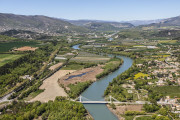
The Durance by bike
47.34km 426m 544m
Château-Arnoux-Saint-Auban
47.34km 426m 544m
Château-Arnoux-Saint-Auban

3 days in the land of the Earth's memory !
Digne-les-Bains
Digne-les-Bains
3 days / 2 nights

2 days in the land of the Earth's memory !
Digne-les-Bains
Digne-les-Bains
2 days / 1 night
Birdwatching stay – Birds of prey in the Haute-Provence Geopark
Digne-les-Bains
Digne-les-Bains
2 days / 1 night
Le Club mountain bike stay, the group formula!
Château-Arnoux-Saint-Auban
Château-Arnoux-Saint-Auban
2 days / 1 night
The MaxiGéant MTB trip, from the Alps to Provence!
Château-Arnoux-Saint-Auban
Château-Arnoux-Saint-Auban
5 days / 4 nights
Le Géant, pure All Mountain MTB trip!
Château-Arnoux-Saint-Auban
Château-Arnoux-Saint-Auban
4 days / 3 nights
«Fameux» Enduro in the Black Lands
Château-Arnoux-Saint-Auban
Château-Arnoux-Saint-Auban
3 days / 2 nights
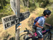
Le Mythique mountain bike stay, the unmissable 100% singletracks!
Château-Arnoux-Saint-Auban
Château-Arnoux-Saint-Auban
3 days / 2 nights
Le Suprême mountain bike stay, pure “Down-Country” mountain biking!
Château-Arnoux-Saint-Auban
Château-Arnoux-Saint-Auban
2 days / 1 night
Mountain biking holiday at Le Campagnard, the easy family option!
Château-Arnoux-Saint-Auban
Château-Arnoux-Saint-Auban
2 days / 1 night
Mountain bike stay Le Montagnard, to do in E.Bike
Seyne
Seyne
3 days / 2 nightsE-BIKE
Mountain bike stay L'Authentique, the best trails of the area
Château-Arnoux-Saint-Auban
Château-Arnoux-Saint-Auban
4 days / 3 nights
3 days cycling Tour - Grand Tour Provence-Alpes
Château-Arnoux-Saint-Auban
Château-Arnoux-Saint-Auban
3 days / 2 nights
Stay 2 days of Cycling - Tour Provence-Alpes
Château-Arnoux-Saint-Auban
Château-Arnoux-Saint-Auban
2 days / 1 night
2 jours de GRAVEL en Haute-Provence
Château-Arnoux-Saint-Auban
Château-Arnoux-Saint-Auban
3 days of GRAVEL in Haute-Provence
Château-Arnoux-Saint-Auban
Château-Arnoux-Saint-Auban
2 days / 1 night
Trail Trip Provence-Alps
Château-Arnoux-Saint-Auban
Château-Arnoux-Saint-Auban
3 days / 2 nights

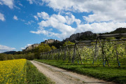
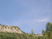
Site de décollage parapente - Le plateau de la Chau
Montclar
Montclar

Site de décollage parapente - L'Andran
Digne-les-Bains
Digne-les-Bains

Site de décollage parapente - Villevieille
Digne-les-Bains
Digne-les-Bains

Site de décollage parapente - Le Cousson
Digne-les-Bains
Digne-les-Bains

Site de décollage parapente - Courchon
Moustiers-Sainte-Marie
Moustiers-Sainte-Marie
National Gliding Center
Château-Arnoux-Saint-Auban
Château-Arnoux-Saint-Auban

Aérodrome et plateforme vélivole de Seyne
Seyne
Seyne
Aéronefs & Aérostats de Provence
Marcoux
Marcoux

Site d'escalade sportif de Blégiers
Prads-Haute-Bléone
Prads-Haute-Bléone

Site d'escalade de Valbonnette / Chabrières
Entrages
Entrages

Site d'escalade de Courbons
Digne-les-Bains
Digne-les-Bains

Climbing at Château-Arnoux
Château-Arnoux-Saint-Auban
Château-Arnoux-Saint-Auban

Digne @ Bloc
Digne-les-Bains
Digne-les-Bains
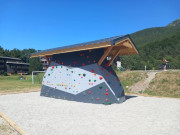
Blocs d'escalade
Montclar
Montclar

Site de bloc de l'Estrop
Prads-Haute-Bléone
Prads-Haute-Bléone
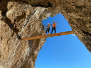
Via Ferrata du Rocher de Neuf Heures
Digne-les-Bains
Digne-les-Bains

Via Ferrata de la Falaise de Meichira
Prads-Haute-Bléone
Prads-Haute-Bléone
International
France
 Provence Alpes Outdoor - Liste des activités

