VTT n°23 - Le Tour de Tigne
Add to my favorites


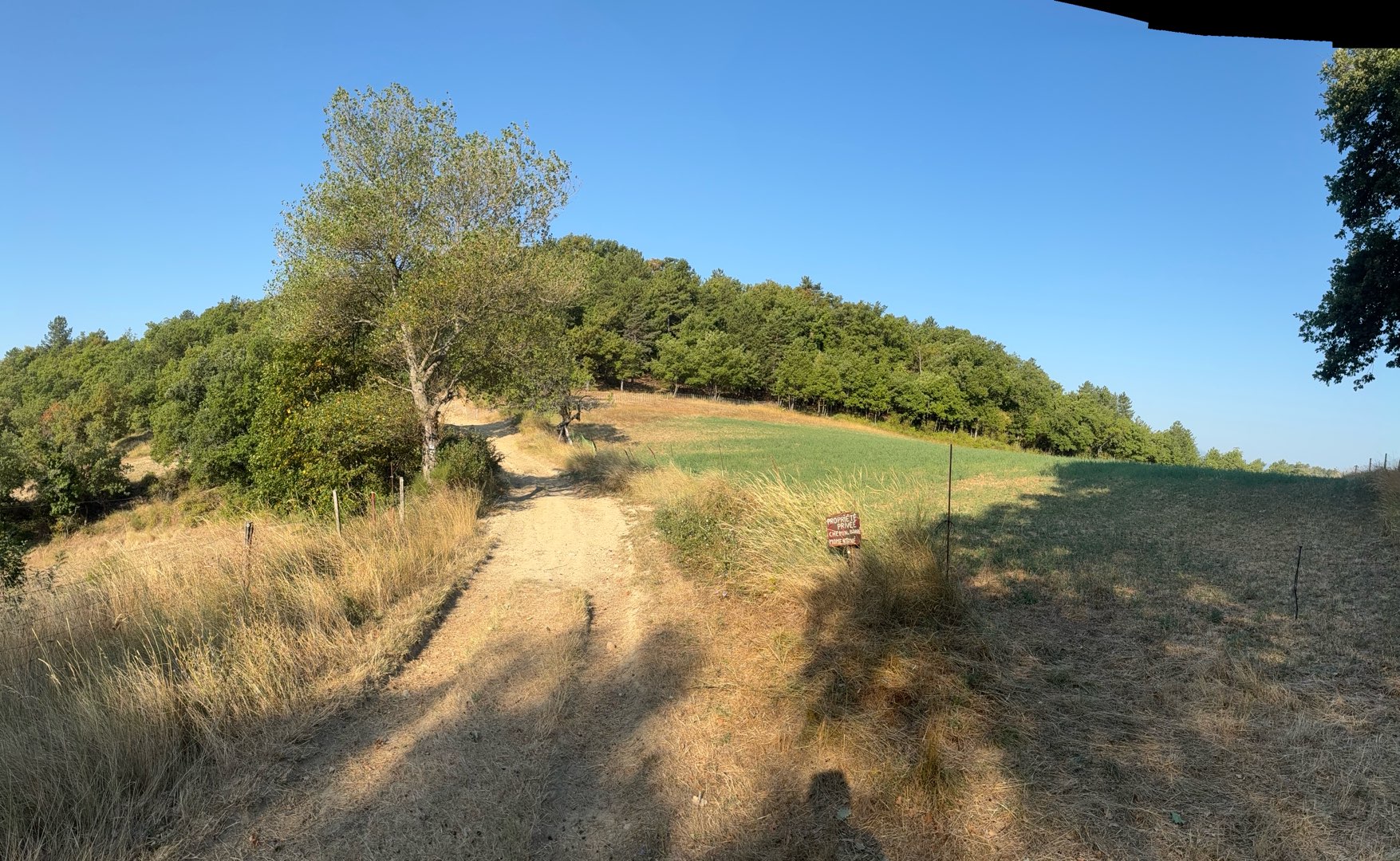
Cross the village towards the Trois Bastides by a small road. The path rises gently to reach the foot of the summit of Tigne. The descent is by a long track to the plateau of La Rouvière where there are lavender fields.
The characteristics of the route.

Volonne (04)
- Distance 9.9 km
- Elevation gain 280 m
- Elevation lost 280 m
- Min. elevation 433 m
- Max. elevation. 679 m
- Duration (depending on pace) 1h
- Suivre le balisage Yes

Departure from Volonne, parking next to the bridge. The departure is shared with route n°12 (La Fubie) to the Trois Bastides then continue straight towards the Hameau des Broumas.
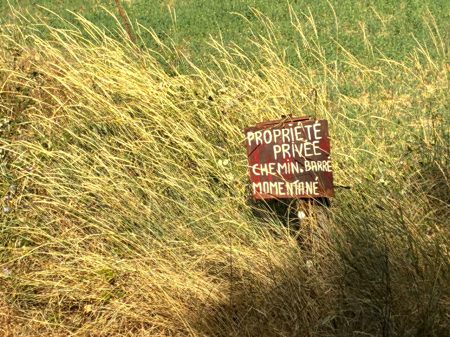
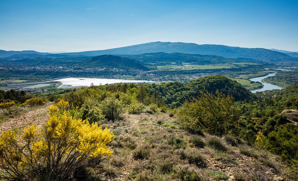
After having toured the Tigne massif, you will descend via an easy track to the Rouvière plateau where there are lavender fields (flowering June/July). Return via a small technical balcony path to the heart of the village.
After having toured the Tigne massif, you will descend via an easy track to the Rouvière plateau where there are lavender fields (flowering June/July). Return via a small technical balcony path to the heart of the village.
Area : Val de Durance
Report a problem
THIS ROUTE IN YOUR MOBILE PHONE
Download Provence Alpes Outdoor app
Get all the routes on your smartphone with the Provence Alpes outdoor app. You'll find a host of functions :
- Take advantage of detailed IGN maps
- Download data for consultation even when you're not connected to the network
- Geolocate yourself at any time on the route and altimeter profile
- Activate the off-track alarm to be alerted if you stray from the itinerary
- Find nearby services
- Share your experience (add a report, share your lap time)...

manulevolonnais
finished in 00:40:00
The 2025/10/25
En savoir plus
fredlesmees04
The 2025/08/18
En savoir plus
Ajouter votre chrono et partager vos sensations
2025/10/25 00:40:00
manulevolonnais
manulevolonnais
petit tour super sympa. Attention aux chiens à la ferme Briançon. Descente vers Volonne un peu technique mais roulante dans les sous bois...de quoi se faire plaisir.
2025/10/25 00:40:00
manulevolonnais
manulevolonnais
petit tour super sympa. Attention aux chiens à la ferme Briançon. Descente vers Volonne un peu technique mais roulante dans les sous bois...de quoi se faire plaisir.


Information updated on 2026-06-09 by Office de Tourisme Provence Alpes Digne les Bains


Provence Alpes Digne-les-Bains tourist office
+ 33(0)4 92 36 62 62
Tourist office
contact mail
Val de Durance – Château-Arnoux tourist office
+33 (0)4 92 64 02 64
Tourist office
contact mail
![]()
Moustiers-Sainte-Marie Tourist office
+ 33(0)4 92 74 67 84
Tourist office
contact mail
Seyne - Blanche Serre-Ponçon Tourist office
+33 (0)4 92 35 11 00
Tourist office
contact mail
 Provence Alpes Outdoor - Parcours - VTT n°23 - Le Tour de Tigne
Hello, world! This is a toast message.
Provence Alpes Outdoor - Parcours - VTT n°23 - Le Tour de Tigne
Hello, world! This is a toast message.
Provence Alpes Outdoor - Parcours - VTT n°23 - Le Tour de Tigne
Hello, world! This is a toast message.


OK
Annuler