Tour de la Magdeleine
Add to my favorites

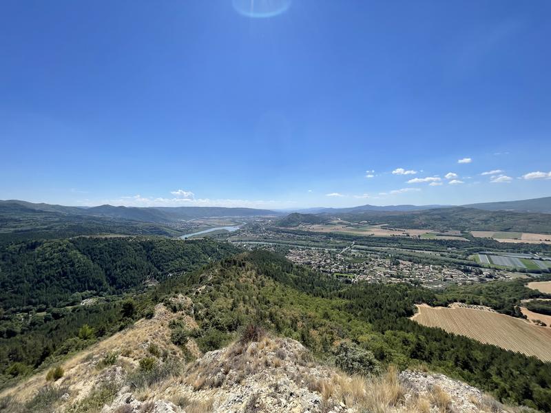
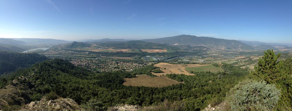
The Tour de la Magdeleine is an ideal circuit to discover, from above, the Durance modified over time by the hand of man. Superb views of the valley, and of the surrounding mountains and countryside.
The characteristics of the route.

Volonne (04)
- Distance 10.21 km
- Elevation gain 440 m
- Elevation lost 440 m
- Min. elevation 448 m
- Max. elevation. 877 m
- Duration (depending on pace) 3h
- Suivre le balisage Yes

From the village square of Volonne, the route follows the same direction as that of the St Antoine belvedere. After passing some farmland, the path rises through a forest of Austrian black pines, from the reforestation carried out by the ONF, up to the large cistern. From there, leave the track to continue along the ridge. The climb is quite steep. When you join the track, the path branches off to the left, through the woods, until reaching pastures below the old sheepfold of La Fubie, inhabited until 1922, then gradually abandoned. The return takes place at the bottom of the ravine, first by a track, then over the last two kilometers by a small tarmac road which will take you to the village.
Area : Val de Durance
Report a problem
THIS ROUTE IN YOUR MOBILE PHONE
Download Provence Alpes Outdoor app
Get all the routes on your smartphone with the Provence Alpes outdoor app. You'll find a host of functions :
- Take advantage of detailed IGN maps
- Download data for consultation even when you're not connected to the network
- Geolocate yourself at any time on the route and altimeter profile
- Activate the off-track alarm to be alerted if you stray from the itinerary
- Find nearby services
- Share your experience (add a report, share your lap time)...

LauLau04
The 2025/08/16
En savoir plus
Ajouter votre chrono et partager vos sensations
2025/08/16 LauLau04
2025/08/16 LauLau04


Information updated on 2025-04-24 by Office de Tourisme Provence Alpes Digne les Bains


Provence Alpes Digne-les-Bains tourist office
+ 33(0)4 92 36 62 62
Tourist office
contact mail
Val de Durance – Château-Arnoux tourist office
+33 (0)4 92 64 02 64
Tourist office
contact mail
![]()
Moustiers-Sainte-Marie Tourist office
+ 33(0)4 92 74 67 84
Tourist office
contact mail
Seyne - Blanche Serre-Ponçon Tourist office
+33 (0)4 92 35 11 00
Tourist office
contact mail
 Provence Alpes Outdoor - Parcours - Tour de la Magdeleine
Hello, world! This is a toast message.
Provence Alpes Outdoor - Parcours - Tour de la Magdeleine
Hello, world! This is a toast message.
Provence Alpes Outdoor - Parcours - Tour de la Magdeleine
Hello, world! This is a toast message.


OK
Annuler