Forêt du Prieuré
Add to my favorites


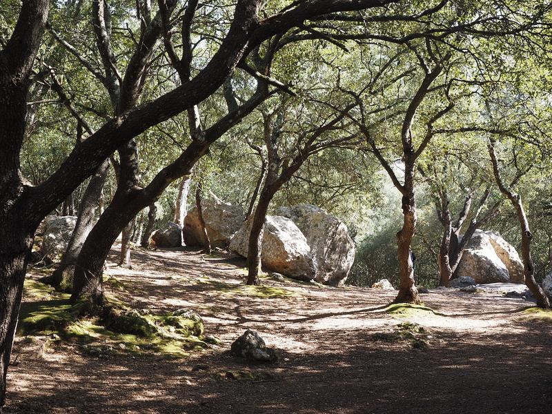
Starting from the town hall of Ganagobie, the hike leads to the plateau. The ridge route allows you to discover a vast forest dominated by Aleppo pines, white and holm oaks. After the descent to the Pont Bernard ravine, the route runs along the canal.
The characteristics of the route.

Ganagobie (04)
- Distance 10.8 km
- Elevation gain 440 m
- Elevation lost 450 m
- Min. elevation 400 m
- Max. elevation. 705 m
- Duration (depending on pace) 3h30
- Suivre le balisage Yes


Area : Val de Durance
Report a problem
THIS ROUTE IN YOUR MOBILE PHONE
Download Provence Alpes Outdoor app
Get all the routes on your smartphone with the Provence Alpes outdoor app. You'll find a host of functions :
- Take advantage of detailed IGN maps
- Download data for consultation even when you're not connected to the network
- Geolocate yourself at any time on the route and altimeter profile
- Activate the off-track alarm to be alerted if you stray from the itinerary
- Find nearby services
- Share your experience (add a report, share your lap time)...

Add your time and share your feelings


Information updated on 2025-07-24 by Office de Tourisme Provence Alpes Digne les Bains


Provence Alpes Digne-les-Bains tourist office
+ 33(0)4 92 36 62 62
Tourist office
contact mail
Val de Durance – Château-Arnoux tourist office
+33 (0)4 92 64 02 64
Tourist office
contact mail
![]()
Moustiers-Sainte-Marie Tourist office
+ 33(0)4 92 74 67 84
Tourist office
contact mail
Seyne - Blanche Serre-Ponçon Tourist office
+33 (0)4 92 35 11 00
Tourist office
contact mail
 Provence Alpes Outdoor - Parcours - Forêt du Prieuré
Hello, world! This is a toast message.
Provence Alpes Outdoor - Parcours - Forêt du Prieuré
Hello, world! This is a toast message.
Provence Alpes Outdoor - Parcours - Forêt du Prieuré
Hello, world! This is a toast message.


OK
Annuler