Sommet de Dormillouse et Lacs du Col Bas depuis le télésiège du Belvédère
Add to my favorites

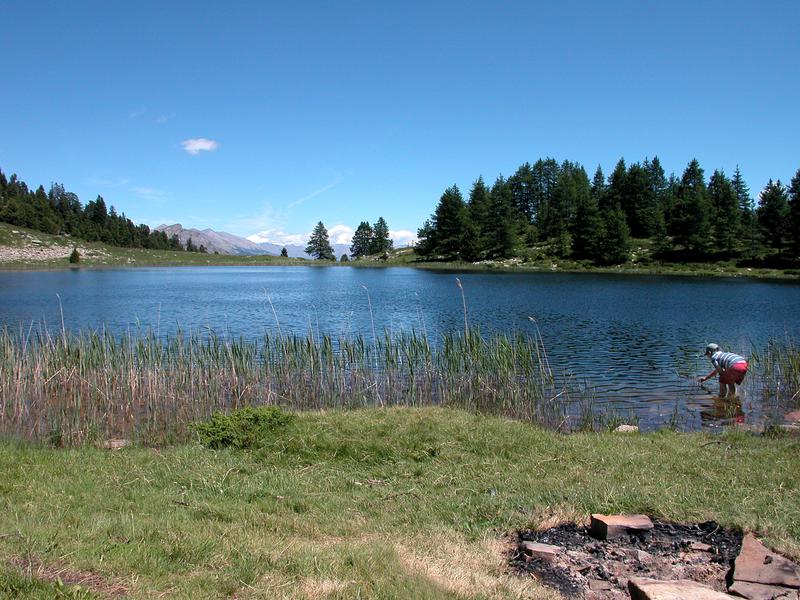
The panoramic view of Lake Serre-Ponçon, along with the beauty of the lakes and the diversity of the landscapes encountered, make this hike, at the crossroads of the Ubaye and La Blanche valleys, an essential itinerary in the Alpes de Haute-Provence.
The characteristics of the route.

Montclar (04)
- Distance 12.9 km
- Elevation gain 670 m
- Elevation lost 670 m
- Min. elevation 1906 m
- Max. elevation. 2487 m
- Duration (depending on pace) 5h
- Suivre le balisage Yes

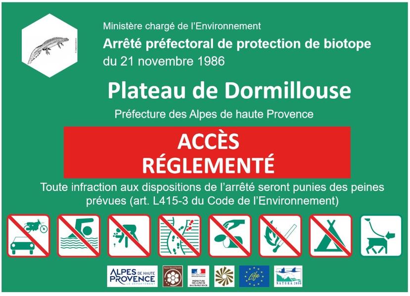
"The site of the Lacs du Col Bas is classified as a Sensitive Natural Area, a fragile site that is rich in biodiversity. It is important to stay on the marked trail (Decree of Biotope Protection No. 8–3106). You can find the arrêté de protection de biotope n°86-3106 for more information.
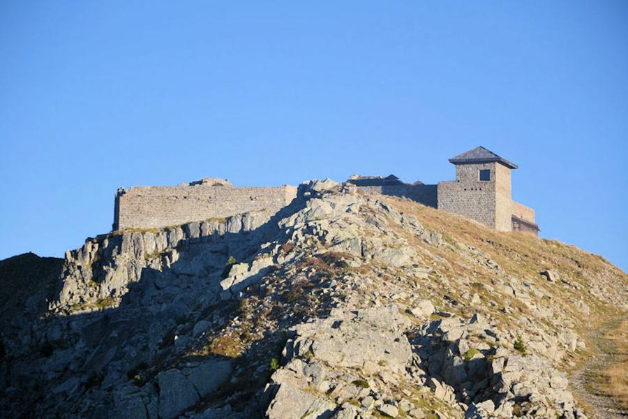
At Lac Noir, it is possible to descend to the Lac du Milieu, whose shores are lined with larch trees. Crossing the pastoral mountain of Clo Bas offers a completely different landscape, with exceptional plant and animal diversity. The ascent to the summit is done through an old military track that follows the mountainside.
At Lac Noir, it is possible to descend to the Lac du Milieu, whose shores are lined with larch trees. Crossing the pastoral mountain of Clo Bas offers a completely different landscape, with exceptional plant and animal diversity. The ascent to the summit is done through an old military track that follows the mountainside.
Area : Blanche Serre-Ponçon
Report a problem
THIS ROUTE IN YOUR MOBILE PHONE
Download Provence Alpes Outdoor app
Get all the routes on your smartphone with the Provence Alpes outdoor app. You'll find a host of functions :
- Take advantage of detailed IGN maps
- Download data for consultation even when you're not connected to the network
- Geolocate yourself at any time on the route and altimeter profile
- Activate the off-track alarm to be alerted if you stray from the itinerary
- Find nearby services
- Share your experience (add a report, share your lap time)...

Add your time and share your feelings


Information updated on 2025-04-03 by Office de Tourisme Provence Alpes Digne les Bains


Provence Alpes Digne-les-Bains tourist office
+ 33(0)4 92 36 62 62
Tourist office
contact mail
Val de Durance – Château-Arnoux tourist office
+33 (0)4 92 64 02 64
Tourist office
contact mail
![]()
Moustiers-Sainte-Marie Tourist office
+ 33(0)4 92 74 67 84
Tourist office
contact mail
Seyne - Blanche Serre-Ponçon Tourist office
+33 (0)4 92 35 11 00
Tourist office
contact mail
 Provence Alpes Outdoor - Parcours - Sommet de Dormillouse et Lacs du Col Bas depuis le télésiège du Belvédère
Hello, world! This is a toast message.
Provence Alpes Outdoor - Parcours - Sommet de Dormillouse et Lacs du Col Bas depuis le télésiège du Belvédère
Hello, world! This is a toast message.
Provence Alpes Outdoor - Parcours - Sommet de Dormillouse et Lacs du Col Bas depuis le télésiège du Belvédère
Hello, world! This is a toast message.


OK
Annuler