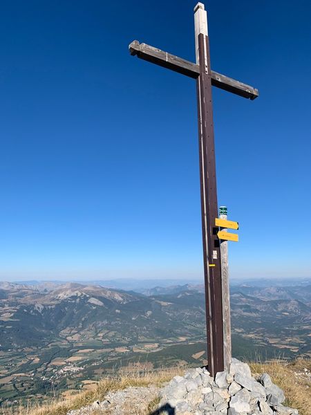
Pic de Bernardez (2430 m)
Add to my favorites

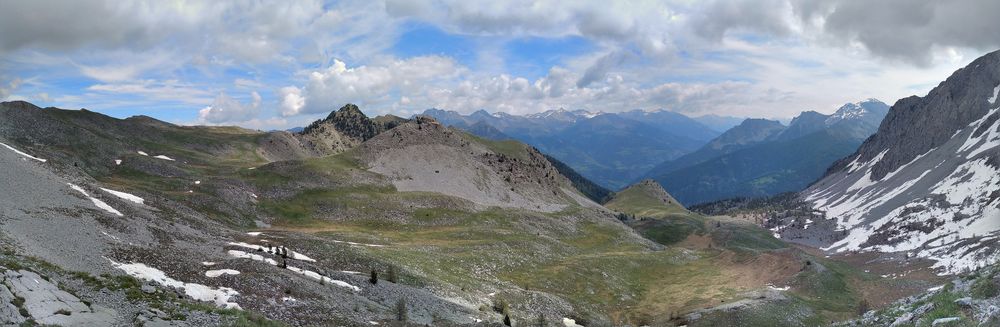
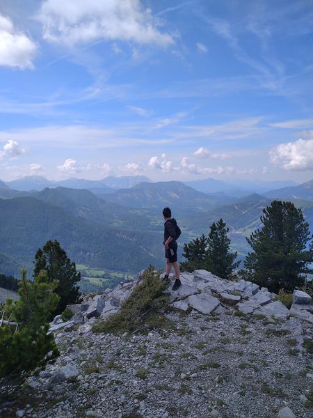
A demanding hike to a magnificent 360° viewpoint over the Ventoux and the Barre des Ecrins. This route follows the GR®6, between Ubaye and Blanche, along the ridge edge. Watch the griffon vultures soar above the thermals.
The characteristics of the route.

Seyne (04)
- Distance 12.7 km
- Elevation gain 970 m
- Elevation lost 970 m
- Min. elevation 1583 m
- Max. elevation. 2425 m
- Duration (depending on pace) 5h30
- Suivre le balisage Yes


From Seyne-les-Alpes (6 km), take the D207 towards Montclar, then the D607 to Saint-Pons, where you follow the Col-Bas forest track (open from May to October). Car park at the crossroads of the road and tracks near the Maison Forestière.
Maison Forestière de Bellevue - At the crossroads with the Maison Forestière, take the path that climbs up from the top of the crossroads on the right-hand side of the road and into the forest. It alternates between several large hairpins and gradually climbs between the larches to reach a crossroads.
La Chaumasse - Follow the GR®6 and GR®69 uphill towards the Col de Bernardez. The path gradually leaves the forest and crosses some scree.
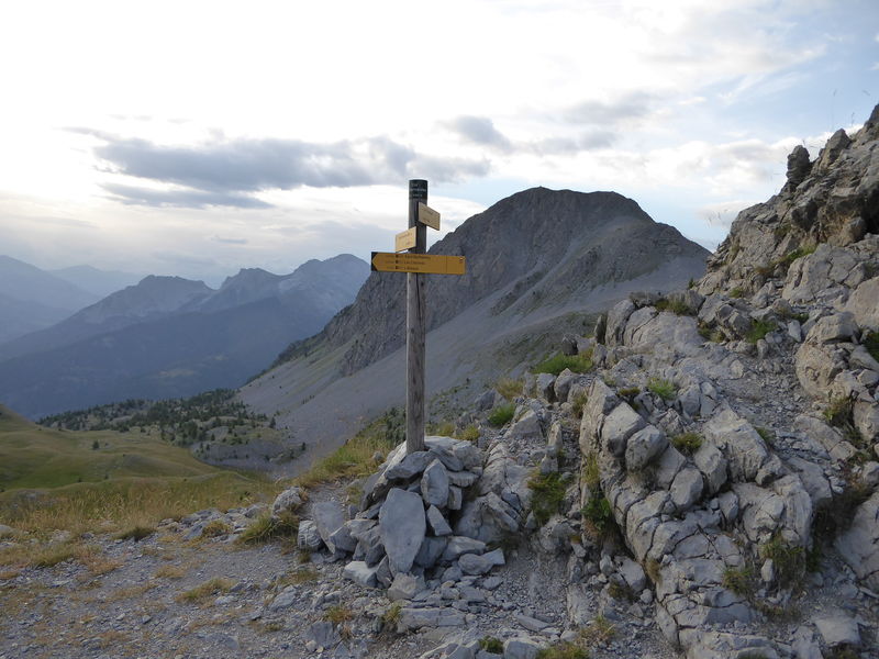
Col de Bernardez - At the col, head directly left along the ridge towards the peak, following a path that is sometimes lightly marked and uneven to reach the summit. Switch to the other side and descend towards the Pic de Savernes, which you must skirt to the left. Reach the Col Bas without going over the summit.
Col Bas - At Col Bas, take the track on the left down towards Seyne les Alpes. After 1 km, reach a bend in the track.
Take the path on the outside of the bend in the track. It becomes narrow and descends in a series of small, sometimes slippery, banked bends. Reach point 2 and then descend along the GR® to the start car park.
Maison Forestière de Bellevue - At the crossroads with the Maison Forestière, take the path that climbs up from the top of the crossroads on the right-hand side of the road and into the forest. It alternates between several large hairpins and gradually climbs between the larches to reach a crossroads.
La Chaumasse - Follow the GR®6 and GR®69 uphill towards the Col de Bernardez. The path gradually leaves the forest and crosses some scree.
Col de Bernardez - At the col, head directly left along the ridge towards the peak, following a path that is sometimes lightly marked and uneven to reach the summit. Switch to the other side and descend towards the Pic de Savernes, which you must skirt to the left. Reach the Col Bas without going over the summit.
Col Bas - At Col Bas, take the track on the left down towards Seyne les Alpes. After 1 km, reach a bend in the track.
Take the path on the outside of the bend in the track. It becomes narrow and descends in a series of small, sometimes slippery, banked bends. Reach point 2 and then descend along the GR® to the start car park.
Area : Blanche Serre-Ponçon
Report a problem
THIS ROUTE IN YOUR MOBILE PHONE
Download Provence Alpes Outdoor app
Get all the routes on your smartphone with the Provence Alpes outdoor app. You'll find a host of functions :
- Take advantage of detailed IGN maps
- Download data for consultation even when you're not connected to the network
- Geolocate yourself at any time on the route and altimeter profile
- Activate the off-track alarm to be alerted if you stray from the itinerary
- Find nearby services
- Share your experience (add a report, share your lap time)...

Add your time and share your feelings


Information updated on 2025-04-03 by Office de Tourisme Provence Alpes Digne les Bains


Provence Alpes Digne-les-Bains tourist office
+ 33(0)4 92 36 62 62
Tourist office
contact mail
Val de Durance – Château-Arnoux tourist office
+33 (0)4 92 64 02 64
Tourist office
contact mail
![]()
Moustiers-Sainte-Marie Tourist office
+ 33(0)4 92 74 67 84
Tourist office
contact mail
Seyne - Blanche Serre-Ponçon Tourist office
+33 (0)4 92 35 11 00
Tourist office
contact mail
 Provence Alpes Outdoor - Parcours - Pic de Bernardez (2430 m)
Hello, world! This is a toast message.
Provence Alpes Outdoor - Parcours - Pic de Bernardez (2430 m)
Hello, world! This is a toast message.
Provence Alpes Outdoor - Parcours - Pic de Bernardez (2430 m)
Hello, world! This is a toast message.


OK
Annuler