Tour des clues de Verdaches
Add to my favorites

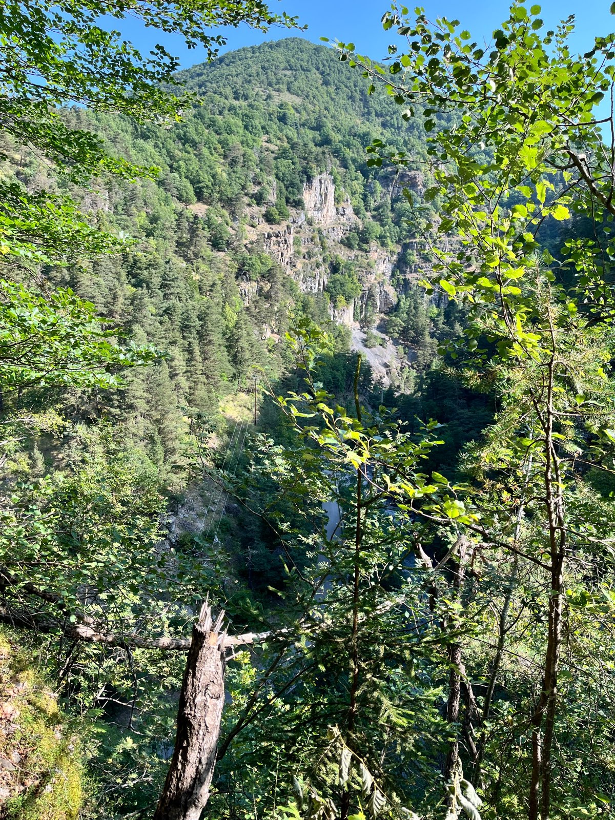
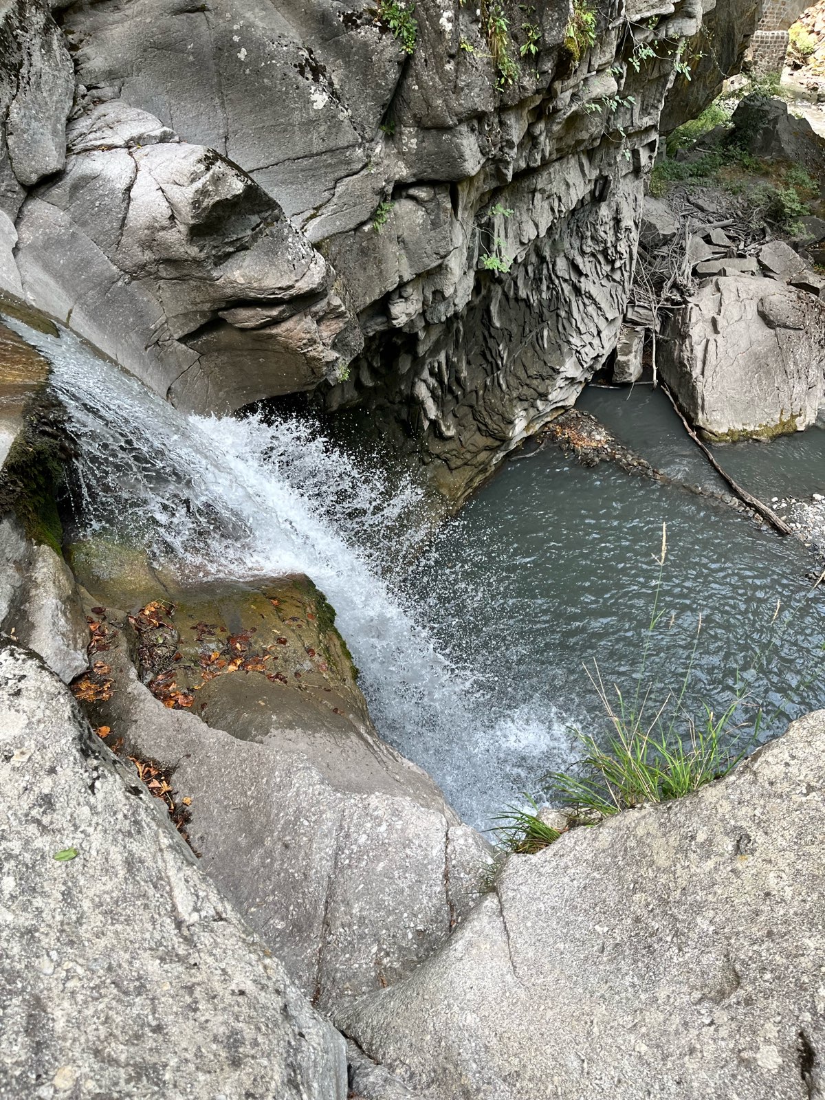
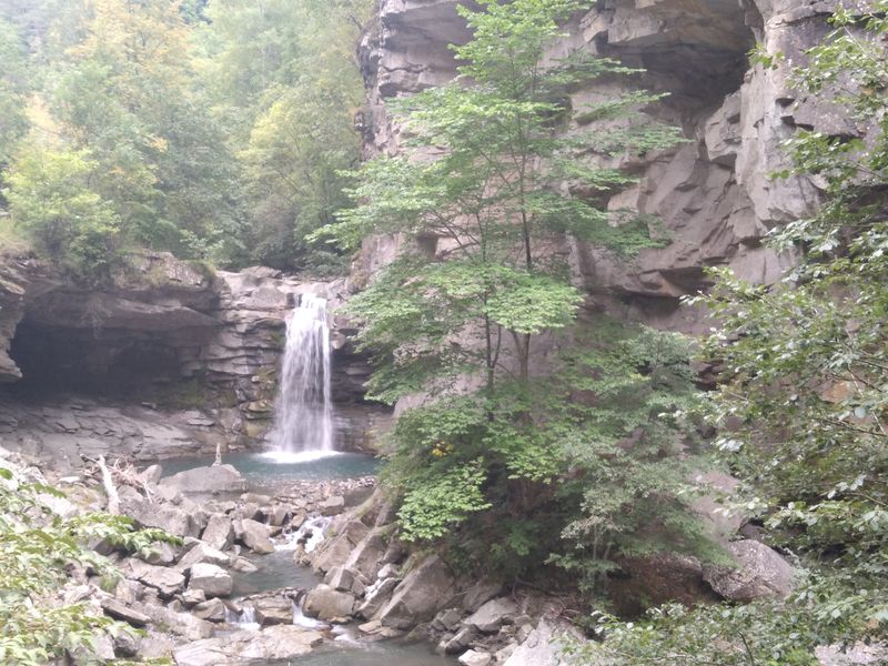
Balcony path above the gorges in a pretty larch forest and view of the Saut de la Pie waterfall. The Lower Triassic terrains are rare, the quartzites represent ancient quartz sands and gravels carried by rivers.
The characteristics of the route.

Verdaches (04)
- Distance 8.2 km
- Elevation gain 370 m
- Elevation lost 380 m
- Min. elevation 1010 m
- Max. elevation. 1225 m
- Duration (depending on pace) 3h15
- Suivre le balisage Yes

The Verdaches gorge, where the "Bès" torrent flows, presents a landscape in two shades. Near the torrent, we observe dark and black rocks, and above, an enormous light gray rock bar that draws vertical walls. The layers of the lower part of the gorge contain a large proportion of organic matter transformed into coal, hence its black color. Plant fossils are numerous there. We find all kinds of tree ferns, giant horsetails related to those of our current wetlands or even large trees that no longer have any equivalent today. These fossils make it possible to date the rocks to -305 million years, or to the Upper Carboniferous (primary era).
Area : Blanche Serre-Ponçon
Report a problem
THIS ROUTE IN YOUR MOBILE PHONE
Download Provence Alpes Outdoor app
Get all the routes on your smartphone with the Provence Alpes outdoor app. You'll find a host of functions :
- Take advantage of detailed IGN maps
- Download data for consultation even when you're not connected to the network
- Geolocate yourself at any time on the route and altimeter profile
- Activate the off-track alarm to be alerted if you stray from the itinerary
- Find nearby services
- Share your experience (add a report, share your lap time)...

regis_13
finished in 03:00:00
The 2025/08/13
En savoir plus
Ajouter votre chrono et partager vos sensations


Information updated on 2026-06-05 by Office de Tourisme Provence Alpes Digne les Bains


Provence Alpes Digne-les-Bains tourist office
+ 33(0)4 92 36 62 62
Tourist office
contact mail
Val de Durance – Château-Arnoux tourist office
+33 (0)4 92 64 02 64
Tourist office
contact mail
![]()
Moustiers-Sainte-Marie Tourist office
+ 33(0)4 92 74 67 84
Tourist office
contact mail
Seyne - Blanche Serre-Ponçon Tourist office
+33 (0)4 92 35 11 00
Tourist office
contact mail
 Provence Alpes Outdoor - Parcours - Tour des clues de Verdaches
Hello, world! This is a toast message.
Provence Alpes Outdoor - Parcours - Tour des clues de Verdaches
Hello, world! This is a toast message.
Provence Alpes Outdoor - Parcours - Tour des clues de Verdaches
Hello, world! This is a toast message.


OK
Annuler