Forêt du Labouret
Add to my favorites

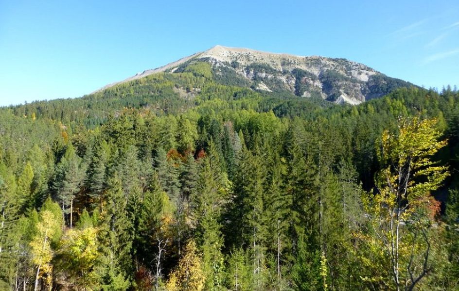
Discover the reforestation work carried out at the end of the 19th century on the initiative of forester Prosper Demontzey. From the pass, the path passes through a completely artificial forest that did not exist 200 years ago and was planted to combat erosion.
The characteristics of the route.

Le Vernet (04)
- Distance 7.04 km
- Elevation gain 340 m
- Elevation lost 340 m
- Min. elevation 1220 m
- Max. elevation. 1528 m
- Duration (depending on pace) 2h30
- Suivre le balisage Yes


The return journey takes you through the hamlet of Haut Vernet and the Parc Demontzey.
Parc Demontzey (1,220 m) - From the car park, climb to the right along the gated forest track. At the crossroads, go straight ahead then take the path on the right at the first hairpin bend. It twists and turns through the forest until it reaches a wider path below a ridge. Follow it to the left, sometimes staying on the ridge, sometimes on the north-facing slope, crossing several ravines and coming to a crossroads. Climb to the right to reach a forest track. Take the path opposite and, after a number of hairpin bends, rejoin the track a little further up.
Follow it to the right. After a hairpin bend and a crossing, it ends in a loop. Continue straight ahead on the track, ignoring the side tracks. Just before its end, turn left down a path, cross two ravines and emerge above a clearing. Continue in the same direction, paying close attention to the markings, and rejoin the path a little further on. Descend to the left bank of the ravine and then into the ravine itself. The path then crosses to the right bank and turns into a track to reach the hamlet of Haut Vernet.
Le Haut Vernet (1,300 m) - Turn left and drive past the cemetery. Turn right and then straight ahead at the next two crossroads. The track descends through meadows, crosses the Auches ravine and continues through the forest.
At a wide bend to the right, go down a path to the left that joins the Demontzey park.
Area : Blanche Serre-Ponçon
Report a problem
THIS ROUTE IN YOUR MOBILE PHONE
Download Provence Alpes Outdoor app
Get all the routes on your smartphone with the Provence Alpes outdoor app. You'll find a host of functions :
- Take advantage of detailed IGN maps
- Download data for consultation even when you're not connected to the network
- Geolocate yourself at any time on the route and altimeter profile
- Activate the off-track alarm to be alerted if you stray from the itinerary
- Find nearby services
- Share your experience (add a report, share your lap time)...

Add your time and share your feelings


Information updated on 2025-05-30 by Office de Tourisme Provence Alpes Digne les Bains


Provence Alpes Digne-les-Bains tourist office
+ 33(0)4 92 36 62 62
Tourist office
contact mail
Val de Durance – Château-Arnoux tourist office
+33 (0)4 92 64 02 64
Tourist office
contact mail
![]()
Moustiers-Sainte-Marie Tourist office
+ 33(0)4 92 74 67 84
Tourist office
contact mail
Seyne - Blanche Serre-Ponçon Tourist office
+33 (0)4 92 35 11 00
Tourist office
contact mail
 Provence Alpes Outdoor - Parcours - Forêt du Labouret
Hello, world! This is a toast message.
Provence Alpes Outdoor - Parcours - Forêt du Labouret
Hello, world! This is a toast message.
Provence Alpes Outdoor - Parcours - Forêt du Labouret
Hello, world! This is a toast message.


OK
Annuler