Tour de la roche des Brigands
Add to my favorites

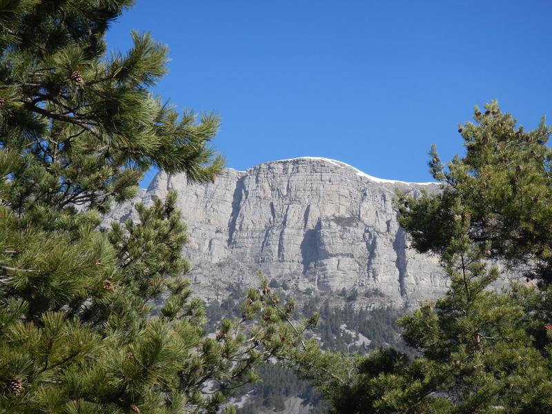
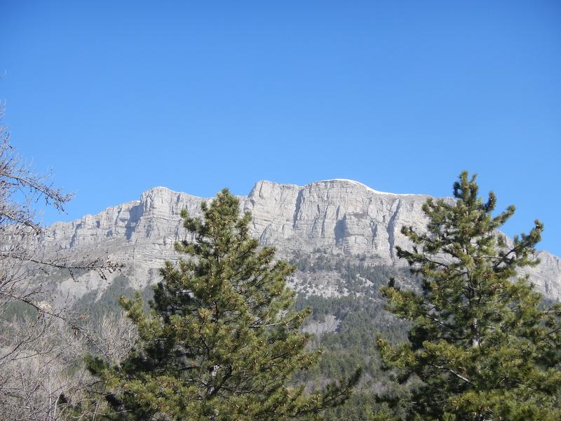
In a preserved natural environment, this hike accesses the old paths linking Mélan to the hamlets of Auribeau and Brigands, to geological sites and to panoramic viewpoints over the Duyes valley.
The characteristics of the route.

Hautes-Duyes (04)
- Distance 10 km
- Elevation gain 400 m
- Elevation lost 400 m
- Min. elevation 1049 m
- Max. elevation. 1251 m
- Duration (depending on pace) 3h15
- Suivre le balisage Yes

From the Col de l'Hysope and its viewpoint, the route descends to the Clue de Bramefan before going around the Roche des Brigands through its undergrowth of beeches and pines. Along the path between Auribeau and Mélan, we find the remains of the filioles on the side of the rock, and the hamlets of Brigands and Villard on each side of the Bramafan ravine. From the Col St Pierre there is a beautiful view of the Duyes valley and the Château d'Auribeau.
Area : Digne-les-Bains
Report a problem
THIS ROUTE IN YOUR MOBILE PHONE
Download Provence Alpes Outdoor app
Get all the routes on your smartphone with the Provence Alpes outdoor app. You'll find a host of functions :
- Take advantage of detailed IGN maps
- Download data for consultation even when you're not connected to the network
- Geolocate yourself at any time on the route and altimeter profile
- Activate the off-track alarm to be alerted if you stray from the itinerary
- Find nearby services
- Share your experience (add a report, share your lap time)...

Add your time and share your feelings


Information updated on 2025-04-03 by Office de Tourisme Provence Alpes Digne les Bains


Provence Alpes Digne-les-Bains tourist office
+ 33(0)4 92 36 62 62
Tourist office
contact mail
Val de Durance – Château-Arnoux tourist office
+33 (0)4 92 64 02 64
Tourist office
contact mail
![]()
Moustiers-Sainte-Marie Tourist office
+ 33(0)4 92 74 67 84
Tourist office
contact mail
Seyne - Blanche Serre-Ponçon Tourist office
+33 (0)4 92 35 11 00
Tourist office
contact mail
 Provence Alpes Outdoor - Parcours - Tour de la roche des Brigands
Hello, world! This is a toast message.
Provence Alpes Outdoor - Parcours - Tour de la roche des Brigands
Hello, world! This is a toast message.
Provence Alpes Outdoor - Parcours - Tour de la roche des Brigands
Hello, world! This is a toast message.


OK
Annuler