Crêtes de l'Ourbes
Add to my favorites

Discover the Ourbes ridge, the starting point of the rocky bar that dominates the right bank of the Gorges du Verdon. The walk starts at the foot of the village (next to the motorhome park and sports fields), at the junction of the D952 and the Chemin de Quinson.
The characteristics of the route.

Moustiers-Sainte-Marie (04)
- Distance 17.3 km
- Elevation gain 910 m
- Elevation lost 910 m
- Min. elevation 514 m
- Max. elevation. 1212 m
- Duration (depending on pace) 5h
- Suivre le balisage Yes


Walk down the chemin de Quinson and, immediately after the ford, if you wish, continue straight on and back to the entrance to the old fortified farmhouse of l'Hert (privately owned, known as "Château de la Reine Jeanne"), a locality in Moustiers.
Then pick up the GR®4 and start climbing at the Maison du Parc du Verdon roundabout. This is the start of a steep ascent.
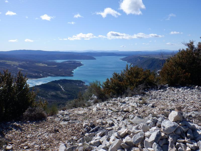
After this ascent, follow the ridge to admire the surrounding views. The Crête de l'Ourbes marks the start of the rocky bar that runs along the right bank of the Verdon canyon.
The descent to the Vénascle plateau is on a fairly steep path. From the plateau, you can return to the village along the Courchon path, which offers a view of Lac de Sainte-Croix.
17.3km · 910m D+ · 5/6h
Then pick up the GR®4 and start climbing at the Maison du Parc du Verdon roundabout. This is the start of a steep ascent.
After this ascent, follow the ridge to admire the surrounding views. The Crête de l'Ourbes marks the start of the rocky bar that runs along the right bank of the Verdon canyon.
The descent to the Vénascle plateau is on a fairly steep path. From the plateau, you can return to the village along the Courchon path, which offers a view of Lac de Sainte-Croix.
17.3km · 910m D+ · 5/6h
Area : Verdon
Report a problem
THIS ROUTE IN YOUR MOBILE PHONE
Download Provence Alpes Outdoor app
Get all the routes on your smartphone with the Provence Alpes outdoor app. You'll find a host of functions :
- Take advantage of detailed IGN maps
- Download data for consultation even when you're not connected to the network
- Geolocate yourself at any time on the route and altimeter profile
- Activate the off-track alarm to be alerted if you stray from the itinerary
- Find nearby services
- Share your experience (add a report, share your lap time)...

Add your time and share your feelings


Information updated on 2025-09-17 by Office de tourisme de Moustiers-Sainte-Marie


Provence Alpes Digne-les-Bains tourist office
+ 33(0)4 92 36 62 62
Tourist office
contact mail
Val de Durance – Château-Arnoux tourist office
+33 (0)4 92 64 02 64
Tourist office
contact mail
![]()
Moustiers-Sainte-Marie Tourist office
+ 33(0)4 92 74 67 84
Tourist office
contact mail
Seyne - Blanche Serre-Ponçon Tourist office
+33 (0)4 92 35 11 00
Tourist office
contact mail
 Provence Alpes Outdoor - Parcours - Crêtes de l'Ourbes
Hello, world! This is a toast message.
Provence Alpes Outdoor - Parcours - Crêtes de l'Ourbes
Hello, world! This is a toast message.
Provence Alpes Outdoor - Parcours - Crêtes de l'Ourbes
Hello, world! This is a toast message.


OK
Annuler