Sommet de l'Agra (1523 m)
Add to my favorites

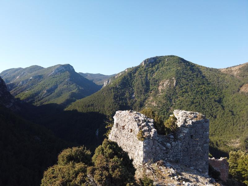
A beautiful hike from the picturesque village of Saint-Jurs to the summit of Agra and its breathtaking view of the Valensole plateau. In summer, the forest is sometimes closed due to fire risk.
The characteristics of the route.

Saint-Jurs (04)
- Distance 10.4 km
- Elevation gain 640 m
- Elevation lost 640 m
- Min. elevation 881 m
- Max. elevation. 1519 m
- Duration (depending on pace) 4h30
- Suivre le balisage Yes

From the car park, return towards the village Take rue “Lou pas” opposite, then turn right into rue du Four. Pass under the old castle and join the Col de St Jurs road. Take in front. The marked trail quickly joins the road. Follow it for 500 m. Go up the marked route for another 2 km, alternating along the path in the woods and passages on the small road to the pass. After a final road crossing, join the path at a crossroads of marked routes. Leave access to the St Jurs pass on the left and continue straight on to the pass from where the path leads to the summit of Agra.
The path quickly enters a rocky gorge (a little steep but not particularly difficult) then continue the path in bends up to the crest of the Agra. In the middle of the boxwoods reach the summit.
Head back towards the summit of Montdenier and go down the path between the rocks to the woods. Turn left along the path and go down in bends, under the pines, to the track. Take in front. The route goes to the left, crosses a valley and joins the Levens track. Return, to the left, to the Col de St Jurs. Then take the path on the left 150 m after the car park and go down to the village.
Area : Verdon
Report a problem
THIS ROUTE IN YOUR MOBILE PHONE
Download Provence Alpes Outdoor app
Get all the routes on your smartphone with the Provence Alpes outdoor app. You'll find a host of functions :
- Take advantage of detailed IGN maps
- Download data for consultation even when you're not connected to the network
- Geolocate yourself at any time on the route and altimeter profile
- Activate the off-track alarm to be alerted if you stray from the itinerary
- Find nearby services
- Share your experience (add a report, share your lap time)...

Add your time and share your feelings


Information updated on 2026-06-04 by Office de Tourisme Provence Alpes Digne les Bains


Provence Alpes Digne-les-Bains tourist office
+ 33(0)4 92 36 62 62
Tourist office
contact mail
Val de Durance – Château-Arnoux tourist office
+33 (0)4 92 64 02 64
Tourist office
contact mail
![]()
Moustiers-Sainte-Marie Tourist office
+ 33(0)4 92 74 67 84
Tourist office
contact mail
Seyne - Blanche Serre-Ponçon Tourist office
+33 (0)4 92 35 11 00
Tourist office
contact mail
 Provence Alpes Outdoor - Parcours - Sommet de l'Agra (1523 m)
Hello, world! This is a toast message.
Provence Alpes Outdoor - Parcours - Sommet de l'Agra (1523 m)
Hello, world! This is a toast message.
Provence Alpes Outdoor - Parcours - Sommet de l'Agra (1523 m)
Hello, world! This is a toast message.


OK
Annuler