Trail n°3 - Sommet du Cousson
Add to my favorites

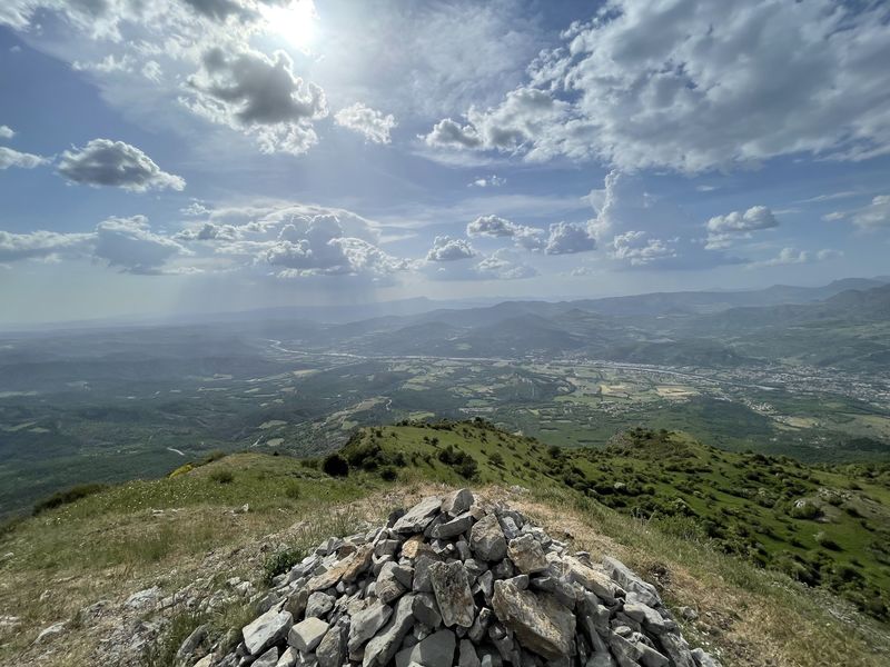
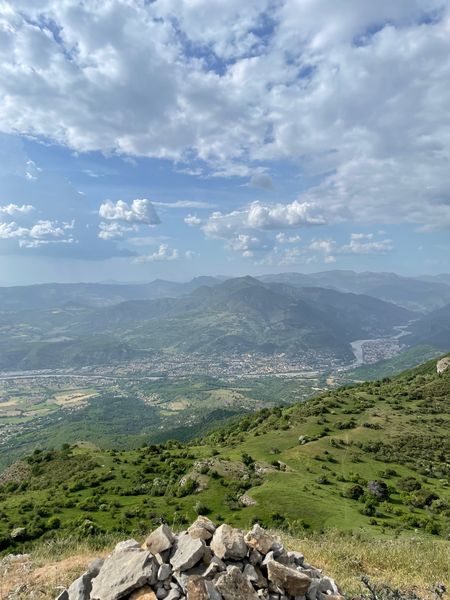
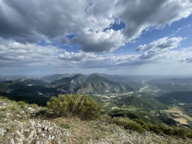
Departing from the Tourist Office. Take boulevard Thiers then college Gassendi and start the Cousson route by the Caramantran path to the Hautes Bâties forester's house.
The characteristics of the route.

Digne-les-Bains (04)
- Distance 16.7 km
- Elevation gain 1010 m
- Elevation lost 1010 m
- Min. elevation 588 m
- Max. elevation. 1505 m
- Duration (depending on pace) 4h
- Suivre le balisage Yes

Continue via the Pas d'Entrages (superb view of the village of Entrages and the Barre des Dourbes). Continue the route on the ridge then descend via the Pas de Baudillon. In the hamlet of Basses Bâties take the route des Oreilles d'ânes and return to Digne les Bains at the Tourist Office.
Area : Digne-les-Bains
Report a problem
THIS ROUTE IN YOUR MOBILE PHONE
Download Provence Alpes Outdoor app
Get all the routes on your smartphone with the Provence Alpes outdoor app. You'll find a host of functions :
- Take advantage of detailed IGN maps
- Download data for consultation even when you're not connected to the network
- Geolocate yourself at any time on the route and altimeter profile
- Activate the off-track alarm to be alerted if you stray from the itinerary
- Find nearby services
- Share your experience (add a report, share your lap time)...

Add your time and share your feelings


Information updated on 2025-06-13 by Office de Tourisme Provence Alpes Digne les Bains


Provence Alpes Digne-les-Bains tourist office
+ 33(0)4 92 36 62 62
Tourist office
contact mail
Val de Durance – Château-Arnoux tourist office
+33 (0)4 92 64 02 64
Tourist office
contact mail
![]()
Moustiers-Sainte-Marie Tourist office
+ 33(0)4 92 74 67 84
Tourist office
contact mail
Seyne - Blanche Serre-Ponçon Tourist office
+33 (0)4 92 35 11 00
Tourist office
contact mail
 Provence Alpes Outdoor - Parcours - Trail n°3 - Sommet du Cousson
Hello, world! This is a toast message.
Provence Alpes Outdoor - Parcours - Trail n°3 - Sommet du Cousson
Hello, world! This is a toast message.
Provence Alpes Outdoor - Parcours - Trail n°3 - Sommet du Cousson
Hello, world! This is a toast message.


OK
Annuler