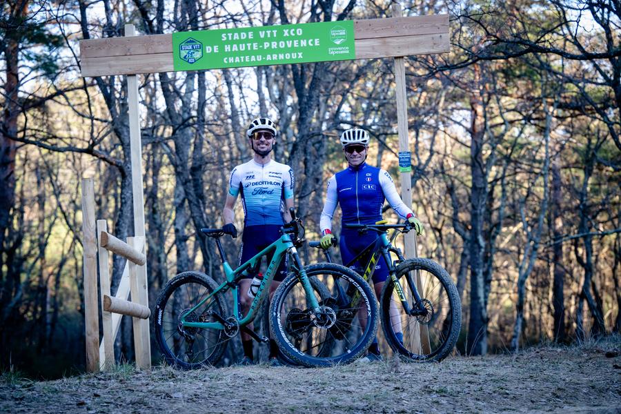
Parcours rouge/noir - Stade VTT XCO de Haute-Provence
Add to my favorites

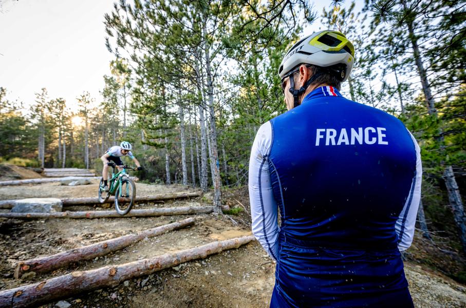
The XCO VTT Stadium in Haute-Provence in Château-Arnoux is designed for high-level training. Located in a natural area, free and open all year round, it brings together 4 courses. Parking and departure from the Tourist Office in Château-Arnoux (connection 2,5km)
The characteristics of the route.

Château-Arnoux-Saint-Auban (04)
- Distance 6.4 km
- Elevation gain 250 m
- Elevation lost 250 m
- Min. elevation 565 m
- Max. elevation. 716 m
- Suivre le balisage Yes

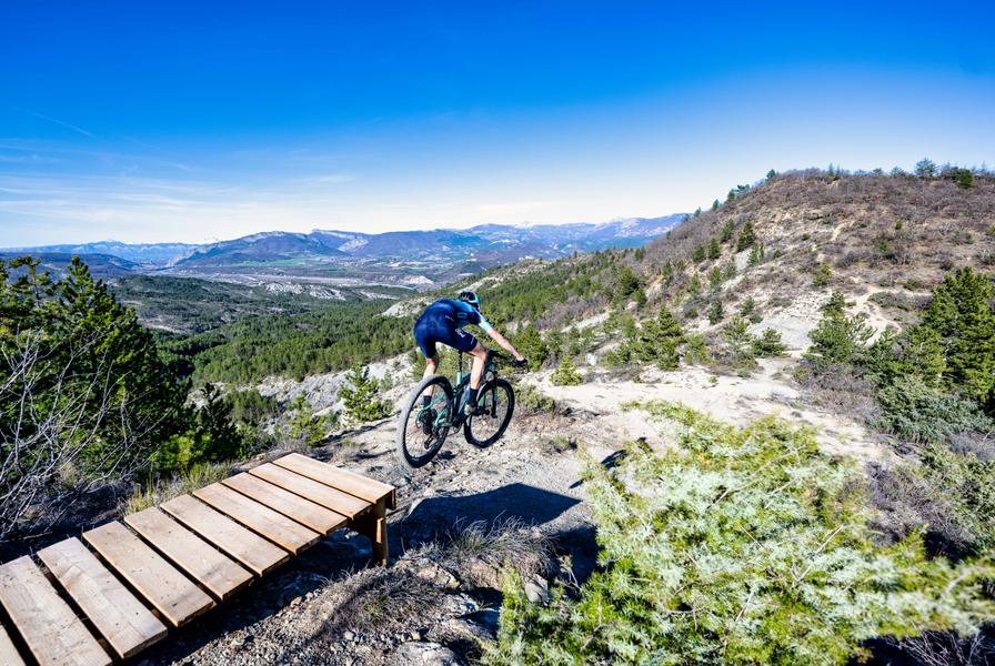
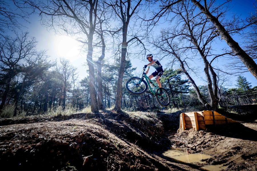
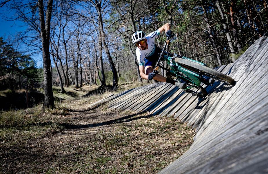
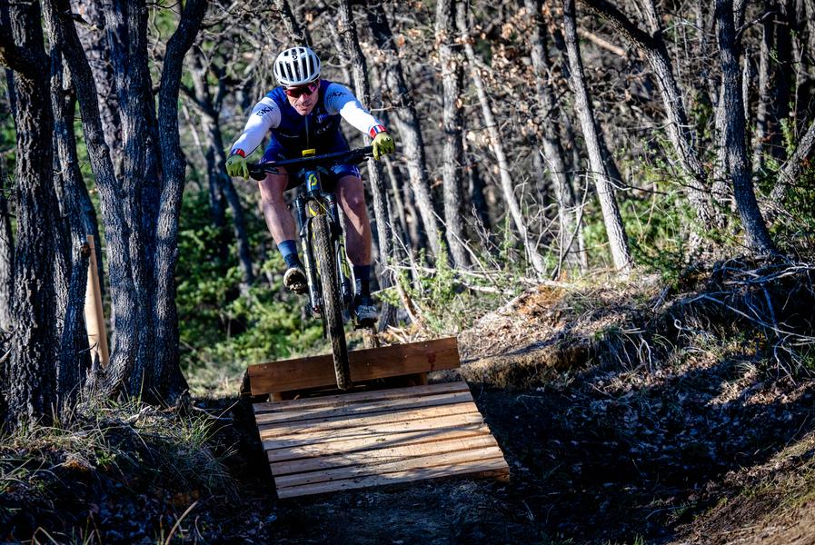
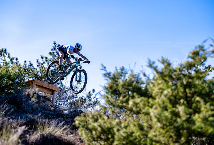
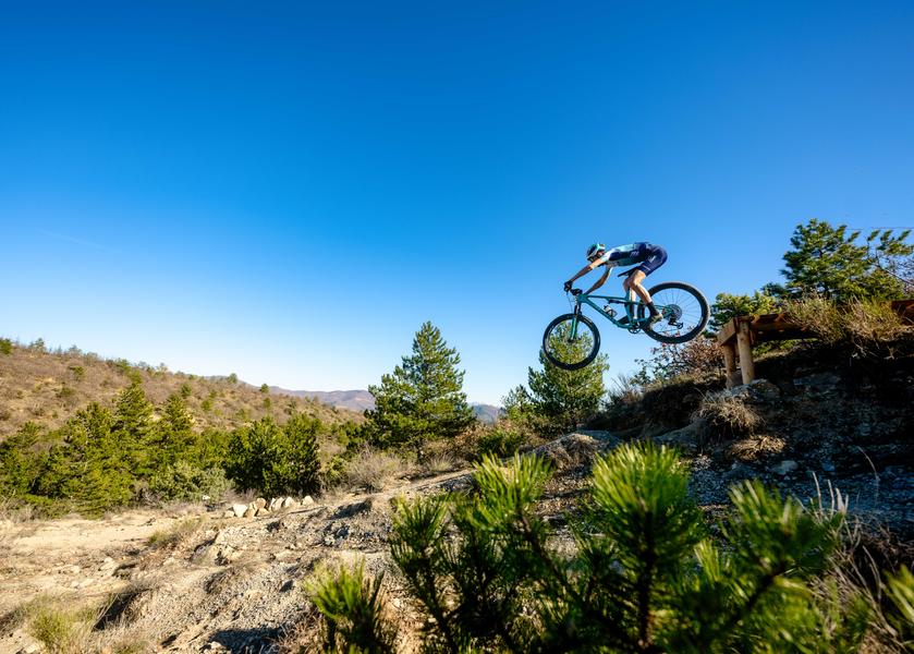
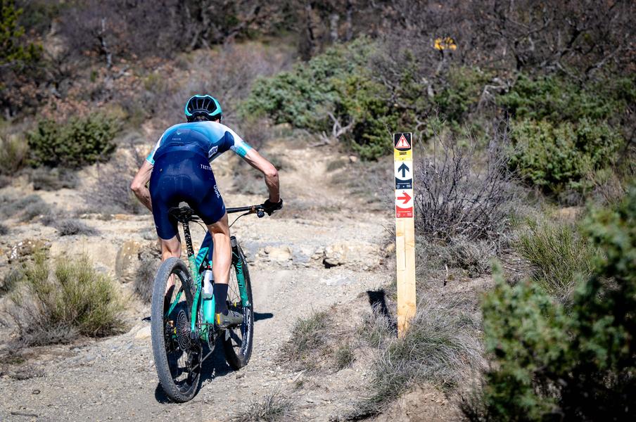
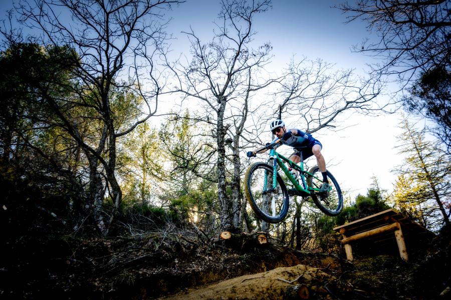
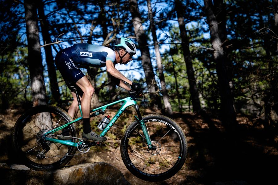
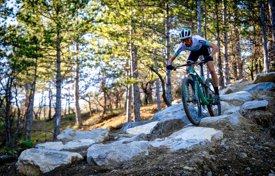
• Red/black course: 6,45 km – 240 m altitude difference – 15 XCO apparatus (jumps, wooden modules, rock garden, dual slalom, stairs, banked turns, etc.)
• Natural pumptrack
• A fun handling area: 20 pieces of equipment
The XCO MTB stadium in Haute-Provence is located at the heart of the Val de Durance MTB singletrack network, which allows you to extend the experience and training on unique natural terrain in France (600 km of marked MTB routes around the Stadium).
The tourist office, specialized in mountain biking, will assist you in preparing your stay:
· Tourist reception and information point (maps, GPS tracks, topoguides, etc.)
· Bike washing station, repair workshop, mountain bike rental, e-bike recharging, cycle store
· Marked mountain bike, road bike, gravel, trail routes
· Specialized accommodation “Accueil Vélo”
· National high-level training center
· Weight room with high-end equipment
· Doctor, physiotherapists…
The “Domaine VTT Provence Alpes” is one of the largest mountain bike areas in France with the FFC label, with 100 marked trails, an XCO Stadium, the “Terres Noires” mountain bike site, the Evo Bike Park (open all year round). ) in Digne-les-Bains, 3 Grandes Traversées, 8 itinerant stay packages with luggage transfers, 5 gravel courses, 19 road bike courses for training, 15 road passes, 100 free GPS tracks, etc
Area : Val de Durance
Report a problem
Pdf file Pdf file THIS ROUTE IN YOUR MOBILE PHONE
Download Provence Alpes Outdoor app
Get all the routes on your smartphone with the Provence Alpes outdoor app. You'll find a host of functions :
- Take advantage of detailed IGN maps
- Download data for consultation even when you're not connected to the network
- Geolocate yourself at any time on the route and altimeter profile
- Activate the off-track alarm to be alerted if you stray from the itinerary
- Find nearby services
- Share your experience (add a report, share your lap time)...

Add your time and share your feelings


Information updated on 2025-09-12 by Office de Tourisme Provence Alpes Digne les Bains


Provence Alpes Digne-les-Bains tourist office
+ 33(0)4 92 36 62 62
Tourist office
contact mail
Val de Durance – Château-Arnoux tourist office
+33 (0)4 92 64 02 64
Tourist office
contact mail
![]()
Moustiers-Sainte-Marie Tourist office
+ 33(0)4 92 74 67 84
Tourist office
contact mail
Seyne - Blanche Serre-Ponçon Tourist office
+33 (0)4 92 35 11 00
Tourist office
contact mail
 Provence Alpes Outdoor - Parcours - Parcours rouge/noir - Stade VTT XCO de Haute-Provence
Hello, world! This is a toast message.
Provence Alpes Outdoor - Parcours - Parcours rouge/noir - Stade VTT XCO de Haute-Provence
Hello, world! This is a toast message.
Provence Alpes Outdoor - Parcours - Parcours rouge/noir - Stade VTT XCO de Haute-Provence
Hello, world! This is a toast message.


OK
Annuler