
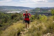
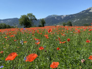
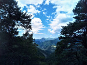
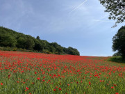
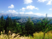
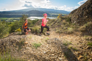
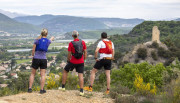
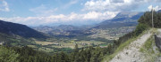
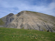
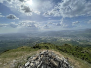
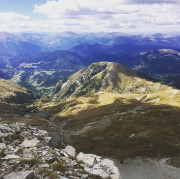
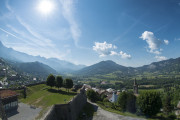
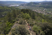
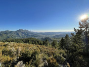
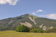
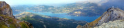
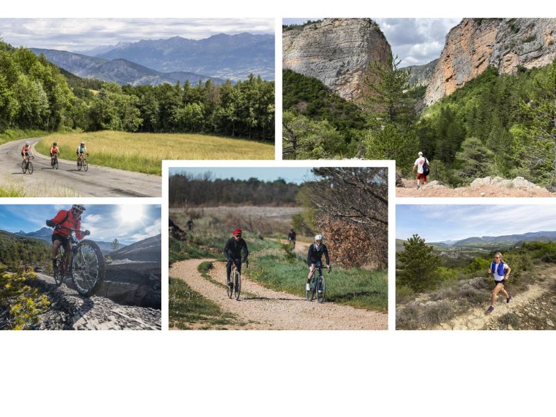
Run in Haute-Provence in spring or autumn between l'Escale, Volonne and Digne-les-Bains, discover the Lac de Sainte Croix and the Grand canyon du Verdon via Plein Voir, reach the summits in summer from our mountain resorts (Montclar, Chabanon, Grand-Puy), tackle the mythical Vertical du Blayeul (1000 m vertical ascent) or the Trail du sommet de l'Estrop (2961 m altitude), are all moments to be shared on our region's trail-running routes.
4 different areas for trail running :
- Val de Durance (Château-Arnoux) : 5 trail-running routes
- Digne-les-Bains : 9 trail-running routes
- Verdon (Moustiers-Sainte-Marie): 5 trail-running routes
- Blanche Serre Ponçon (Seyne): 15 trail-running routes
Every year, around ten trail-running races are organized in the region (see calendar).
This area is renowned for the quality of its trails and has been awarded the "Espace Trail" label.


4.88km 140m 140m
Montclar
5km 240m 240m
L'Escale
5.5km 100m 100m
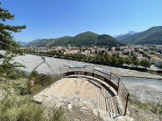
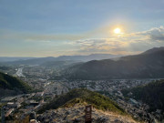
Digne-les-Bains
6.63km 220m 220m
Selonnet
5.84km 200m 200m
Selonnet
6.91km 310m 310m
Seyne
6.9km 290m 290m
Auzet

13km 400m 400m
Moustiers-Sainte-Marie
14.48km 610m 610m
Montclar
6.91km 280m 280m
Digne-les-Bains
8.02km 470m 470m
Seyne
11.12km 550m 550m
L'Escale
9.97km 290m 290m
Volonne

14.35km 489m 489m
L'Escale
9.54km 330m 330m
Montclar

11.9km 540m 540m
Moustiers-Sainte-Marie

12.93km 590m 590m
Moustiers-Sainte-Marie
11.45km 470m 470m
Auzet

9.64km 410m 410m
Selonnet
15.64km 640m 640m
Selonnet
23.08km 900m 900m
Auzet
16.68km 1010m 1010m
Digne-les-Bains
24.11km 1020m 1020m
Montclar
17.02km 1060m 1060m
Digne-les-Bains

24.33km 1220m 1220m
Moustiers-Sainte-Marie
33.36km 1350m 1350m
Seyne
25.3km 1530m 1530m
L'Escale
33.69km 2030m 2030m
Digne-les-Bains

22.56km 1620m 1620m
Moustiers-Sainte-Marie


The Provence Alpes Digne-les-Bains Tourist Office offers a range of all-inclusive outdoor sports stays, most of them designed as itinerant trips, including luggage transfers from one stage to the next and full-board accommodation (with packed lunches).
These 2- to 5-day packages can be enjoyed independently or accompanied by a guide, with flexible dates — meaning guests can choose to depart on any day of the year.
Hiking, mountain biking, gravel, road cycling, or trail-running stays can be savored solo, with family, or among friends — the choice is yours!
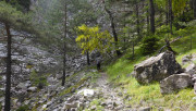
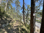
Trail-running routes are equipped with Trail-running markers. Each marker is stamped with the number(s) of the route to be followed and the color of difficulty (green - blue - red - black).
Trail-running markers are placed at regular intervals, at each change of direction. Between two Trail markers, follow the existing hiking markers (yellow, white/red, yellow/red).
Please note : route n°4 in Volonne (Trail des 2 Tours) is equipped with retro-reflective markers for night-time use.

Before running :
- Check the weather forecast before you leave, as itineraries can become dangerous in bad weather.
- Inform a friend or family member of your itinerary and planned times.
- Take water and food with you.
On the routes :
- Respect the natural and agricultural environments you pass through.
- Close the gates after you've passed through Stay on the trails, don't cut the laces
- All sections of the route on public roads are subject to the Highway Code, so be sure to obey it.
- Keep all garbage with you
Safety information : In the event of an accident, please contact the emergency services by dialing 112.

With this application, take all the Provence Alpes Outdoor itineraries and activities with you on your smartphone. Discover a host of features :
- Download content for offline use
- Locate yourself at any time on the map and profile
- Take advantage of IGN maps
- Be alerted in case of route departure
- Share your experience
- ...

Provence Alpes Digne-les-Bains tourist office
+ 33(0)4 92 36 62 62
Tourist office
contact mail
Val de Durance – Château-Arnoux tourist office
+33 (0)4 92 64 02 64
Tourist office
contact mail
![]()
Moustiers-Sainte-Marie Tourist office
+ 33(0)4 92 74 67 84
Tourist office
contact mail
Seyne - Blanche Serre-Ponçon Tourist office
+33 (0)4 92 35 11 00
Tourist office
contact mail
 Provence Alpes Outdoor - ESPACE TRAIL

