
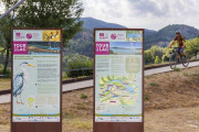
Discover outdoor activities


routes filtered
Only my favorites
Delete filters
Around me :
< 5km
< 10km
< 25km
< 50km
Inactive
Difficulties :
Easy
Medium
Difficult
Expert
Durée :
<1h
1-2h
2-3h
3-4h
>4h
Distance (km) :
<10
10-25
25-50
50-75
>75
Distance (km) :
<25
25-50
50-100
100-150
>150
Elevation gain (m) :
<500
500-1000
1000-1500
1500-2500
>2500
Elevation lost (m) :
<500
500-1000
1000-1500
1500-2500
>2500
Tags :
Areas :
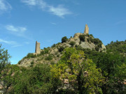
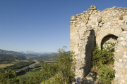
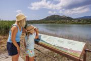
Écobalade : Les 2 tours
2.09km 100m 100m
Volonne
2.09km 100m 100m
Volonne

Écobalade : Au Fil de l’eau
4.16km 110m 110m
Volonne
4.16km 110m 110m
Volonne

Écobalade : Belvédères Saint-Antoine
2.85km 150m 150m
Volonne
2.85km 150m 150m
Volonne
Écobalade : Balade du patrimoine
2.22km 70m 70m
Volonne
2.22km 70m 70m
Volonne

Sentier de découverte de Marcoux
1.4km 80m 80m
Marcoux
1.4km 80m 80m
Marcoux

Circuit de la Chapelle d'Auges
1.9km 60m 60m
Peyruis
1.9km 60m 60m
Peyruis

Circuit de Grosse Pierre
5.6km 150m 150m
Selonnet
5.6km 150m 150m
Selonnet

Sentier Marcel
4km 200m 200m
Prads-Haute-Bléone
4km 200m 200m
Prads-Haute-Bléone
Sentier thématique du plateau de la Chau
3.1km 170m 170m
Montclar
3.1km 170m 170m
Montclar
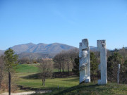
Découverte du Golf des Lavandes
2.25km 40m 40m
Digne-les-Bains
2.25km 40m 40m
Digne-les-Bains

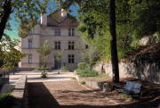
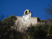
Sentier du parc du château
1.3km 20m 20m
Château-Arnoux-Saint-Auban
1.3km 20m 20m
Château-Arnoux-Saint-Auban
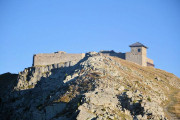
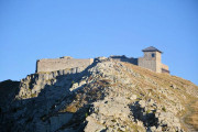
Saint-Vincent-les-Forts
9.6km 180m 180m
Montclar
9.6km 180m 180m
Montclar

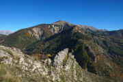
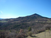
Sommet des philosophes
3.15km 160m 160m
Digne-les-Bains
3.15km 160m 160m
Digne-les-Bains
Sentier de la Tatée
3.61km 110m 110m
Château-Arnoux-Saint-Auban
3.61km 110m 110m
Château-Arnoux-Saint-Auban

Sentier du gypse et de Sainte-Madeleine
3.72km 240m 240m
Thoard
3.72km 240m 240m
Thoard

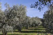
Chemin des Oliviers
3.7km 50m 60m
Les Mées
3.7km 50m 60m
Les Mées

La Forestière
5.5km 160m 160m
Seyne
5.5km 160m 160m
Seyne

Lagremuse
2.9km 160m 160m
Le Chaffaut-Saint-Jurson
2.9km 160m 160m
Le Chaffaut-Saint-Jurson

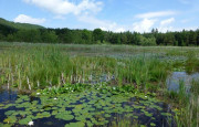
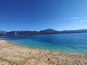
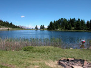
Lac de Saint-Léger
4.7km 130m 130m
Montclar
4.7km 130m 130m
Montclar

Promenade du philosophe
0.7km 40m 40m
Champtercier
0.7km 40m 40m
Champtercier

Sentier Armand Payan
3.6km 190m 190m
Barles
3.6km 190m 190m
Barles

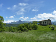
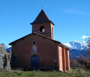
Chapelle Notre-Dame
3.3km 170m 170m
Mézel
3.3km 170m 170m
Mézel

Le Col
6.2km 260m 260m
Auzet
6.2km 260m 260m
Auzet

Sentier de découverte du Col de Fontbelle
2.15km 70m 70m
Le Castellard-Melan
2.15km 70m 70m
Le Castellard-Melan

Tour du village par les Claux
2.46km 100m 100m
Moustiers-Sainte-Marie
2.46km 100m 100m
Moustiers-Sainte-Marie

Montée du Vieux-Bras d'Asse
2.3km 140m 140m
Bras-d'Asse
2.3km 140m 140m
Bras-d'Asse

Forêt de Valentin
6km 190m 200m
Selonnet
6km 190m 200m
Selonnet

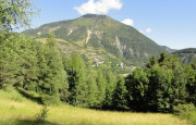
La Routo et la Chapelle Saint-Jean
3.5km 220m 220m
Saint-Jeannet
3.5km 220m 220m
Saint-Jeannet

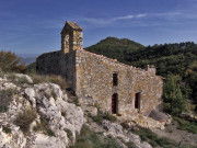
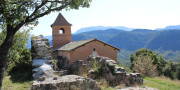
Chapelle Saint Pancrace
5.62km 240m 240m
Digne-les-Bains
5.62km 240m 240m
Digne-les-Bains

Ichtyosaure de la Robine
4.26km 190m 190m
La Robine-sur-Galabre
4.26km 190m 190m
La Robine-sur-Galabre

Chapelle Notre Dame (variante courte)
2.1km 140m 140m
La Javie
2.1km 140m 140m
La Javie

Sentier de découverte de Caguerenard
5.73km 200m 200m
Digne-les-Bains
5.73km 200m 200m
Digne-les-Bains

Boucle de la Dalle aux ammonites
3.51km 140m 140m
Digne-les-Bains
3.51km 140m 140m
Digne-les-Bains

Parcours forestier
4km 90m 90m
Le Brusquet
4km 90m 90m
Le Brusquet

Sentier des trois chapelles
3.64km 270m 270m
Digne-les-Bains
3.64km 270m 270m
Digne-les-Bains

Notre Dame de Lauzière
5.2km 200m 200m
Le Brusquet
5.2km 200m 200m
Le Brusquet

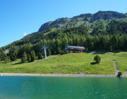
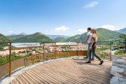
Belvedere de Saint-Jean
4.5km 200m 190m
Château-Arnoux-Saint-Auban
4.5km 200m 190m
Château-Arnoux-Saint-Auban

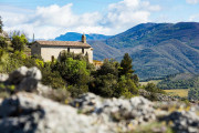
La chapelle Notre Dame (variante longue)
3.8km 210m 210m
La Javie
3.8km 210m 210m
La Javie

Balade du Thoron
3.3km 160m 160m
Thoard
3.3km 160m 160m
Thoard

Les Portes d'Entrages
3.79km 130m 130m
Entrages
3.79km 130m 130m
Entrages

Sentier des Muletiers
4.2km 180m 180m
Sainte-Croix-du-Verdon
4.2km 180m 180m
Sainte-Croix-du-Verdon

Petit tour du lac
3.8km 10m 10m
Château-Arnoux-Saint-Auban
3.8km 10m 10m
Château-Arnoux-Saint-Auban

Sentier botanique de Treguier
4.97km 170m 170m
Moustiers-Sainte-Marie
4.97km 170m 170m
Moustiers-Sainte-Marie
La Salette
3.3km 190m 190m
Montclar
3.3km 190m 190m
Montclar

Cabane des mulets
3.4km 260m 260m
Seyne
3.4km 260m 260m
Seyne


International
France
 Provence Alpes Outdoor - Liste des activités

