
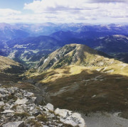
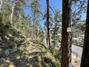
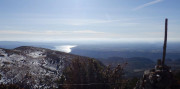
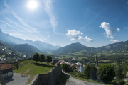
Discover outdoor activities


routes filtered
Only my favorites
Delete filters
Around me :
< 5km
< 10km
< 25km
< 50km
Inactive
Difficulties :
Easy
Medium
Difficult
Expert
Durée :
<1h
1-2h
2-3h
3-4h
>4h
Distance (km) :
<10
10-25
25-50
50-75
>75
Distance (km) :
<25
25-50
50-100
100-150
>150
Elevation gain (m) :
<500
500-1000
1000-1500
1500-2500
>2500
Elevation lost (m) :
<500
500-1000
1000-1500
1500-2500
>2500
Tags :
Areas :
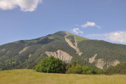
Trail n°1 - Tour de Saint-Léger
4.88km 140m 140m
Montclar
4.88km 140m 140m
Montclar
Trail n°1 - Chabanas
5km 240m 240m
L'Escale
5km 240m 240m
L'Escale
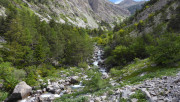
Trail n°1 - Sentier de Caguerenard
5.5km 100m 100m
Digne-les-Bains
5.5km 100m 100m
Digne-les-Bains
Trail n°3 - Tour de la colline du château
6.63km 220m 220m
Selonnet
6.63km 220m 220m
Selonnet
Trail n°2 - Tour de Valentin
5.84km 200m 200m
Selonnet
5.84km 200m 200m
Selonnet
Trail n°4 - Tour de l'Auragnerie
6.91km 310m 310m
Seyne
6.91km 310m 310m
Seyne
Trail n°5 - Crêtes de Fissac
6.9km 290m 290m
Auzet
6.9km 290m 290m
Auzet
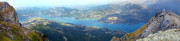
Trail n°1 – Le lac de Sainte Croix
13km 400m 400m
Moustiers-Sainte-Marie
13km 400m 400m
Moustiers-Sainte-Marie

Trail n°13 - Grand tour des Chapelles
14.48km 610m 610m
Montclar
14.48km 610m 610m
Montclar
Trail n°2 - Les trois Chapelles
6.91km 280m 280m
Digne-les-Bains
6.91km 280m 280m
Digne-les-Bains
Trail n°7 - Crêtes du Grand Puy
8.02km 470m 470m
Seyne
8.02km 470m 470m
Seyne
Trail n°2 - Le Pic Bernard
11.12km 550m 550m
L'Escale
11.12km 550m 550m
L'Escale
Trail n°4 - Le Trail des 2 Tours
9.97km 290m 290m
Volonne
9.97km 290m 290m
Volonne
Trail n°5 - Les Balcons de la Durance
14.35km 489m 489m
L'Escale
14.35km 489m 489m
L'Escale
Trail n°6 - Petit Tour des Chapelles
9.54km 330m 330m
Montclar
9.54km 330m 330m
Montclar
Trail N°3 - Voie romaine et Venascle
11.9km 540m 540m
Moustiers-Sainte-Marie
11.9km 540m 540m
Moustiers-Sainte-Marie
Trail n°2 – En Naups
12.93km 590m 590m
Moustiers-Sainte-Marie
12.93km 590m 590m
Moustiers-Sainte-Marie
Trail n°10 - Col de la Grangeasse
11.45km 470m 470m
Auzet
11.45km 470m 470m
Auzet

Trail n°11 - Sommet du Château
9.64km 410m 410m
Selonnet
9.64km 410m 410m
Selonnet
Trail n°12 - Tour de Tête Grosse
15.64km 640m 640m
Selonnet
15.64km 640m 640m
Selonnet
Trail n°14 - Tour de Tête Grosse depuis le col du Fanget
23.08km 900m 900m
Auzet
23.08km 900m 900m
Auzet
Trail n°3 - Sommet du Cousson
16.68km 1010m 1010m
Digne-les-Bains
16.68km 1010m 1010m
Digne-les-Bains
Trail n°16 - Tour du Château de Montclar
24.11km 1020m 1020m
Montclar
24.11km 1020m 1020m
Montclar
Trail n°4 - Sommet du Martignon
17.02km 1060m 1060m
Digne-les-Bains
17.02km 1060m 1060m
Digne-les-Bains
Trail n°4 - Sommet du Pavillon
24.33km 1220m 1220m
Moustiers-Sainte-Marie
24.33km 1220m 1220m
Moustiers-Sainte-Marie
Trail n°17 - Tour de la Blanche
33.36km 1350m 1350m
Seyne
33.36km 1350m 1350m
Seyne
Trail n°3 - Le Grand Ruth
25.3km 1530m 1530m
L'Escale
25.3km 1530m 1530m
L'Escale
Trail n°5 - Les deux sommets (Trail n°3 Le Cousson + Trail n°4 Le Martignon)
33.69km 2030m 2030m
Digne-les-Bains
33.69km 2030m 2030m
Digne-les-Bains
Trail n°5 - Plein Voir
22.56km 1620m 1620m
Moustiers-Sainte-Marie
22.56km 1620m 1620m
Moustiers-Sainte-Marie

International
France
 Provence Alpes Outdoor - Liste des activités

