Cyclo n°2 - Le Tour de Fontbelle
Add to my favorites

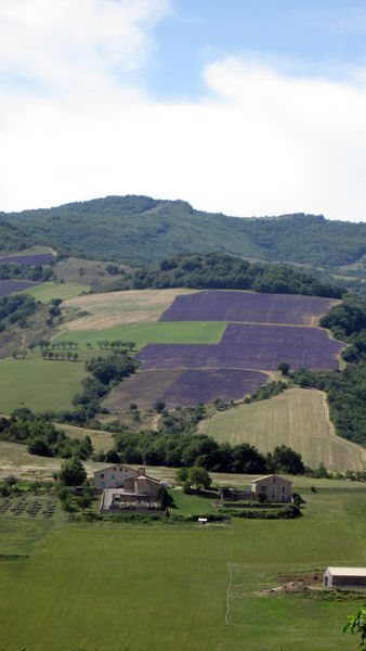
With the sites of the "Road of Time", you can discover the geological and human history of four endearing valleys: Duyes, Vançon-Jabron, Durance, Bléone. At the Col de Fontbelle, a discovery area welcomes you for a welcome break.
The characteristics of the route.

Digne-les-Bains (04)
- Distance 100 km
- Elevation gain 2160 m
- Elevation lost 2160 m
- Min. elevation 419 m
- Max. elevation. 1307 m
- Duration (depending on pace) 5h
- Suivre le balisage Yes
It's a long loop that awaits you (100 km), but your effort will be rewarded with breathtaking panoramas! In Digne les Bains, from the Saint Christophe Zone, take the direction of Champtercier.
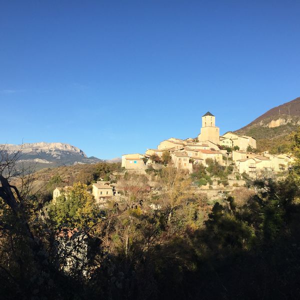
Cross Champtercier, birthplace of the philosopher and astronomer Pierre Gassendi. Pass the Pas de Bonnet pass (7.3km at 4,5%).Continue to Thoard (1.3km at 4,6)%, a medieval hilltop village in the Vallée des Hautes Duyes, and pass the Col de Fontbelle (11km at 4,9% but be careful with several passages above 8%). This pass culminating at an altitude of 1.304 meters is often used by one of the special stages of the Monte Carlo Rally.
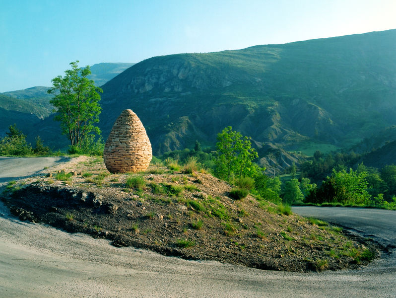
Continue the loop via Authon. At the side of the road, the artist Andy Goldsworthy has installed one of his “Sentinels”, that of the Vançon Valley. This sculpture is part of “Refuge d’Art”, a work of art to “browse” in the Haute Provence Geopark. Pass through Saint Geniez and go down towards Sisteron. Before entering the town, turn left (D4) towards the Durance Valley. Cross Volonne. After L'Escale, cross the N85 and continue on a small road joining the D904. In Malijai, continue on the D8 towards Le Chaffaut, then Digne les Bains.
Variation “Le Pas de Bonnet”
46 km, height difference: 450 m
At Thoard, cross the village and go back down on the D3. At Planas, turn left towards Les Grillons via Les Bourres and Barras, on a false descending flat. Follow the N85 to the left, then the D17 to the right towards Le Chaffaut and return to Digne les Bains via the D12 then the N85.
Cross Champtercier, birthplace of the philosopher and astronomer Pierre Gassendi. Pass the Pas de Bonnet pass (7.3km at 4,5%).Continue to Thoard (1.3km at 4,6)%, a medieval hilltop village in the Vallée des Hautes Duyes, and pass the Col de Fontbelle (11km at 4,9% but be careful with several passages above 8%). This pass culminating at an altitude of 1.304 meters is often used by one of the special stages of the Monte Carlo Rally.
Continue the loop via Authon. At the side of the road, the artist Andy Goldsworthy has installed one of his “Sentinels”, that of the Vançon Valley. This sculpture is part of “Refuge d’Art”, a work of art to “browse” in the Haute Provence Geopark. Pass through Saint Geniez and go down towards Sisteron. Before entering the town, turn left (D4) towards the Durance Valley. Cross Volonne. After L'Escale, cross the N85 and continue on a small road joining the D904. In Malijai, continue on the D8 towards Le Chaffaut, then Digne les Bains.
Variation “Le Pas de Bonnet”
46 km, height difference: 450 m
At Thoard, cross the village and go back down on the D3. At Planas, turn left towards Les Grillons via Les Bourres and Barras, on a false descending flat. Follow the N85 to the left, then the D17 to the right towards Le Chaffaut and return to Digne les Bains via the D12 then the N85.
Area : Digne-les-Bains
Report a problem
THIS ROUTE IN YOUR MOBILE PHONE
Download Provence Alpes Outdoor app
Get all the routes on your smartphone with the Provence Alpes outdoor app. You'll find a host of functions :
- Take advantage of detailed IGN maps
- Download data for consultation even when you're not connected to the network
- Geolocate yourself at any time on the route and altimeter profile
- Activate the off-track alarm to be alerted if you stray from the itinerary
- Find nearby services
- Share your experience (add a report, share your lap time)...

Add your time and share your feelings


Information updated on 2025-05-22 by Office de Tourisme Provence Alpes Digne les Bains


Provence Alpes Digne-les-Bains tourist office
+ 33(0)4 92 36 62 62
Tourist office
contact mail
Val de Durance – Château-Arnoux tourist office
+33 (0)4 92 64 02 64
Tourist office
contact mail
![]()
Moustiers-Sainte-Marie Tourist office
+ 33(0)4 92 74 67 84
Tourist office
contact mail
Seyne - Blanche Serre-Ponçon Tourist office
+33 (0)4 92 35 11 00
Tourist office
contact mail
 Provence Alpes Outdoor - Parcours - Cyclo n°2 - Le Tour de Fontbelle
Hello, world! This is a toast message.
Provence Alpes Outdoor - Parcours - Cyclo n°2 - Le Tour de Fontbelle
Hello, world! This is a toast message.
Provence Alpes Outdoor - Parcours - Cyclo n°2 - Le Tour de Fontbelle
Hello, world! This is a toast message.


OK
Annuler