Sentier des Muletiers
Add to my favorites

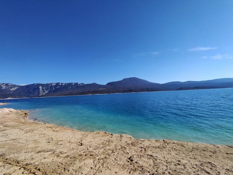
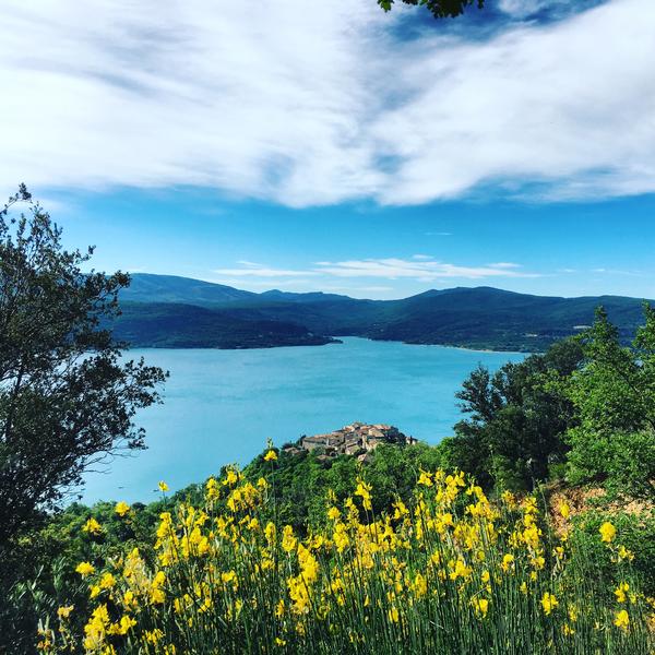
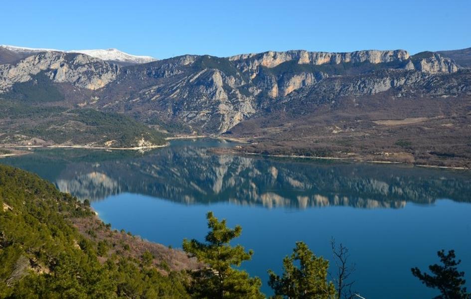
A walk on old mule trails that takes you from the edge of Lake Sainte-Croix to the plateau to enjoy a breathtaking view of the lake and the lavender fields.
The characteristics of the route.

Sainte-Croix-du-Verdon (04)
- Distance 4.2 km
- Elevation gain 180 m
- Elevation lost 180 m
- Min. elevation 475 m
- Max. elevation. 645 m
- Duration (depending on pace) 2h
- Suivre le balisage Yes


From the car park, follow the road along the lake towards the water sports centre and the campsite (Chemin de Paraloup), on the left. Follow the small road for 800 m along the edge of the lake. Go along some terraces (dry stone walls), olive trees and picnic areas.
At the intersection, continue straight on the small road. Continue for 800 m to the path of Muleteers going up to the plateau. Climb the path on the left along a ridge. Higher up (109 m difference in altitude), at the intersection, go up the path on the left, crossing. At the end of the climb, follow the path on the left for 150 m along the plateau, at the edge of the field. Go down to the left on the marked route (PR). Join the road at the point and return to the starting point by the route taken on the way there.
At the intersection, continue straight on the small road. Continue for 800 m to the path of Muleteers going up to the plateau. Climb the path on the left along a ridge. Higher up (109 m difference in altitude), at the intersection, go up the path on the left, crossing. At the end of the climb, follow the path on the left for 150 m along the plateau, at the edge of the field. Go down to the left on the marked route (PR). Join the road at the point and return to the starting point by the route taken on the way there.
Area : Verdon
Report a problem
THIS ROUTE IN YOUR MOBILE PHONE
Download Provence Alpes Outdoor app
Get all the routes on your smartphone with the Provence Alpes outdoor app. You'll find a host of functions :
- Take advantage of detailed IGN maps
- Download data for consultation even when you're not connected to the network
- Geolocate yourself at any time on the route and altimeter profile
- Activate the off-track alarm to be alerted if you stray from the itinerary
- Find nearby services
- Share your experience (add a report, share your lap time)...

Add your time and share your feelings


Information updated on 2025-04-02 by Office de Tourisme Provence Alpes Digne les Bains


Provence Alpes Digne-les-Bains tourist office
+ 33(0)4 92 36 62 62
Tourist office
contact mail
Val de Durance – Château-Arnoux tourist office
+33 (0)4 92 64 02 64
Tourist office
contact mail
![]()
Moustiers-Sainte-Marie Tourist office
+ 33(0)4 92 74 67 84
Tourist office
contact mail
Seyne - Blanche Serre-Ponçon Tourist office
+33 (0)4 92 35 11 00
Tourist office
contact mail
 Provence Alpes Outdoor - Parcours - Sentier des Muletiers
Hello, world! This is a toast message.
Provence Alpes Outdoor - Parcours - Sentier des Muletiers
Hello, world! This is a toast message.
Provence Alpes Outdoor - Parcours - Sentier des Muletiers
Hello, world! This is a toast message.


OK
Annuler