Lagremuse
Add to my favorites

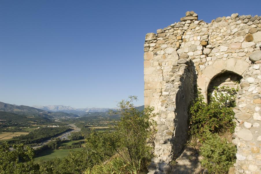
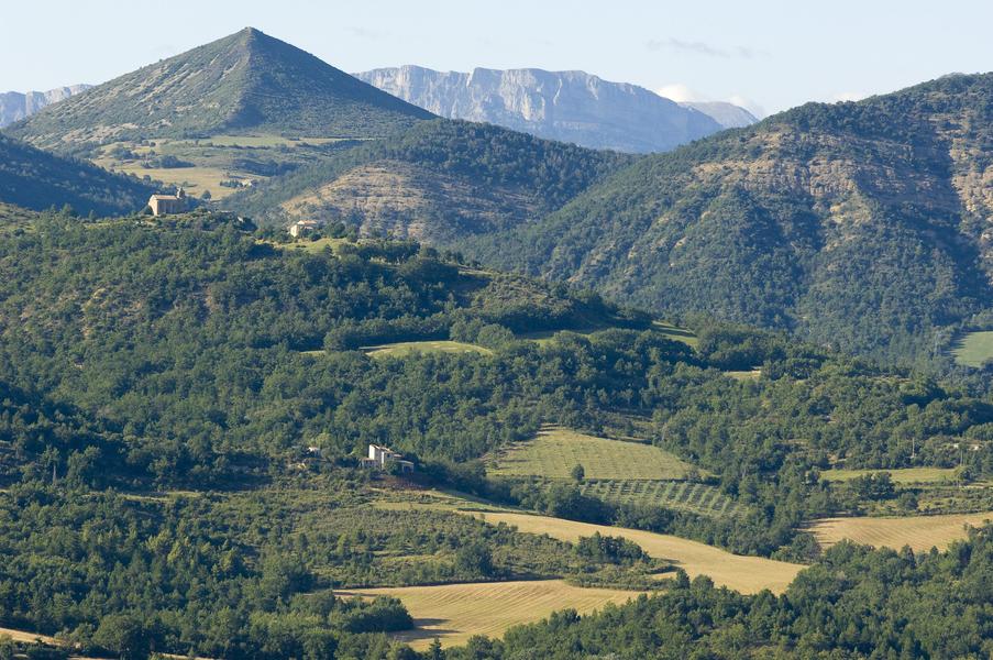
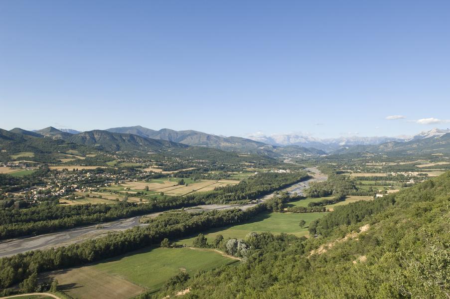
This short hike will take you to the ruined village of Lagremuse, which had 72 inhabitants in 1851. Perched on its rock, Lagremuse offers a beautiful panoramic view of the Bléone valley, with large olive trees still bearing witness to its agricultural past
The characteristics of the route.

Le Chaffaut-Saint-Jurson (04)
- Distance 2.9 km
- Elevation gain 160 m
- Elevation lost 160 m
- Min. elevation 496 m
- Max. elevation. 651 m
- Duration (depending on pace) 1h
- Suivre le balisage Yes


The old village of Lagremuse, now in ruins, has been attached to the commune of Chaffaut-Saint-Jurson since 1887. Remarkably located on a rocky eminence, composed of a conglomerate called puddingstones of Valensole, overlooking the Val de Bléone, it offers a beautiful semi-circular panorama of the Digne Pre-Alps. Lagremuse is also the name given to the small gray wall lizard that is particularly fond of rocky crevices in which it finds refuge.
Area : Digne-les-Bains
Report a problem
THIS ROUTE IN YOUR MOBILE PHONE
Download Provence Alpes Outdoor app
Get all the routes on your smartphone with the Provence Alpes outdoor app. You'll find a host of functions :
- Take advantage of detailed IGN maps
- Download data for consultation even when you're not connected to the network
- Geolocate yourself at any time on the route and altimeter profile
- Activate the off-track alarm to be alerted if you stray from the itinerary
- Find nearby services
- Share your experience (add a report, share your lap time)...

Add your time and share your feelings


Information updated on 2025-05-30 by Office de Tourisme Provence Alpes Digne les Bains


Provence Alpes Digne-les-Bains tourist office
+ 33(0)4 92 36 62 62
Tourist office
contact mail
Val de Durance – Château-Arnoux tourist office
+33 (0)4 92 64 02 64
Tourist office
contact mail
![]()
Moustiers-Sainte-Marie Tourist office
+ 33(0)4 92 74 67 84
Tourist office
contact mail
Seyne - Blanche Serre-Ponçon Tourist office
+33 (0)4 92 35 11 00
Tourist office
contact mail
 Provence Alpes Outdoor - Parcours - Lagremuse
Hello, world! This is a toast message.
Provence Alpes Outdoor - Parcours - Lagremuse
Hello, world! This is a toast message.
Provence Alpes Outdoor - Parcours - Lagremuse
Hello, world! This is a toast message.


OK
Annuler