Sentier botanique de Treguier
Add to my favorites

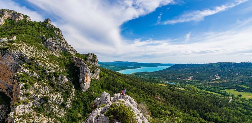
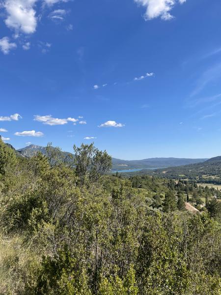
This back and forth botanical trail will guide you until the Tréguier’s Belvedere, that offers a beautiful point of view on the Sainte-Croix’s Lake.
The characteristics of the route.

Moustiers-Sainte-Marie (04)
- Distance 4.97 km
- Elevation gain 170 m
- Elevation lost 170 m
- Min. elevation 631 m
- Max. elevation. 737 m
- Duration (depending on pace) 1h30
- Suivre le balisage Yes

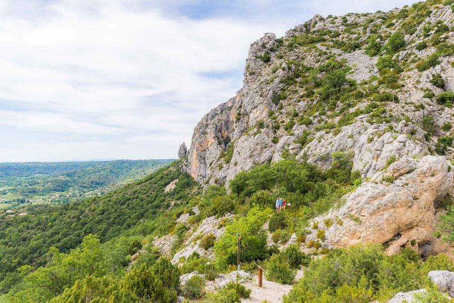
From Moustiers-Sainte-Marie’s "Centre Historique" car parks, follow « Bélvédère de Tréguier » panels. From this point, you will walk back and forth, following 20 educational panels about local fauna and flora. Throughout this short family hike, you will see Moustiers’s restanques and olive groves (an important culture of the village). At the end of the trail, you will have to go up a rock to enjoy a beautiful view point : Sainte-Croix’s lake on your right and Angouire’s canyon.
4.9km · 140m D+ · 2h
4.9km · 140m D+ · 2h
Area : Verdon
Report a problem
THIS ROUTE IN YOUR MOBILE PHONE
Download Provence Alpes Outdoor app
Get all the routes on your smartphone with the Provence Alpes outdoor app. You'll find a host of functions :
- Take advantage of detailed IGN maps
- Download data for consultation even when you're not connected to the network
- Geolocate yourself at any time on the route and altimeter profile
- Activate the off-track alarm to be alerted if you stray from the itinerary
- Find nearby services
- Share your experience (add a report, share your lap time)...

Add your time and share your feelings


Information updated on 2026-06-02 by Office de tourisme de Moustiers-Sainte-Marie


Provence Alpes Digne-les-Bains tourist office
+ 33(0)4 92 36 62 62
Tourist office
contact mail
Val de Durance – Château-Arnoux tourist office
+33 (0)4 92 64 02 64
Tourist office
contact mail
![]()
Moustiers-Sainte-Marie Tourist office
+ 33(0)4 92 74 67 84
Tourist office
contact mail
Seyne - Blanche Serre-Ponçon Tourist office
+33 (0)4 92 35 11 00
Tourist office
contact mail
 Provence Alpes Outdoor - Parcours - Sentier botanique de Treguier
Hello, world! This is a toast message.
Provence Alpes Outdoor - Parcours - Sentier botanique de Treguier
Hello, world! This is a toast message.
Provence Alpes Outdoor - Parcours - Sentier botanique de Treguier
Hello, world! This is a toast message.


OK
Annuler