Chapelle Saint-Joseph (par Volonne)
Add to my favorites

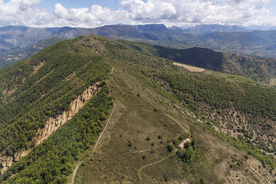
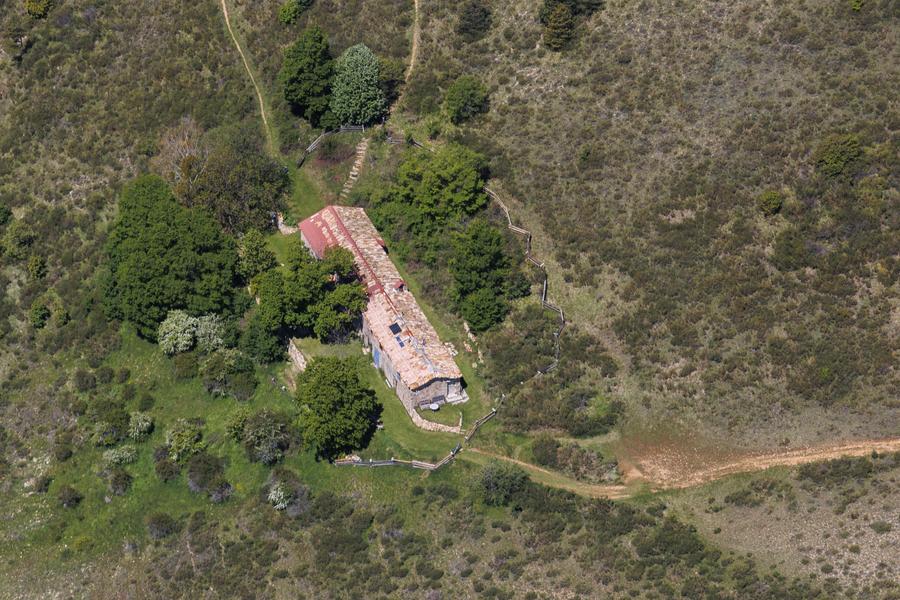
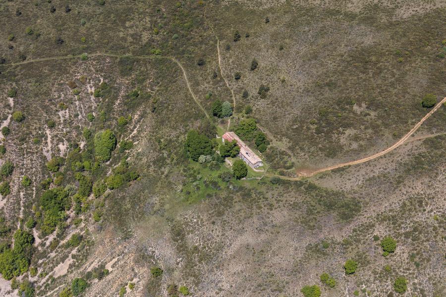
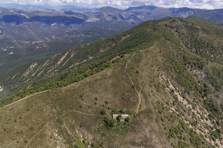
From Volonne at the place called "3 Bastides" (2km NE of the village). The Saint Joseph chapel, associated with its hermitage and its spring, has always served as a shelter for shepherds and pilgrims, as well as for resistance fighters during the Second World War.
The characteristics of the route.

Volonne (04)
- Distance 14.1 km
- Elevation gain 760 m
- Elevation lost 760 m
- Min. elevation 554 m
- Max. elevation. 1264 m
- Duration (depending on pace) 5h30
- Suivre le balisage Yes

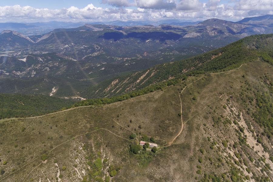
No Parking, park on the side of the road before the ravine of La Grave. From the Cross which overlooks the chapel, you will have a nice view of the valleys of the Durance and the Duyes. The path begins at the bridge of La Grave, at the level of the three bastides.
From there, go up a wide track, at the bottom of the ravine, to a cistern where you leave the Tour de la Magdeleine PR on your right. After 1,5km of gently sloping ascent, enter the oak and pine woods on your left, to emerge at a small ridge near the ruin of Forchochier. The path branches off to the right and almost immediately leaves the large logging track.
The fairly steep, winding climb continues along the hillside, in the middle of a beech forest, very pleasant for its coolness in summer.
Arriving at the crest, the St Joseph chapel is on your left at 1.8km. The return is via the path on the right, first follow the ridge for 1.5km before diving on your right into a forest that is much drier than the previous one, a sign that you have returned to the right. Quite quickly you reach the bottom of the ravine which brings you back to the starting point.
Area : Val de Durance
Report a problem
THIS ROUTE IN YOUR MOBILE PHONE
Download Provence Alpes Outdoor app
Get all the routes on your smartphone with the Provence Alpes outdoor app. You'll find a host of functions :
- Take advantage of detailed IGN maps
- Download data for consultation even when you're not connected to the network
- Geolocate yourself at any time on the route and altimeter profile
- Activate the off-track alarm to be alerted if you stray from the itinerary
- Find nearby services
- Share your experience (add a report, share your lap time)...

Add your time and share your feelings


Information updated on 2025-04-03 by Office de Tourisme Provence Alpes Digne les Bains


Provence Alpes Digne-les-Bains tourist office
+ 33(0)4 92 36 62 62
Tourist office
contact mail
Val de Durance – Château-Arnoux tourist office
+33 (0)4 92 64 02 64
Tourist office
contact mail
![]()
Moustiers-Sainte-Marie Tourist office
+ 33(0)4 92 74 67 84
Tourist office
contact mail
Seyne - Blanche Serre-Ponçon Tourist office
+33 (0)4 92 35 11 00
Tourist office
contact mail
 Provence Alpes Outdoor - Parcours - Chapelle Saint-Joseph (par Volonne)
Hello, world! This is a toast message.
Provence Alpes Outdoor - Parcours - Chapelle Saint-Joseph (par Volonne)
Hello, world! This is a toast message.
Provence Alpes Outdoor - Parcours - Chapelle Saint-Joseph (par Volonne)
Hello, world! This is a toast message.


OK
Annuler