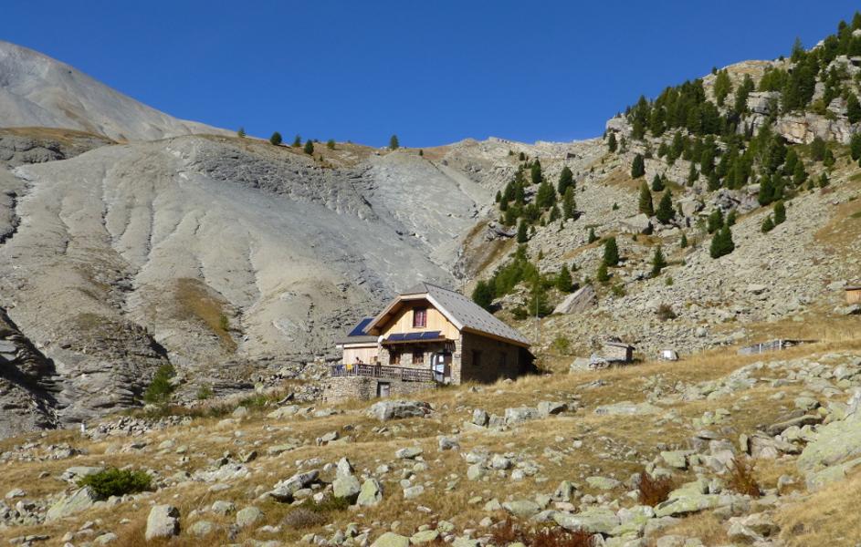
Refuge de l'Estrop
Add to my favorites

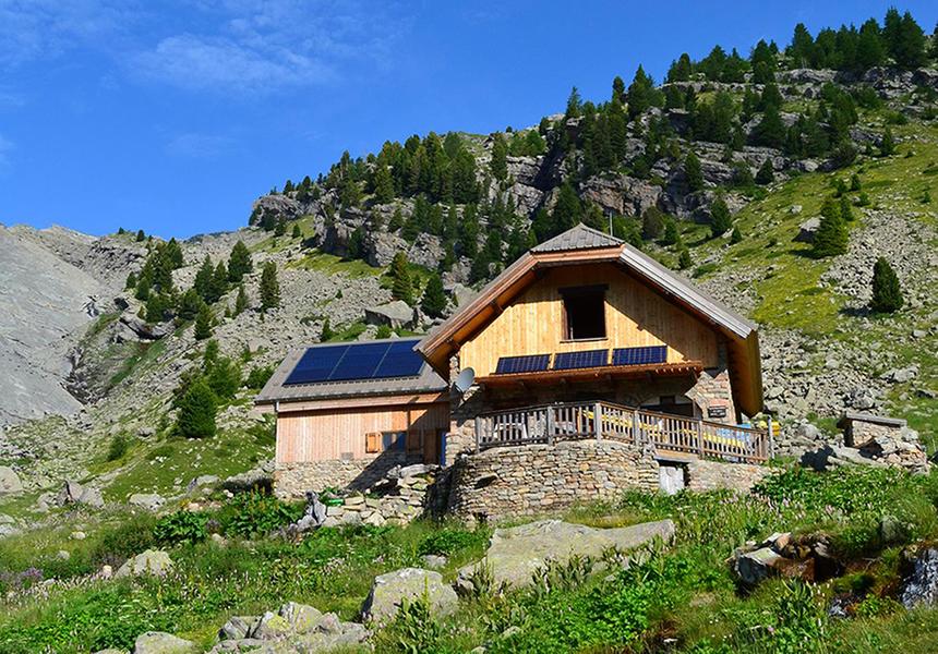
After having exceeded the upper limit of the larch and crossed the Pas de la Piche, you will discover the Roger Carle refuge, a stage allowing you to reach the highest point in the Dignois region: 2961m. Departure from the car park in Prads-Haute-Bléone.
The characteristics of the route.

Prads-Haute-Bléone (04)
- Distance 16.6 km
- Elevation gain 860 m
- Elevation lost 860 m
- Min. elevation 1230 m
- Max. elevation. 2035 m
- Duration (depending on pace) 5h30
- Suivre le balisage Yes

From the Lac des Eaux Chaudes car park, the route follows the access track to the hamlet of La Combe, then a path that rises in the forest before crossing several avalanche corridors. The efforts made to cross the Raidillon des Revaux are largely rewarded by the beauty of the landscapes provided by the Piche waterfall and the outlet into the Estrop circus, with the refuge visible in the distance.
Area : Digne-les-Bains
Report a problem
THIS ROUTE IN YOUR MOBILE PHONE
Download Provence Alpes Outdoor app
Get all the routes on your smartphone with the Provence Alpes outdoor app. You'll find a host of functions :
- Take advantage of detailed IGN maps
- Download data for consultation even when you're not connected to the network
- Geolocate yourself at any time on the route and altimeter profile
- Activate the off-track alarm to be alerted if you stray from the itinerary
- Find nearby services
- Share your experience (add a report, share your lap time)...

Add your time and share your feelings


Information updated on 2025-05-13 by Office de Tourisme Provence Alpes Digne les Bains


Provence Alpes Digne-les-Bains tourist office
+ 33(0)4 92 36 62 62
Tourist office
contact mail
Val de Durance – Château-Arnoux tourist office
+33 (0)4 92 64 02 64
Tourist office
contact mail
![]()
Moustiers-Sainte-Marie Tourist office
+ 33(0)4 92 74 67 84
Tourist office
contact mail
Seyne - Blanche Serre-Ponçon Tourist office
+33 (0)4 92 35 11 00
Tourist office
contact mail
 Provence Alpes Outdoor - Parcours - Refuge de l'Estrop
Hello, world! This is a toast message.
Provence Alpes Outdoor - Parcours - Refuge de l'Estrop
Hello, world! This is a toast message.
Provence Alpes Outdoor - Parcours - Refuge de l'Estrop
Hello, world! This is a toast message.


OK
Annuler