Grotte Saint-Vincent
Add to my favorites

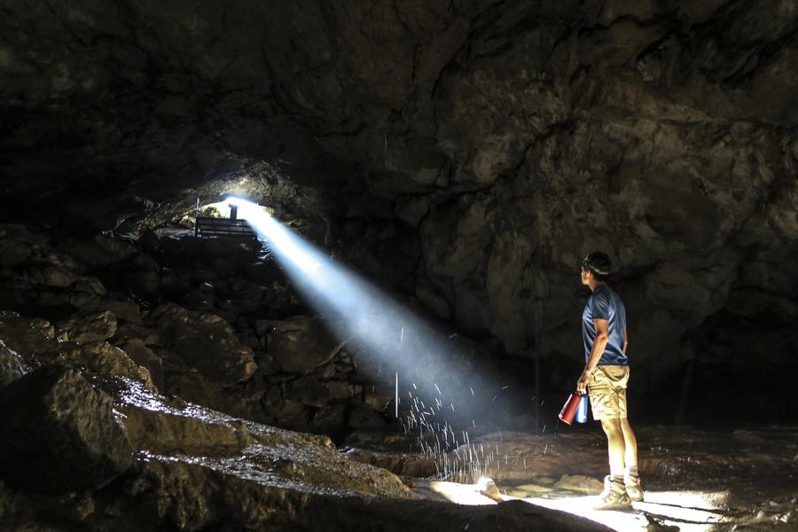
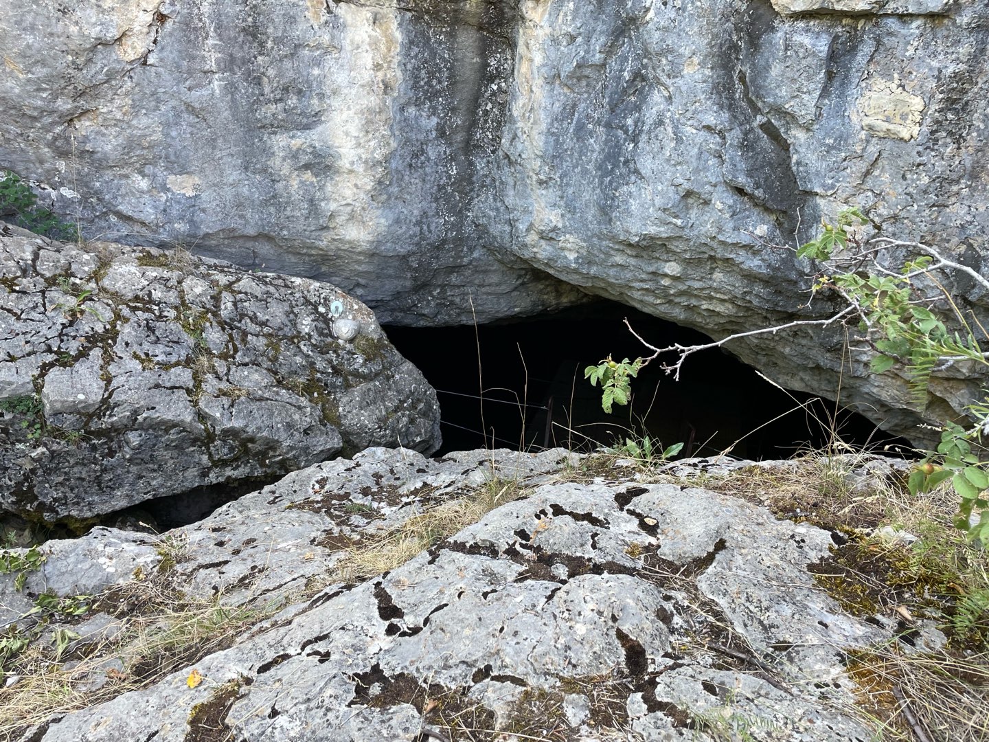
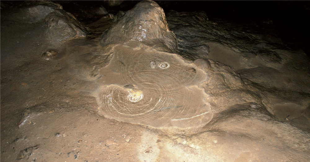
The 30-metre-deep cave of St Vincent sheltered, according to legend, Vincent, the great evangelist. Until the beginning of the 20th century, there was a small chapel outside where the inhabitants of Mélan came in procession on Trinity Sunday.
The characteristics of the route.

Le Castellard-Melan (04)
- Distance 6.58 km
- Elevation gain 240 m
- Elevation lost 240 m
- Min. elevation 1304 m
- Max. elevation. 1517 m
- Duration (depending on pace) 2h
- Suivre le balisage Yes


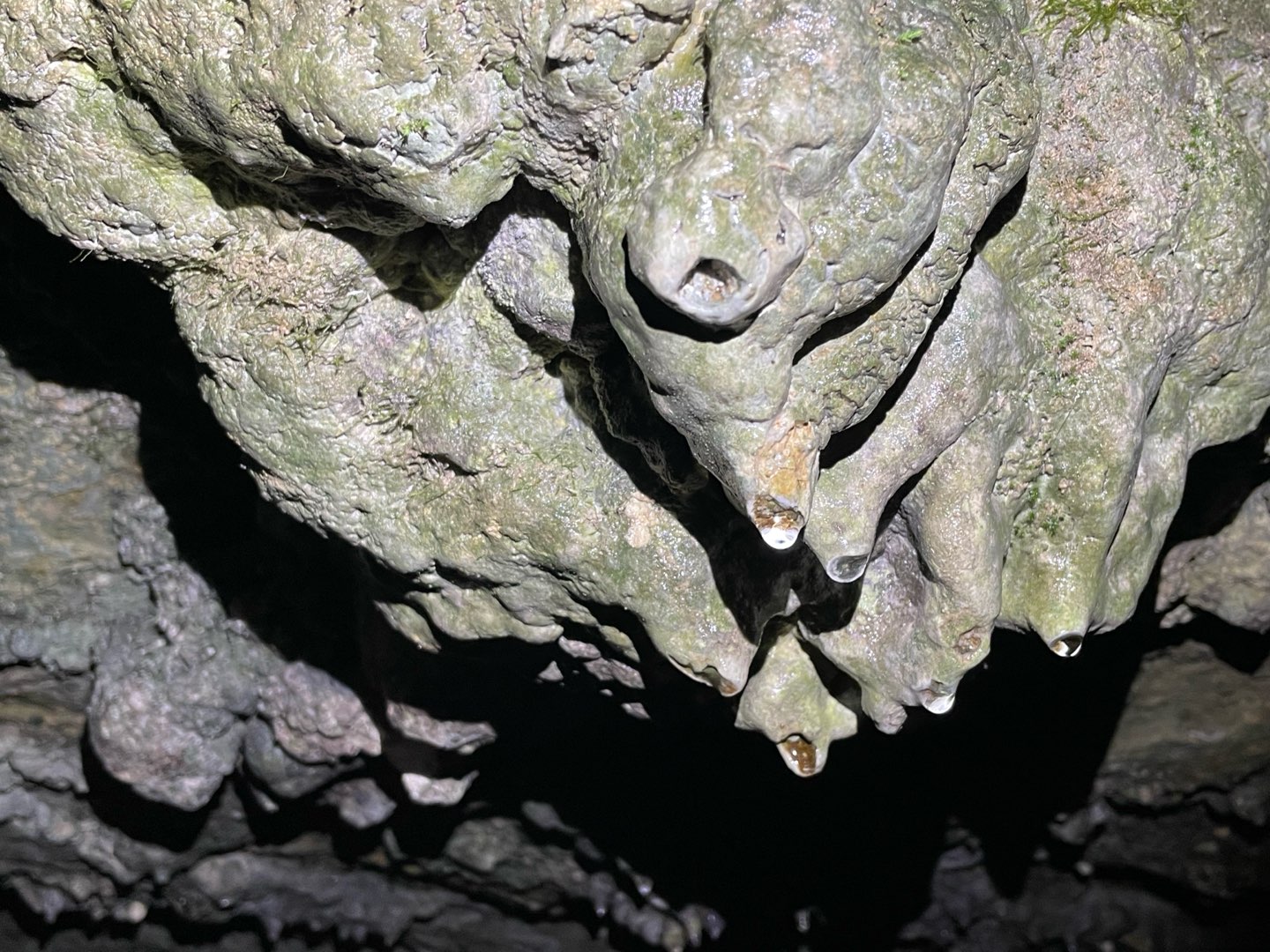
With its main room about thirty meters deep, its stalactites and its basins, the Saint-Vincent cave opens onto the unknown of the underground world. Its formation is due to the dissolution of the Carixian limestones (Lower Jurassic) by meteoric waters, loaded with carbon dioxide, which infiltrate the massif. This erosion creates a karst-type model. If this cave offers less mystery for geologists today, it has long been the seat of a legend.
According to tradition, this is where Saint Vincent, a 5th century priest who came from Africa with Saint Domnin and Saint Marcellin to evangelize Provence, came to pray. Renowned for his gifts as a healer and propagator of the Christian faith, he exasperated the Devil who therefore decided to lock him in the cave to starve him to death. But Saint Vincent defeated the demon and changed him into a 5 meter long stone snake. XNUMXth century authors saw in the various concretions of the cave significant elements of the saint's life: the well where he drew his water, the oven where he baked his bread, the fireplace where he warmed himself... and the trace of his foot - the piayo - that he imprinted in the ground by holding back the rock with which the Devil tried to block the cave.
According to tradition, this is where Saint Vincent, a 5th century priest who came from Africa with Saint Domnin and Saint Marcellin to evangelize Provence, came to pray. Renowned for his gifts as a healer and propagator of the Christian faith, he exasperated the Devil who therefore decided to lock him in the cave to starve him to death. But Saint Vincent defeated the demon and changed him into a 5 meter long stone snake. XNUMXth century authors saw in the various concretions of the cave significant elements of the saint's life: the well where he drew his water, the oven where he baked his bread, the fireplace where he warmed himself... and the trace of his foot - the piayo - that he imprinted in the ground by holding back the rock with which the Devil tried to block the cave.
Area : Digne-les-Bains
Report a problem
THIS ROUTE IN YOUR MOBILE PHONE
Download Provence Alpes Outdoor app
Get all the routes on your smartphone with the Provence Alpes outdoor app. You'll find a host of functions :
- Take advantage of detailed IGN maps
- Download data for consultation even when you're not connected to the network
- Geolocate yourself at any time on the route and altimeter profile
- Activate the off-track alarm to be alerted if you stray from the itinerary
- Find nearby services
- Share your experience (add a report, share your lap time)...

Bibie
finished in 01:30:00
The 2025/07/29
En savoir plus
Ajouter votre chrono et partager vos sensations


Information updated on 2025-05-30 by Office de Tourisme Provence Alpes Digne les Bains


Provence Alpes Digne-les-Bains tourist office
+ 33(0)4 92 36 62 62
Tourist office
contact mail
Val de Durance – Château-Arnoux tourist office
+33 (0)4 92 64 02 64
Tourist office
contact mail
![]()
Moustiers-Sainte-Marie Tourist office
+ 33(0)4 92 74 67 84
Tourist office
contact mail
Seyne - Blanche Serre-Ponçon Tourist office
+33 (0)4 92 35 11 00
Tourist office
contact mail
 Provence Alpes Outdoor - Parcours - Grotte Saint-Vincent
Hello, world! This is a toast message.
Provence Alpes Outdoor - Parcours - Grotte Saint-Vincent
Hello, world! This is a toast message.
Provence Alpes Outdoor - Parcours - Grotte Saint-Vincent
Hello, world! This is a toast message.


OK
Annuler