Rive de l'Asse depuis Mézel
Add to my favorites

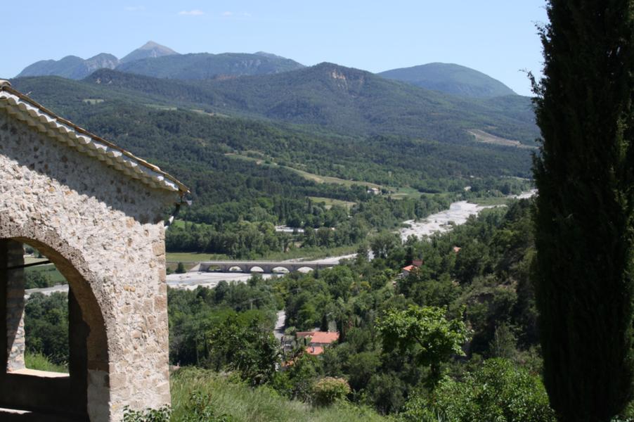
Family hike there and back, count 10 km along the Asse. Departure from Mézel to descend by the small road to Bellegarde passing by Clos d'Auran and Veissel.
The characteristics of the route.

Mézel (04)
- Distance 10.8 km
- Elevation gain 80 m
- Elevation lost 80 m
- Min. elevation 523 m
- Max. elevation. 582 m
- Duration (depending on pace) 3h
- Suivre le balisage Yes

Possibility of combining the two routes 7 and 15 by a game of car or the bus during school term.
Area : Digne-les-Bains
Report a problem
THIS ROUTE IN YOUR MOBILE PHONE
Download Provence Alpes Outdoor app
Get all the routes on your smartphone with the Provence Alpes outdoor app. You'll find a host of functions :
- Take advantage of detailed IGN maps
- Download data for consultation even when you're not connected to the network
- Geolocate yourself at any time on the route and altimeter profile
- Activate the off-track alarm to be alerted if you stray from the itinerary
- Find nearby services
- Share your experience (add a report, share your lap time)...

Add your time and share your feelings


Information updated on 2025-04-03 by Office de Tourisme Provence Alpes Digne les Bains


Provence Alpes Digne-les-Bains tourist office
+ 33(0)4 92 36 62 62
Tourist office
contact mail
Val de Durance – Château-Arnoux tourist office
+33 (0)4 92 64 02 64
Tourist office
contact mail
![]()
Moustiers-Sainte-Marie Tourist office
+ 33(0)4 92 74 67 84
Tourist office
contact mail
Seyne - Blanche Serre-Ponçon Tourist office
+33 (0)4 92 35 11 00
Tourist office
contact mail
 Provence Alpes Outdoor - Parcours - Rive de l'Asse depuis Mézel
Hello, world! This is a toast message.
Provence Alpes Outdoor - Parcours - Rive de l'Asse depuis Mézel
Hello, world! This is a toast message.
Provence Alpes Outdoor - Parcours - Rive de l'Asse depuis Mézel
Hello, world! This is a toast message.


OK
Annuler