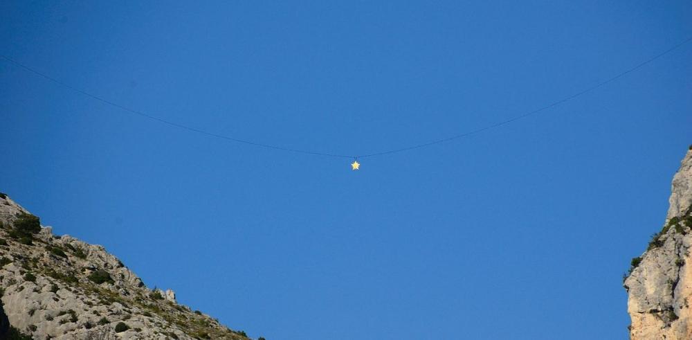
Sentier de la chaine
Add to my favorites

A short and demanding hike to reach the legendary Moustiers-Sainte-Marie star chain. Warning : this trail is dangerous and not recommanded for young children.
The characteristics of the route.

Moustiers-Sainte-Marie (04)
- Distance 6.6 km
- Elevation gain 420 m
- Elevation lost 420 m
- Min. elevation 631 m
- Max. elevation. 927 m
- Duration (depending on pace) 3h
- Suivre le balisage Yes

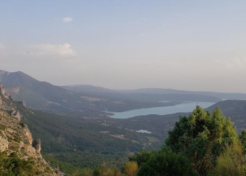
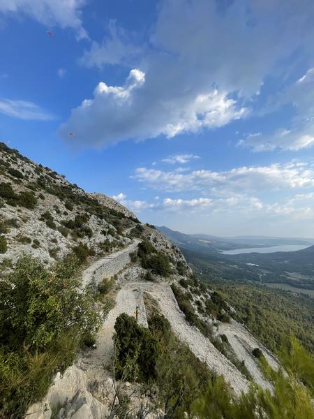
From the upper level of the village's "high car park", above the cemetery, take the ascent to the Chemin de Courchon. Follow the indications "Sentier de la Chaîne". The path is steep and rocky, but still accessible. You will arrive at the promontory of the chain. Retrace your steps and turn left towards a small vertical passage a few metres long (easy level). Follow the signs to "Pierrefeu". It is not advisable to take the Ravin de Notre-Dame to reach the village, as there are regular rockfalls, and the path can only be used "at the hiker's own risk". Return to Moustiers via the Courchon path, which offers a great panoramic view of the lake Sainte-Croix.
6.6km · 420m D+ · 3h
6.6km · 420m D+ · 3h
Area : Verdon
Report a problem
THIS ROUTE IN YOUR MOBILE PHONE
Download Provence Alpes Outdoor app
Get all the routes on your smartphone with the Provence Alpes outdoor app. You'll find a host of functions :
- Take advantage of detailed IGN maps
- Download data for consultation even when you're not connected to the network
- Geolocate yourself at any time on the route and altimeter profile
- Activate the off-track alarm to be alerted if you stray from the itinerary
- Find nearby services
- Share your experience (add a report, share your lap time)...

Add your time and share your feelings


Information updated on 2025-09-17 by Office de tourisme de Moustiers-Sainte-Marie


Provence Alpes Digne-les-Bains tourist office
+ 33(0)4 92 36 62 62
Tourist office
contact mail
Val de Durance – Château-Arnoux tourist office
+33 (0)4 92 64 02 64
Tourist office
contact mail
![]()
Moustiers-Sainte-Marie Tourist office
+ 33(0)4 92 74 67 84
Tourist office
contact mail
Seyne - Blanche Serre-Ponçon Tourist office
+33 (0)4 92 35 11 00
Tourist office
contact mail
 Provence Alpes Outdoor - Parcours - Sentier de la chaine
Hello, world! This is a toast message.
Provence Alpes Outdoor - Parcours - Sentier de la chaine
Hello, world! This is a toast message.
Provence Alpes Outdoor - Parcours - Sentier de la chaine
Hello, world! This is a toast message.


OK
Annuler