Montagne de Beynes (1601 m)
Add to my favorites

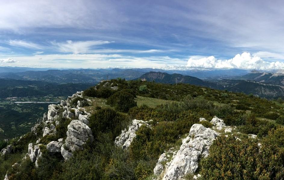
A rich and varied itinerary with a climb through the forest then a summit offering a magnificent, very extensive panoramic view going from the Sainte Victoire mountain to the Ecrins massif, passing through all the foothills of the Digne pre-Alps and Mont Ventoux.
The characteristics of the route.

Beynes (04)
- Distance 13.8 km
- Elevation gain 870 m
- Elevation lost 870 m
- Min. elevation 829 m
- Max. elevation. 1597 m
- Duration (depending on pace) 6h
- Suivre le balisage Yes

The route takes you to the hamlet of Haut Vériscle, before climbing a track and a forest path to the summit of Suy. The route then leaves the undergrowth to reach the ridge and the summit of the Beynes mountain (1601 m). Enjoy a breathtaking view of the Asse and far beyond. On the way back, the route winds through the box trees and thyme, crosses the Pas du Baou, passes near the ONF shelter of Combes and reaches the crossroads of the 4 paths. Allow a day for this rich and varied route.
Area : Digne-les-Bains
Report a problem
THIS ROUTE IN YOUR MOBILE PHONE
Download Provence Alpes Outdoor app
Get all the routes on your smartphone with the Provence Alpes outdoor app. You'll find a host of functions :
- Take advantage of detailed IGN maps
- Download data for consultation even when you're not connected to the network
- Geolocate yourself at any time on the route and altimeter profile
- Activate the off-track alarm to be alerted if you stray from the itinerary
- Find nearby services
- Share your experience (add a report, share your lap time)...

aurelie0304
The 2025/10/18
En savoir plus
Ajouter votre chrono et partager vos sensations
2025/10/18 aurelie0304
2025/10/18 aurelie0304


Information updated on 2025-05-21 by Office de Tourisme Provence Alpes Digne les Bains


Provence Alpes Digne-les-Bains tourist office
+ 33(0)4 92 36 62 62
Tourist office
contact mail
Val de Durance – Château-Arnoux tourist office
+33 (0)4 92 64 02 64
Tourist office
contact mail
![]()
Moustiers-Sainte-Marie Tourist office
+ 33(0)4 92 74 67 84
Tourist office
contact mail
Seyne - Blanche Serre-Ponçon Tourist office
+33 (0)4 92 35 11 00
Tourist office
contact mail
 Provence Alpes Outdoor - Parcours - Montagne de Beynes (1601 m)
Hello, world! This is a toast message.
Provence Alpes Outdoor - Parcours - Montagne de Beynes (1601 m)
Hello, world! This is a toast message.
Provence Alpes Outdoor - Parcours - Montagne de Beynes (1601 m)
Hello, world! This is a toast message.


OK
Annuler