Trail n°6 - KMV Rocher de Neuf Heures
Add to my favorites

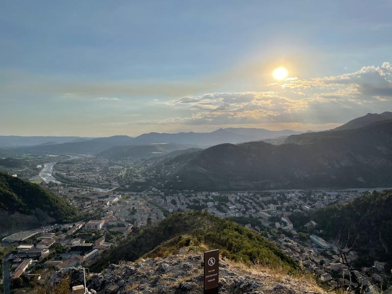
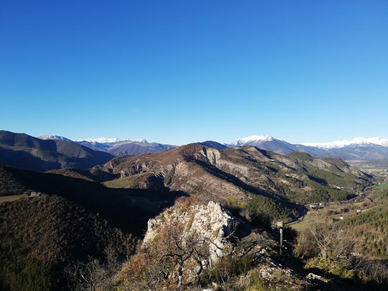
From Chemin Pied Cocu, head for the summit of Rocher de Neuf Heures. First part in undergrowth, then out in the open to the summit (892 m).
The characteristics of the route.

Digne-les-Bains (04)
- Distance 1.23 km
- Elevation gain 270 m
- Elevation lost 0 m
- Min. elevation 623 m
- Max. elevation. 886 m
- Duration (depending on pace) 0h45
- Marking Yes
Area : Digne-les-Bains
Report a problem
THIS ROUTE IN YOUR MOBILE PHONE
Download Provence Alpes Outdoor app
Get all the routes on your smartphone with the Provence Alpes outdoor app. You'll find a host of functions :
- Take advantage of detailed IGN maps
- Download data for consultation even when you're not connected to the network
- Geolocate yourself at any time on the route and altimeter profile
- Activate the off-track alarm to be alerted if you stray from the itinerary
- Find nearby services
- Share your experience (add a report, share your lap time)...

Add your time and share your feelings


Information updated on 2025-06-13 by Office de Tourisme Provence Alpes Digne les Bains


Provence Alpes Digne-les-Bains tourist office
+ 33(0)4 92 36 62 62
Tourist office
contact mail
Val de Durance – Château-Arnoux tourist office
+33 (0)4 92 64 02 64
Tourist office
contact mail
![]()
Moustiers-Sainte-Marie Tourist office
+ 33(0)4 92 74 67 84
Tourist office
contact mail
Seyne - Blanche Serre-Ponçon Tourist office
+33 (0)4 92 35 11 00
Tourist office
contact mail
 Provence Alpes Outdoor - Parcours - Trail n°6 - KMV Rocher de Neuf Heures
Hello, world! This is a toast message.
Provence Alpes Outdoor - Parcours - Trail n°6 - KMV Rocher de Neuf Heures
Hello, world! This is a toast message.
Provence Alpes Outdoor - Parcours - Trail n°6 - KMV Rocher de Neuf Heures
Hello, world! This is a toast message.


OK
Annuler