GR®4 – Haute-Provence via the Verdon Gorges
Add to my favorites

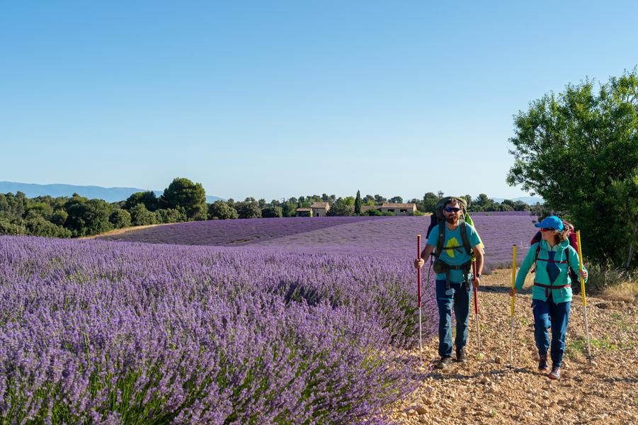
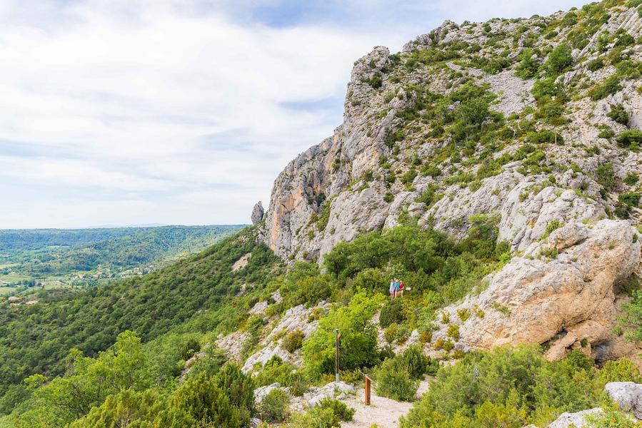
The GR®4 offers some of the most beautiful landscapes in Provence. It crosses the deserted plateaus of the Grasse hinterland and joins the course of the Verdon where it crosses the Grand Canyon by the famous Blanc-Martel trail.
The characteristics of the route.

Moustiers-Sainte-Marie (04)
- Distance 33.49 km
- Elevation gain 1480 m
- Elevation lost 1064 m
- Min. elevation 475 m
- Max. elevation. 1380 m
- Duration (depending on pace) 0h
- Suivre le balisage Yes

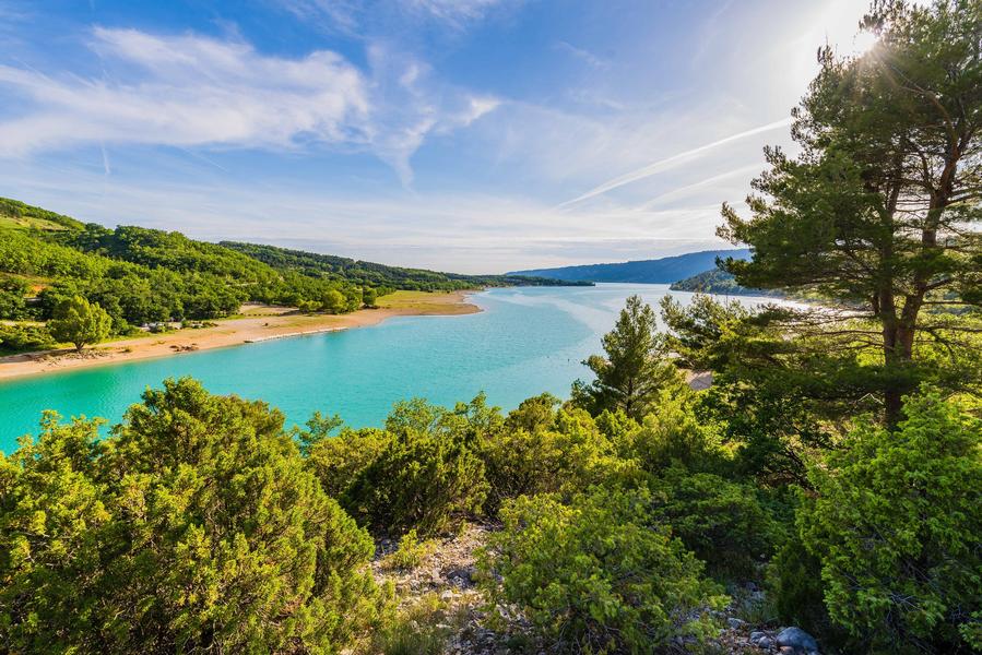
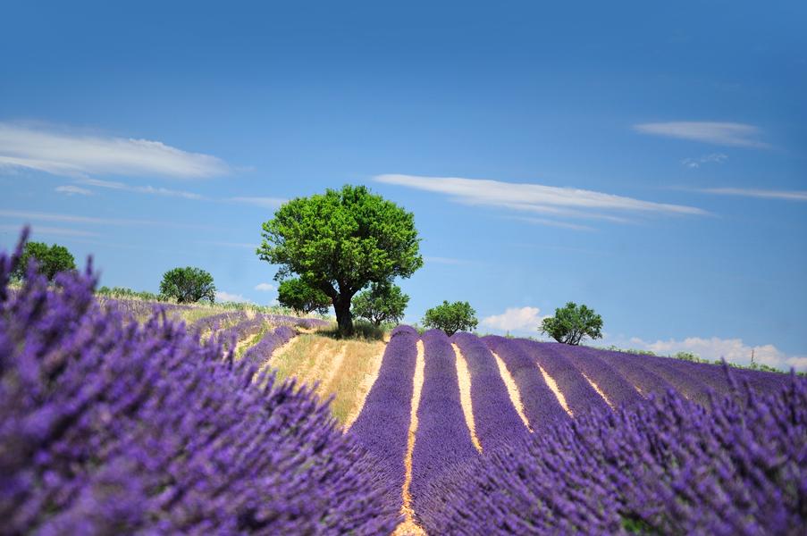
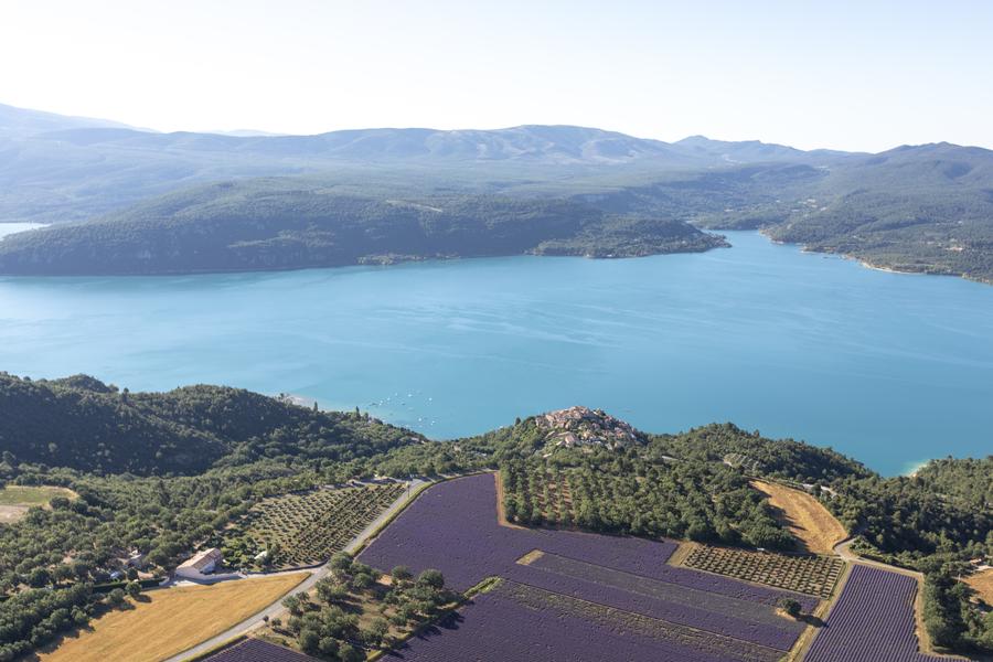
This stage between the villages of La Palud sur Verdon and Sainte-Croix du Verdon will allow you to discover some of the Verdon's gems, including the Grand Canyon with its famous gorges, the sumptuous Lake Sainte-Croix and the charming village of Moustiers-Sainte-Marie, which is listed as one of the Most Beautiful Villages in France. The GR4 then continues towards the vast lavender fields of the Valensole plateau and on through the hills of Manosque and the Luberon Regional Nature Park. Further west, the GR®4 crosses Mont Ventoux before reaching the Rhône valley.
GR® and GR® de Pays are registered trademarks of the FFRandonnée. They refer to the routes created by the FFRandonnée and identified by the name ‘GR®’, marked with red and white signs, and ‘GR® de Pays’, marked with yellow and red signs. Reproduction of the routes and signs is subject to the express authorisation of the FFRandonnée.
GR® and GR® de Pays routes are maintained by FFRandonnée volunteers.
The GPX tracks provided are the property of FFRandonnée and are reserved for normal private use, in particular for the preparation of hikes and itineraries. Their reproduction for commercial or promotional purposes or for integration into Open Data or collaborative sharing is strictly prohibited.
Area : Verdon
Report a problem
THIS ROUTE IN YOUR MOBILE PHONE
Download Provence Alpes Outdoor app
Get all the routes on your smartphone with the Provence Alpes outdoor app. You'll find a host of functions :
- Take advantage of detailed IGN maps
- Download data for consultation even when you're not connected to the network
- Geolocate yourself at any time on the route and altimeter profile
- Activate the off-track alarm to be alerted if you stray from the itinerary
- Find nearby services
- Share your experience (add a report, share your lap time)...

Add your time and share your feelings


Information updated on 2025-09-05 by Office de tourisme de Moustiers-Sainte-Marie


Provence Alpes Digne-les-Bains tourist office
+ 33(0)4 92 36 62 62
Tourist office
contact mail
Val de Durance – Château-Arnoux tourist office
+33 (0)4 92 64 02 64
Tourist office
contact mail
![]()
Moustiers-Sainte-Marie Tourist office
+ 33(0)4 92 74 67 84
Tourist office
contact mail
Seyne - Blanche Serre-Ponçon Tourist office
+33 (0)4 92 35 11 00
Tourist office
contact mail
 Provence Alpes Outdoor - Parcours - GR®4 – Haute-Provence via the Verdon Gorges
Hello, world! This is a toast message.
Provence Alpes Outdoor - Parcours - GR®4 – Haute-Provence via the Verdon Gorges
Hello, world! This is a toast message.
Provence Alpes Outdoor - Parcours - GR®4 – Haute-Provence via the Verdon Gorges
Hello, world! This is a toast message.


OK
Annuler