Trail n°4 - Sommet du Pavillon
Add to my favorites

An extremely playful itinerary up to the summit of the "Pavillon", the southern highest point of the Montdenier massif.
The characteristics of the route.

Moustiers-Sainte-Marie (04)
- Distance 24.33 km
- Elevation gain 1220 m
- Elevation lost 1220 m
- Min. elevation 571 m
- Max. elevation. 1620 m
- Duration (depending on pace) 4h
- Suivre le balisage Yes

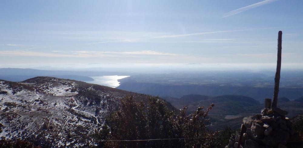
A breathtaking panorama at its highest point (with, in particular, the lake of Sainte-Croix and the plateau of Valensole on one side, and the mount Chiran and the Mourre de Chanier on the other...) and a magnificent descent to conclude, as a "cherry on the cake", by the ancient Roman way of the Courchon path !
Area : Verdon
Report a problem
THIS ROUTE IN YOUR MOBILE PHONE
Download Provence Alpes Outdoor app
Get all the routes on your smartphone with the Provence Alpes outdoor app. You'll find a host of functions :
- Take advantage of detailed IGN maps
- Download data for consultation even when you're not connected to the network
- Geolocate yourself at any time on the route and altimeter profile
- Activate the off-track alarm to be alerted if you stray from the itinerary
- Find nearby services
- Share your experience (add a report, share your lap time)...

Add your time and share your feelings


Information updated on 2025-09-05 by Office de tourisme de Moustiers-Sainte-Marie


Provence Alpes Digne-les-Bains tourist office
+ 33(0)4 92 36 62 62
Tourist office
contact mail
Val de Durance – Château-Arnoux tourist office
+33 (0)4 92 64 02 64
Tourist office
contact mail
![]()
Moustiers-Sainte-Marie Tourist office
+ 33(0)4 92 74 67 84
Tourist office
contact mail
Seyne - Blanche Serre-Ponçon Tourist office
+33 (0)4 92 35 11 00
Tourist office
contact mail
 Provence Alpes Outdoor - Parcours - Trail n°4 - Sommet du Pavillon
Hello, world! This is a toast message.
Provence Alpes Outdoor - Parcours - Trail n°4 - Sommet du Pavillon
Hello, world! This is a toast message.
Provence Alpes Outdoor - Parcours - Trail n°4 - Sommet du Pavillon
Hello, world! This is a toast message.


OK
Annuler